Day
Tue
10.06.
HOME |
Iceland Diary |
Juni 2008
|
|
|
Day
|
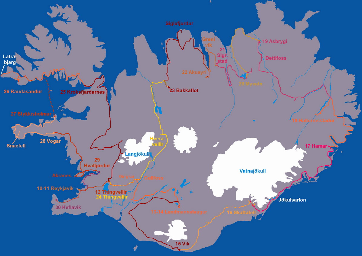
Reykjavik |
|
|
Tue 10.06. |
Flight from Friedrichshafen to Reykjavik |
|
We went by train from Stuttgart to Friedrichshafen Airport. While waiting after check-in we watched the Zeppelin NT starting and landing on the other side of the airfield. The flight with Iceland Express started on time, then we flew across France, the Channel, England and Scotland. After 3hours 50 minutes we landed at Keflavik airport, during the approach we could already see fields of old lava and steaming hot springs. Keflavik is a modern airport, and was quite busy during the time we landed. Next to the baggage claim is a big duty free shop, where all incoming icelanders buy huge quantities of alcohol, because that is very expensive in Iceland. We drove the 35km to Reykjavik with the airport bus. Our accomodation Butterfly guesthouse was a normal town house in a quiet but central location. The room was very small, but the beds were good and the people were nice. In the evening we went to town and found a restaurant where we had a good fish buffet. At 9 pm we were very tired (time difference to Germany is - 2h) and went to bed. |
|
Day
|
Reykjavik |
|
|
Wed 11.06. |
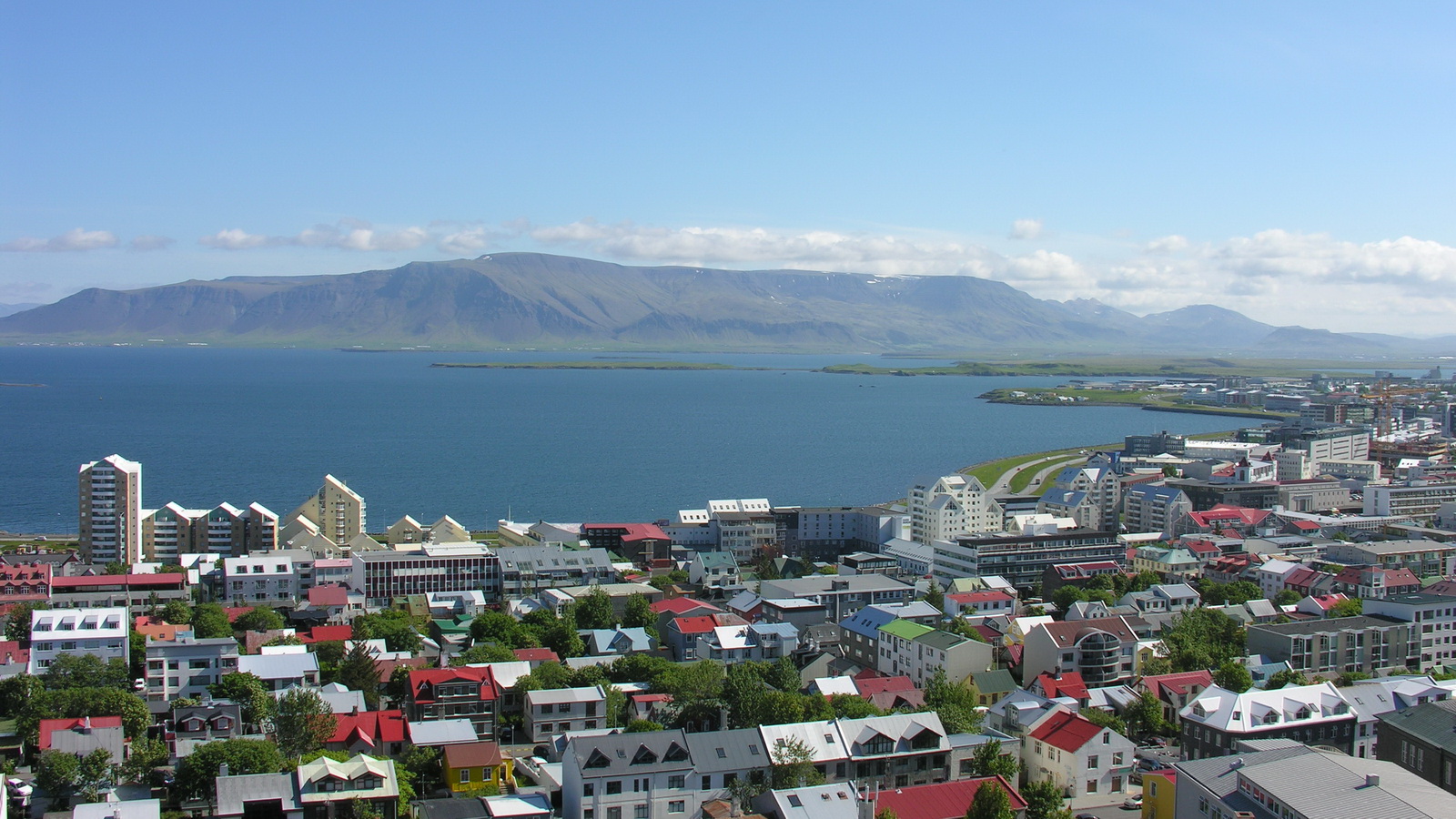
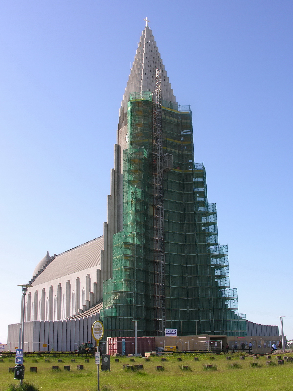
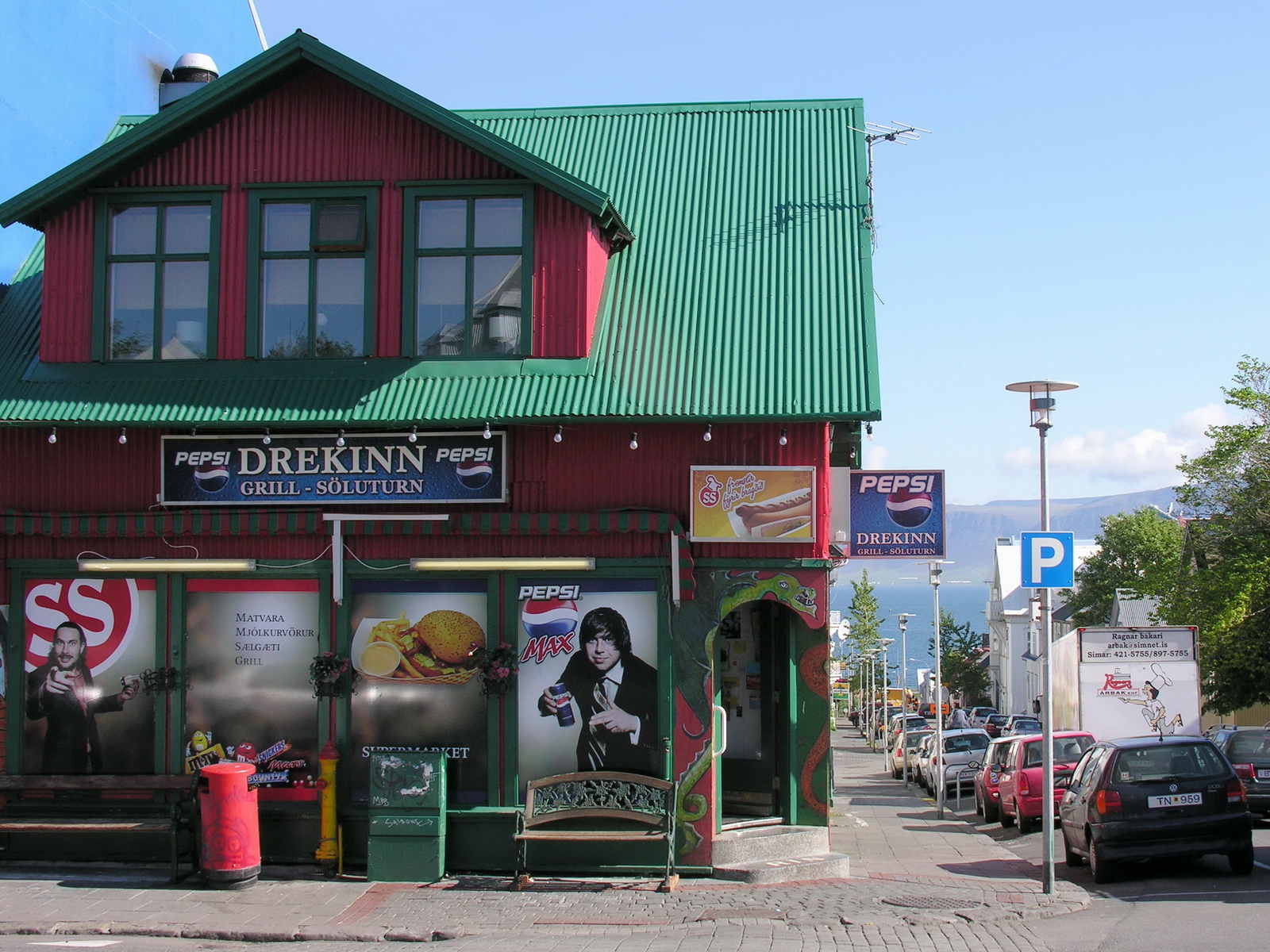
Sightseeing in Reykjavik |
|
We slept a little
uneasy, because it doesn't get really dark. After breakfast we were ready
to explore Reykjavik: |
 |
 |
 |
 |
|
Reykjavik
|
Hallgrimskirkja
|
Colorful Houses
|
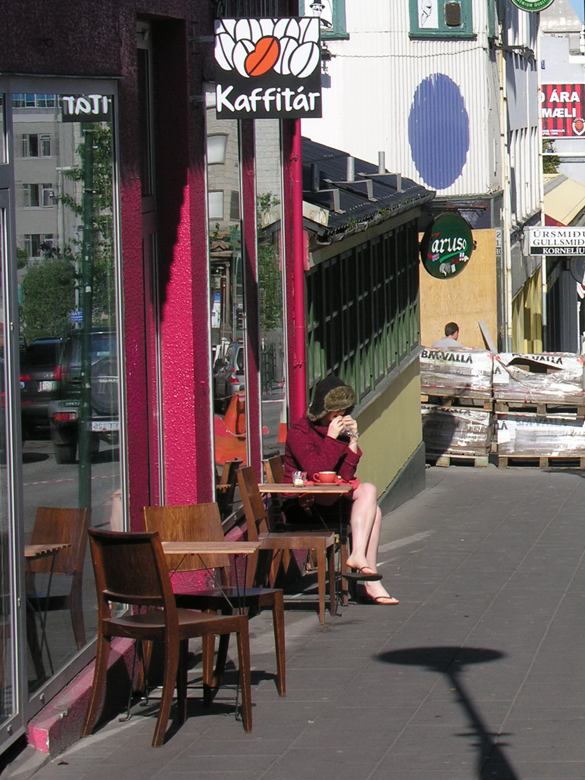
Breakfast
Coffee in Fur Cap and Thongs
|
 |
 |
 |
 |
|
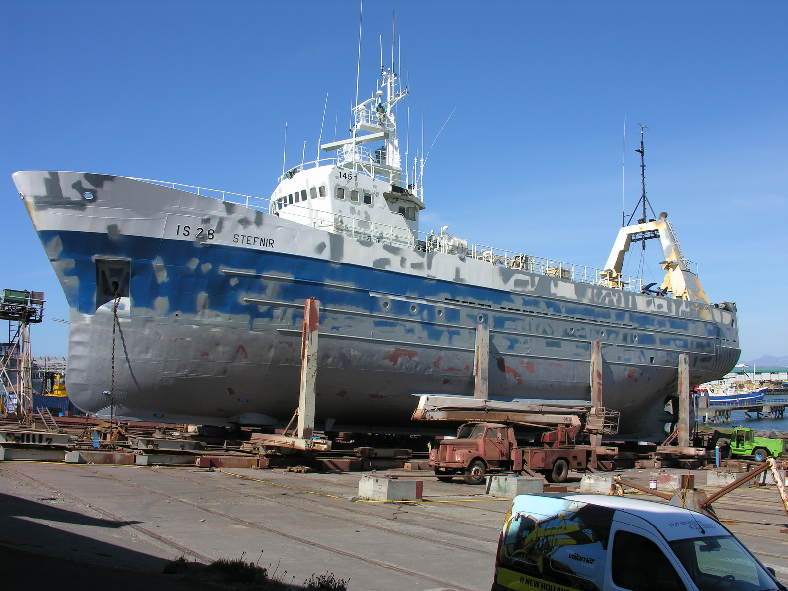
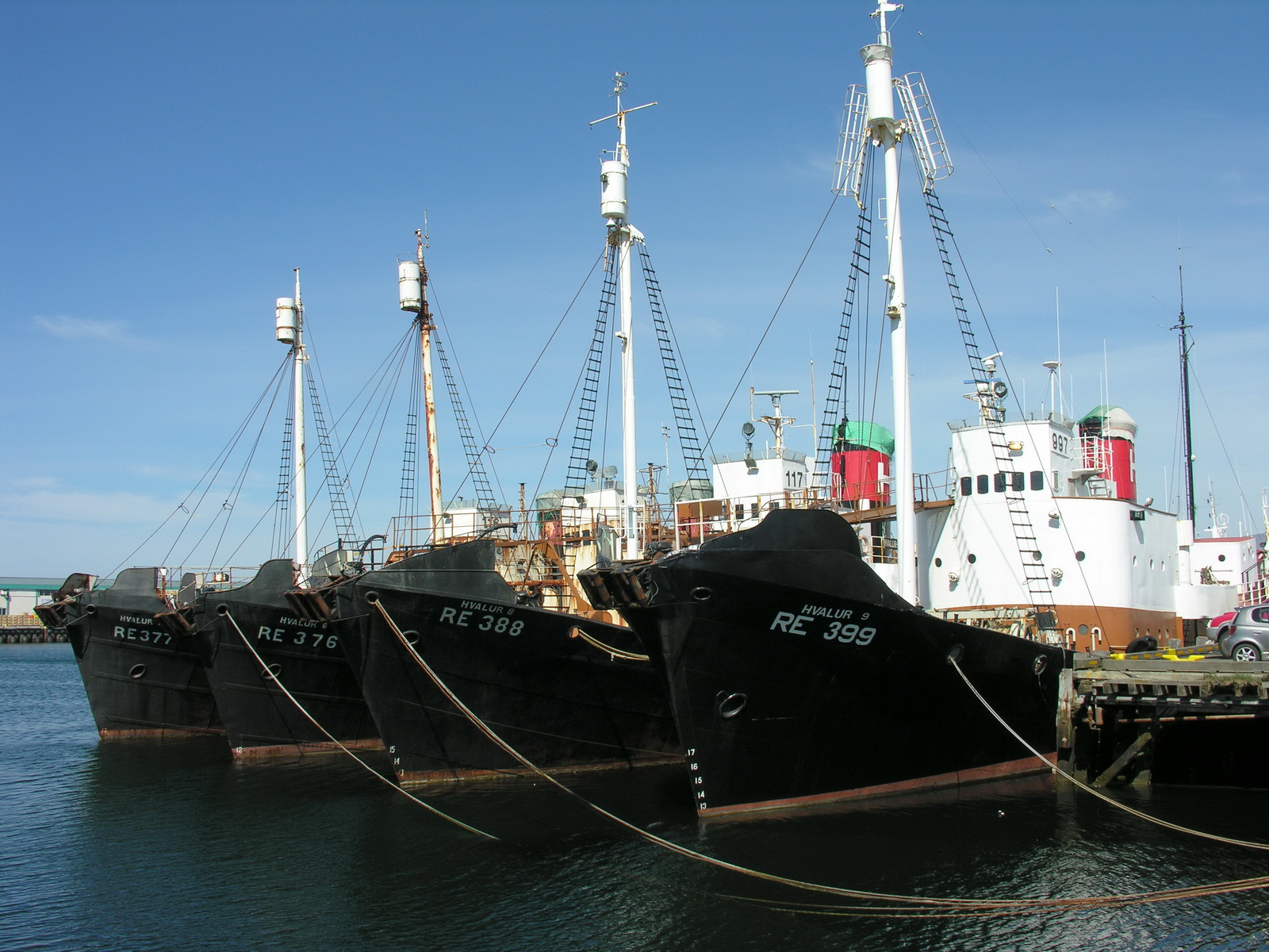
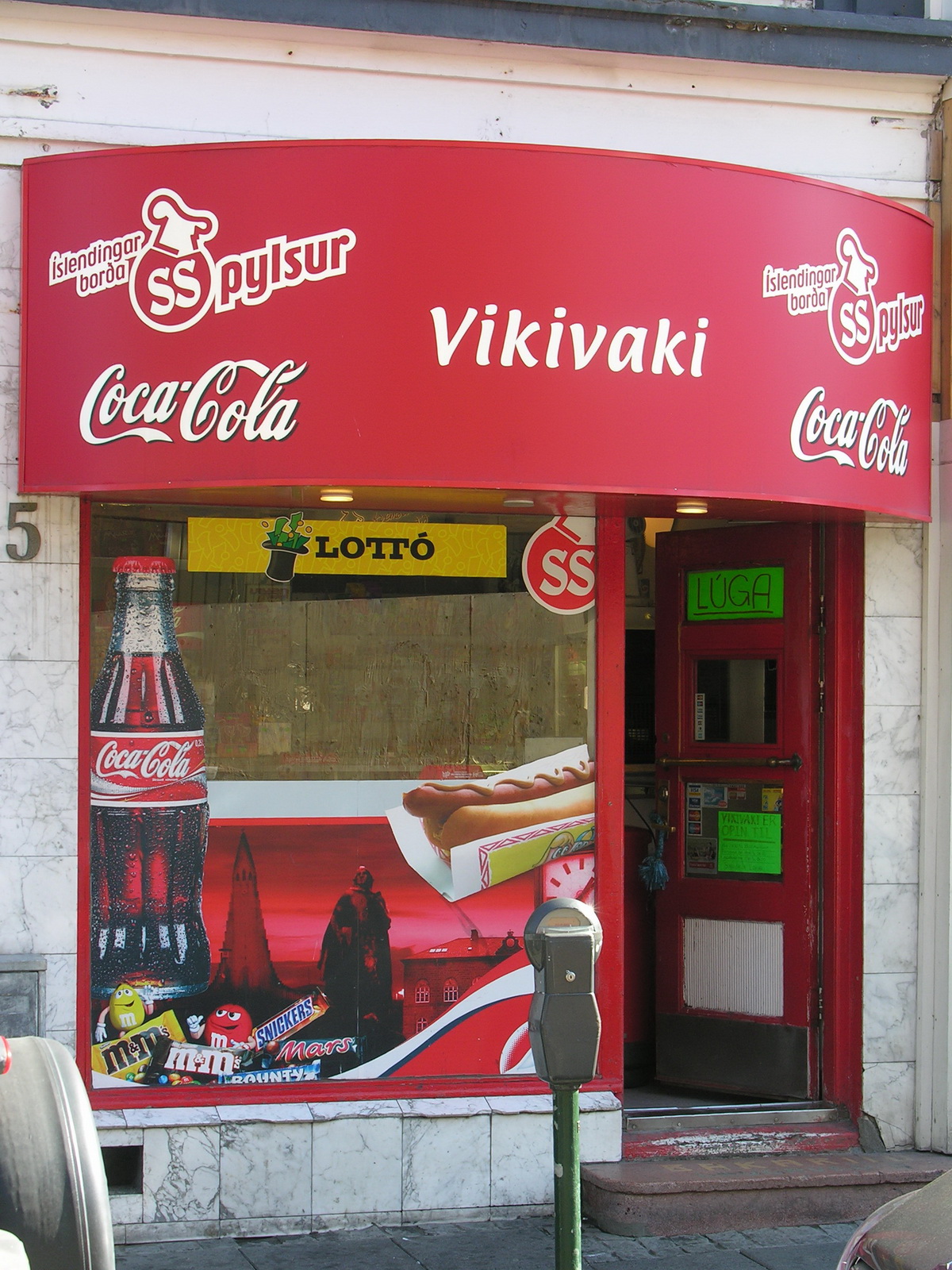
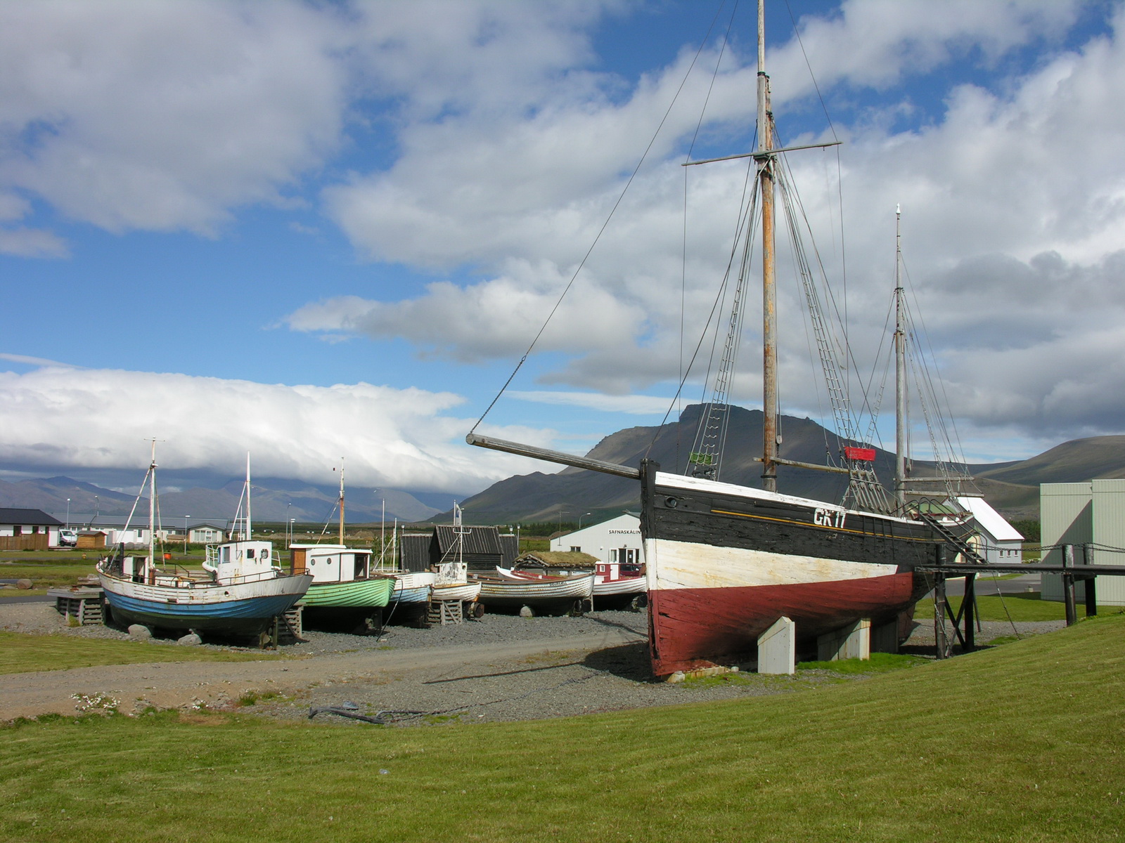
In the Wharf
|
Whalers
|
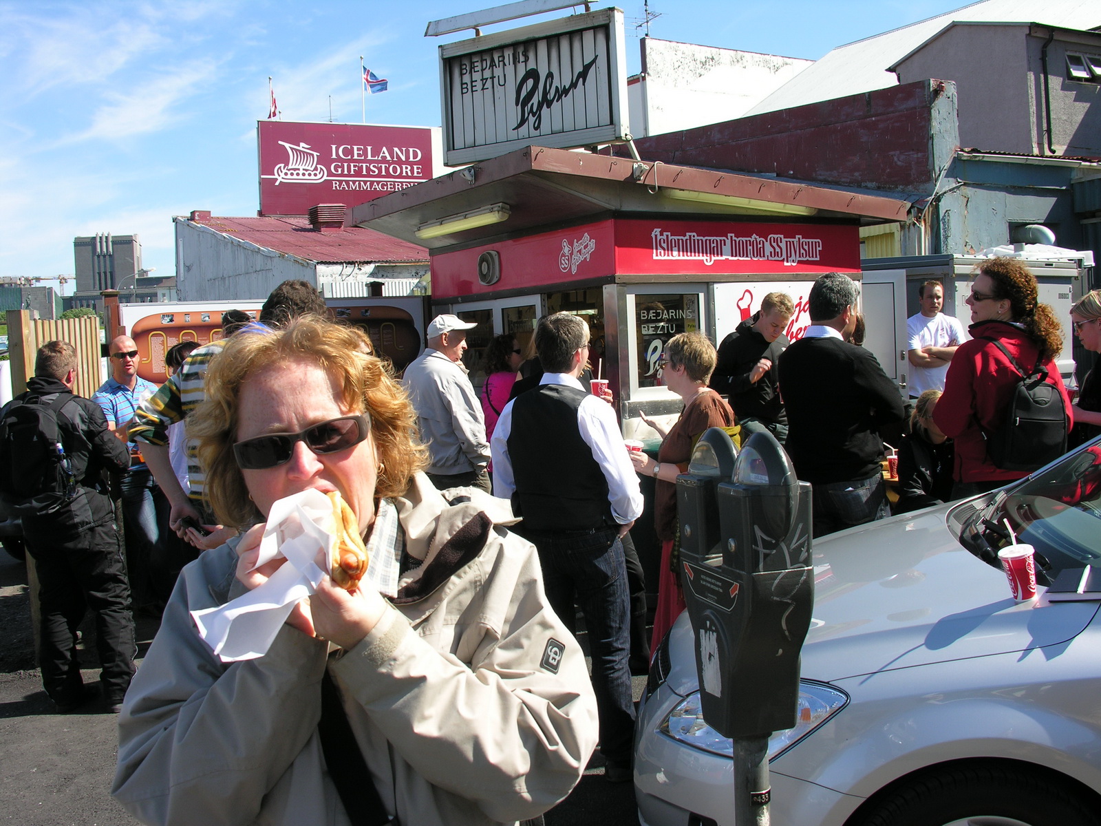
Bjaerinns
beztu Pylzur
|
Strange Takeaway
|
|
Day
|
Thingvellir |
|
|
Thu 12.06. |
Strolling through Reykjavik, Camper pick up, shopping and Go! |
|
We woke up at 4am
because of the sun blinking through the blinds. At breakfast in the kitchen
at 7am, it's a little bit like a flat share community, we met 2 Australians
from Perth with their little son. They had just arrived from Barcelona.
After another little stroll through the city (it's not big, you can see
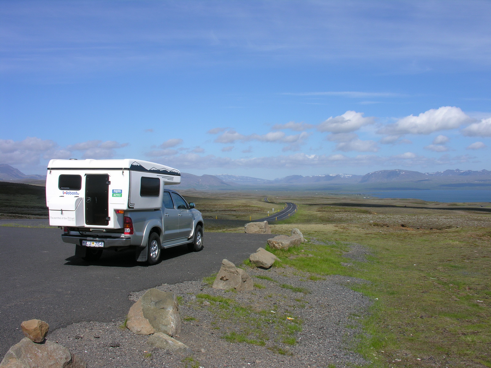
a lot of it in a day) we were picked up by the car rental company at 1pm.
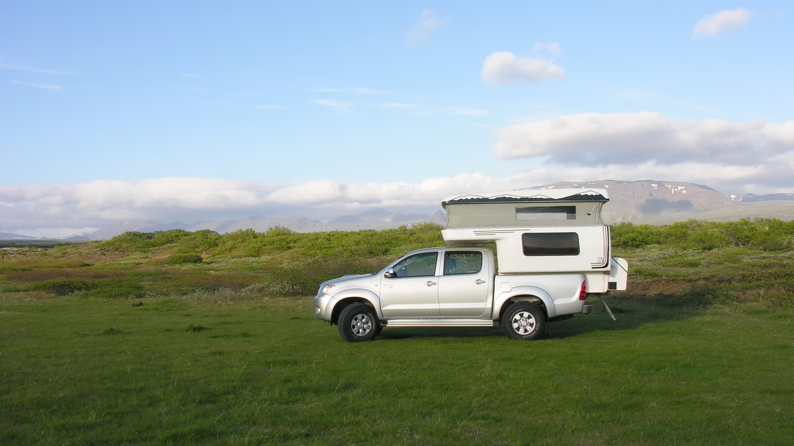
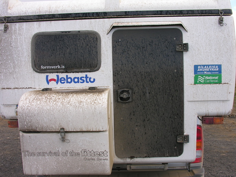
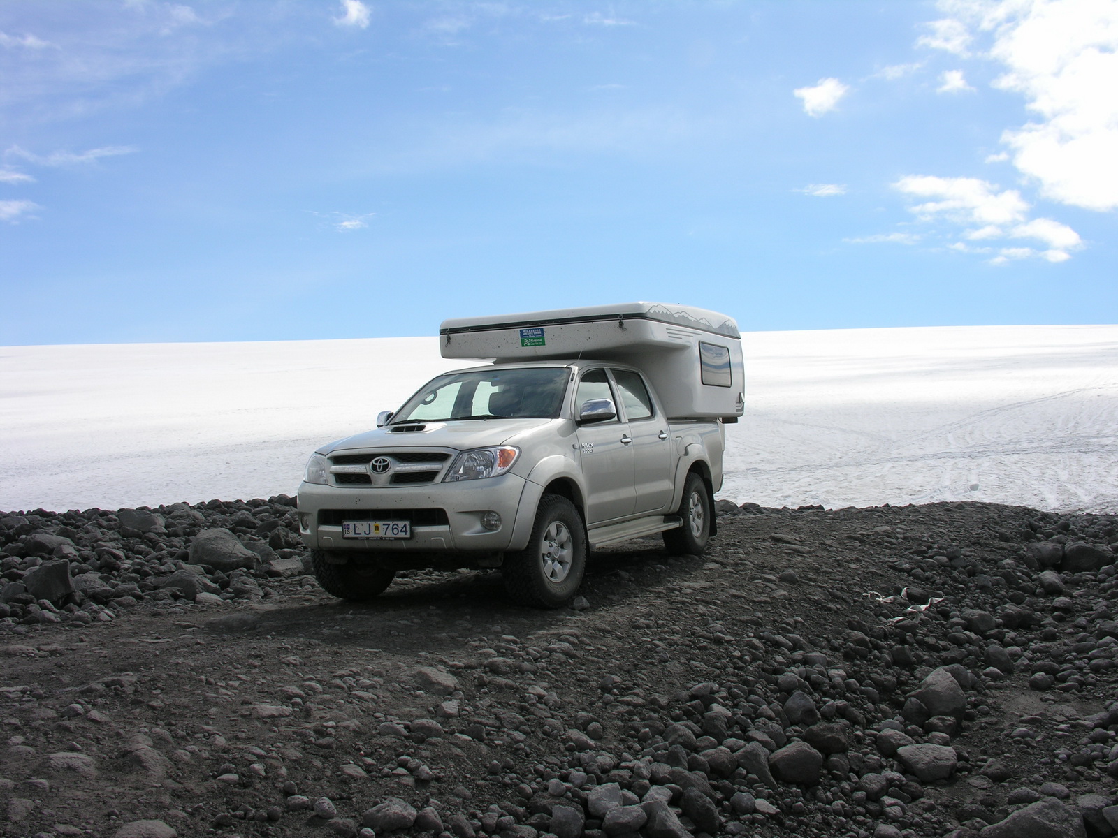
At 2pm, handing over of the camper was done. The car was very good, a
Toyota Hilux 4WD ute with a double cabin (4 Cyl Diesel, only 14000 km)
and a camper box (which was older , but still OK). Only the kitchen equipment
was very basic for a camper of that price. |
 |
 |
 |
|
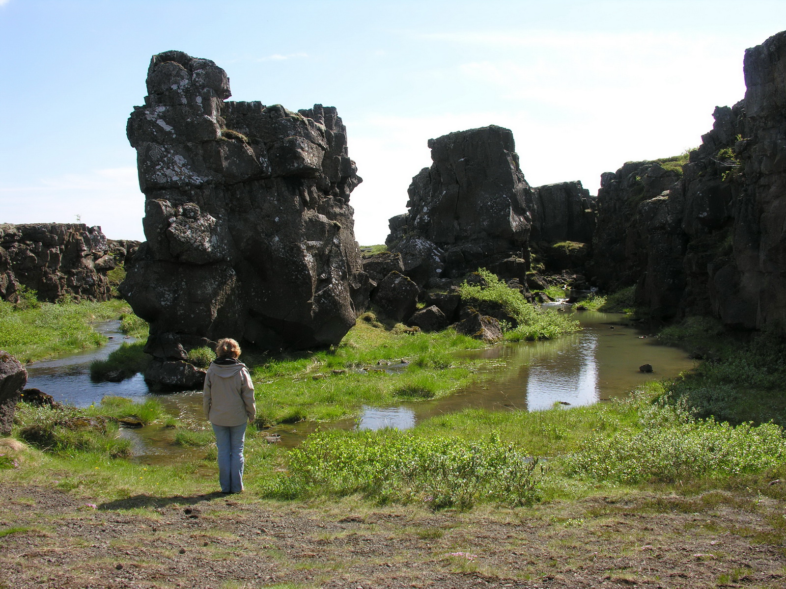
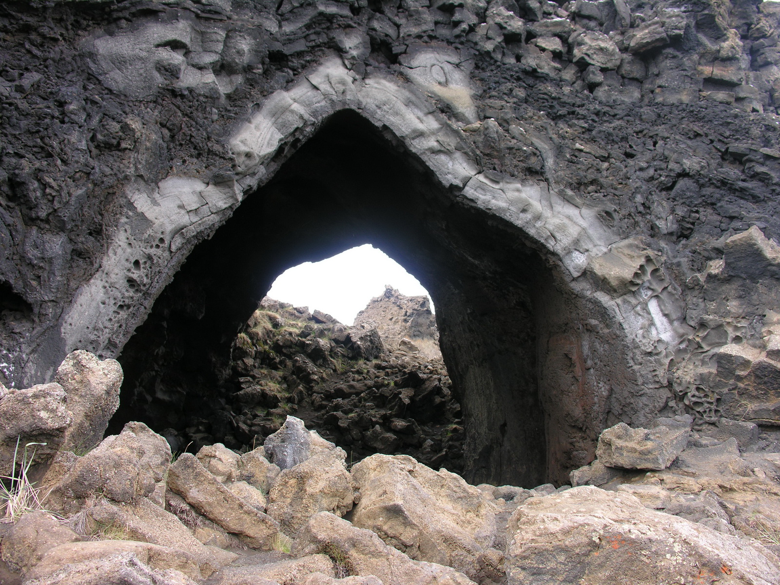
Thingvellir
|
Allmannagja,
one of the Chasms
|
Crowded Campground
|
|
Day
|
Landmannalaugar |
|
|
Fr 13.06. |
Geysers, Waterfalls and Lava: Via Strokkur and Gullfoss to Landmannalaugar |
|
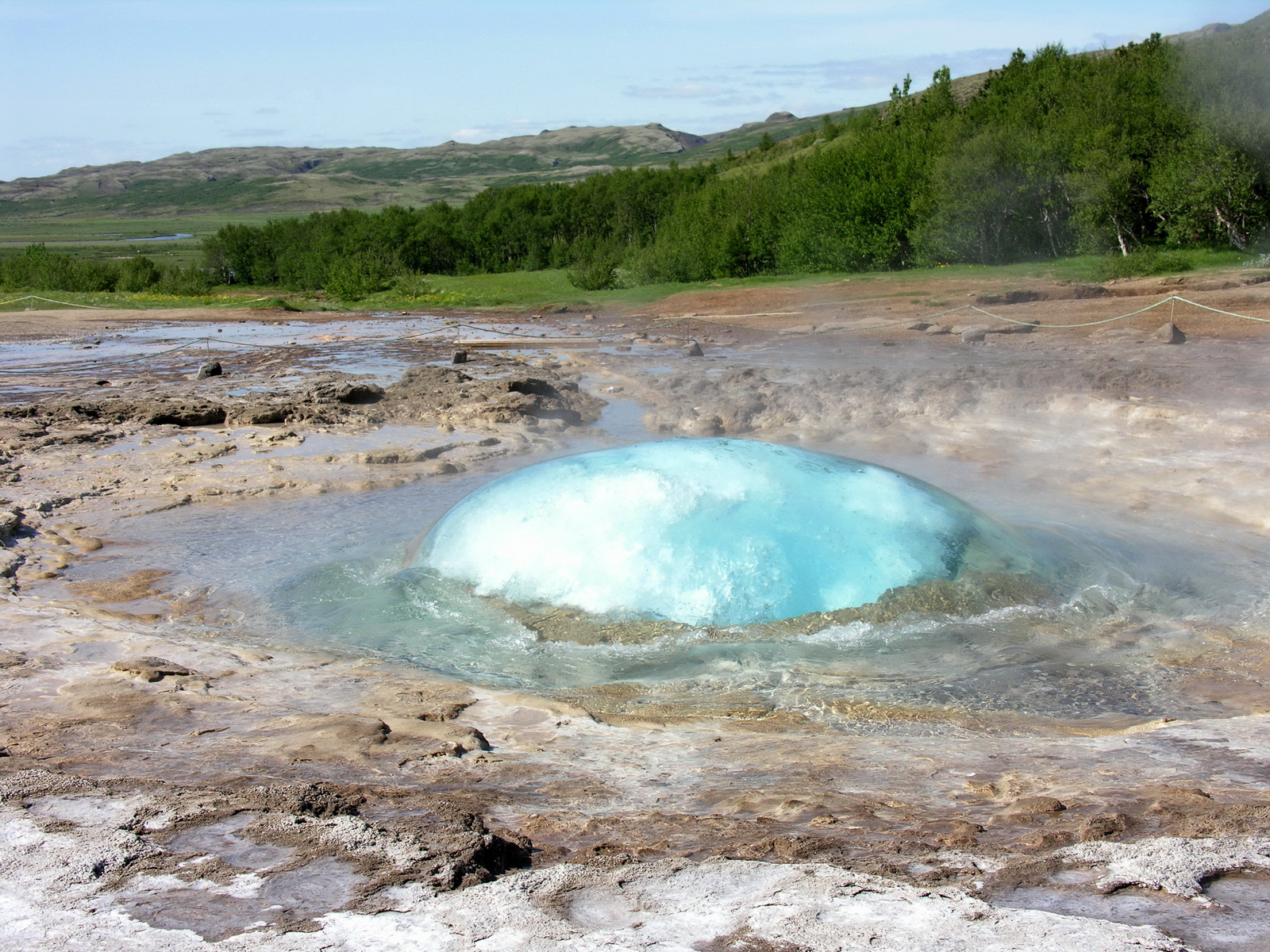
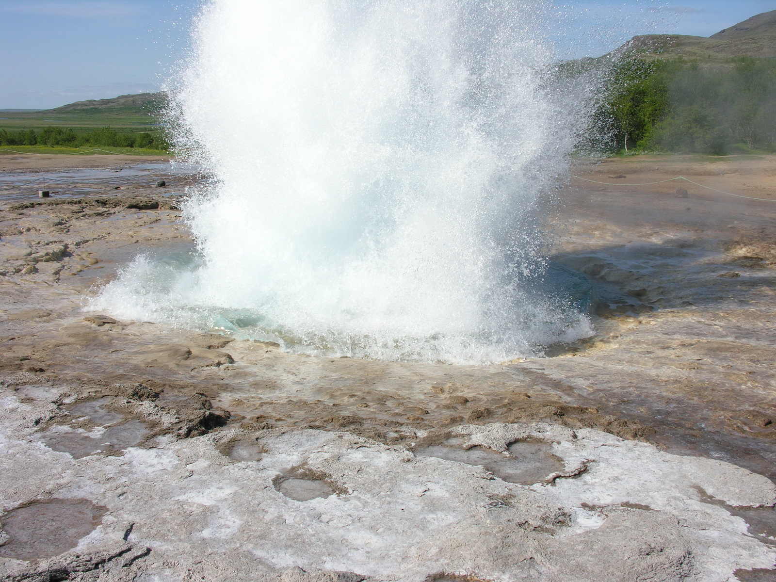
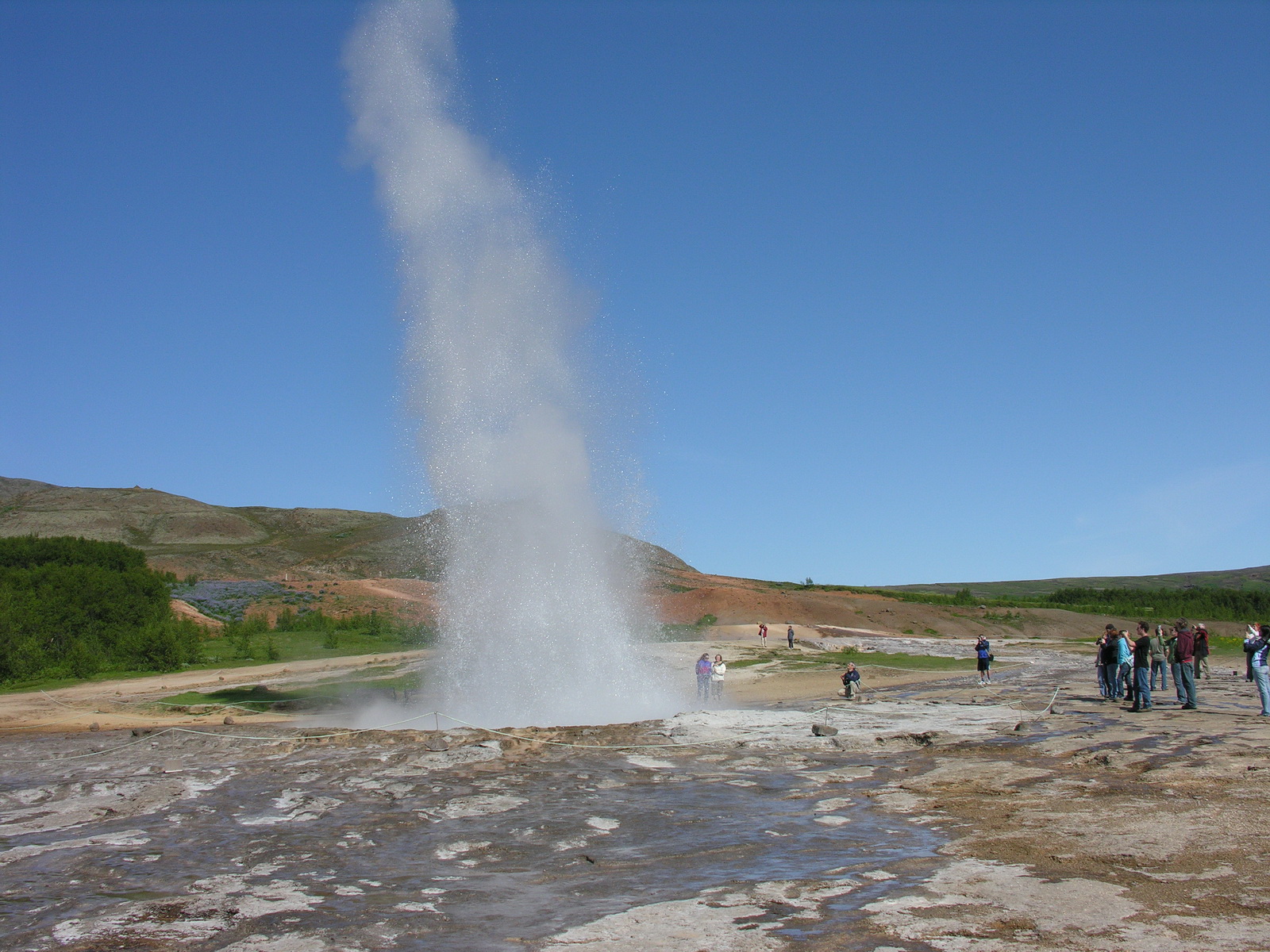
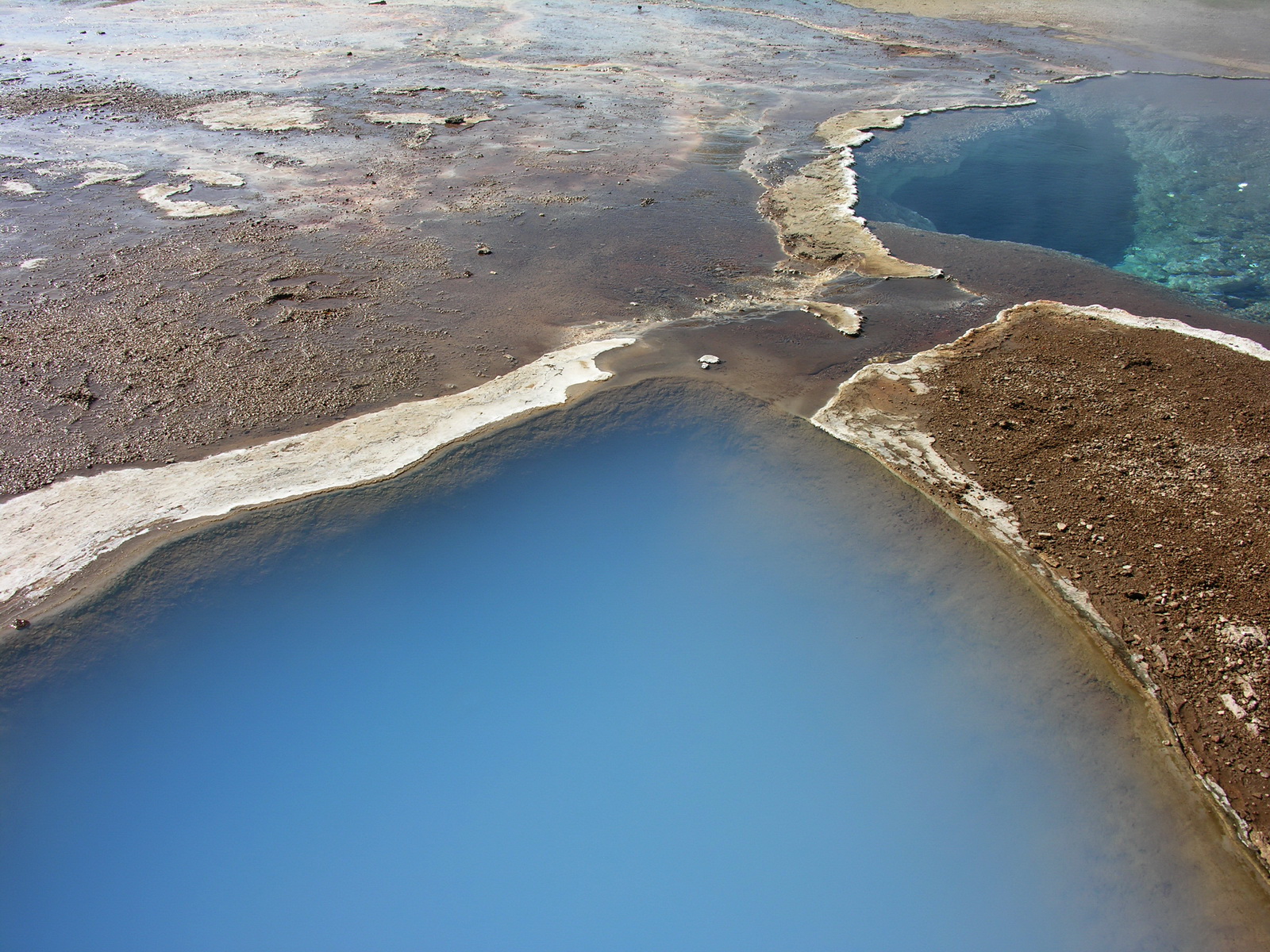
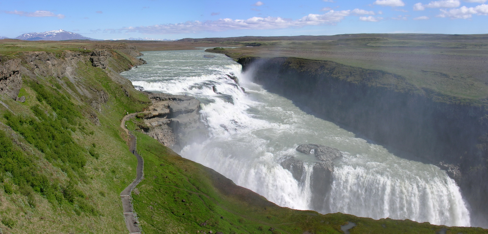
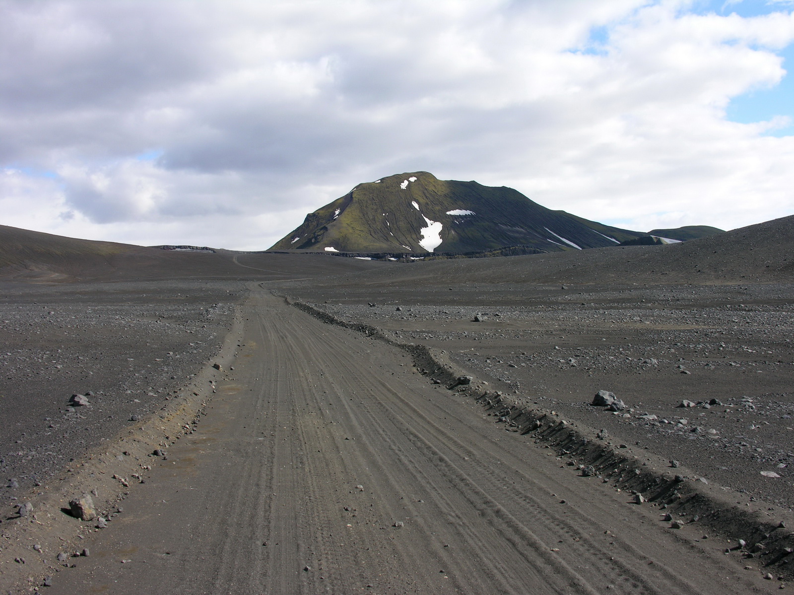
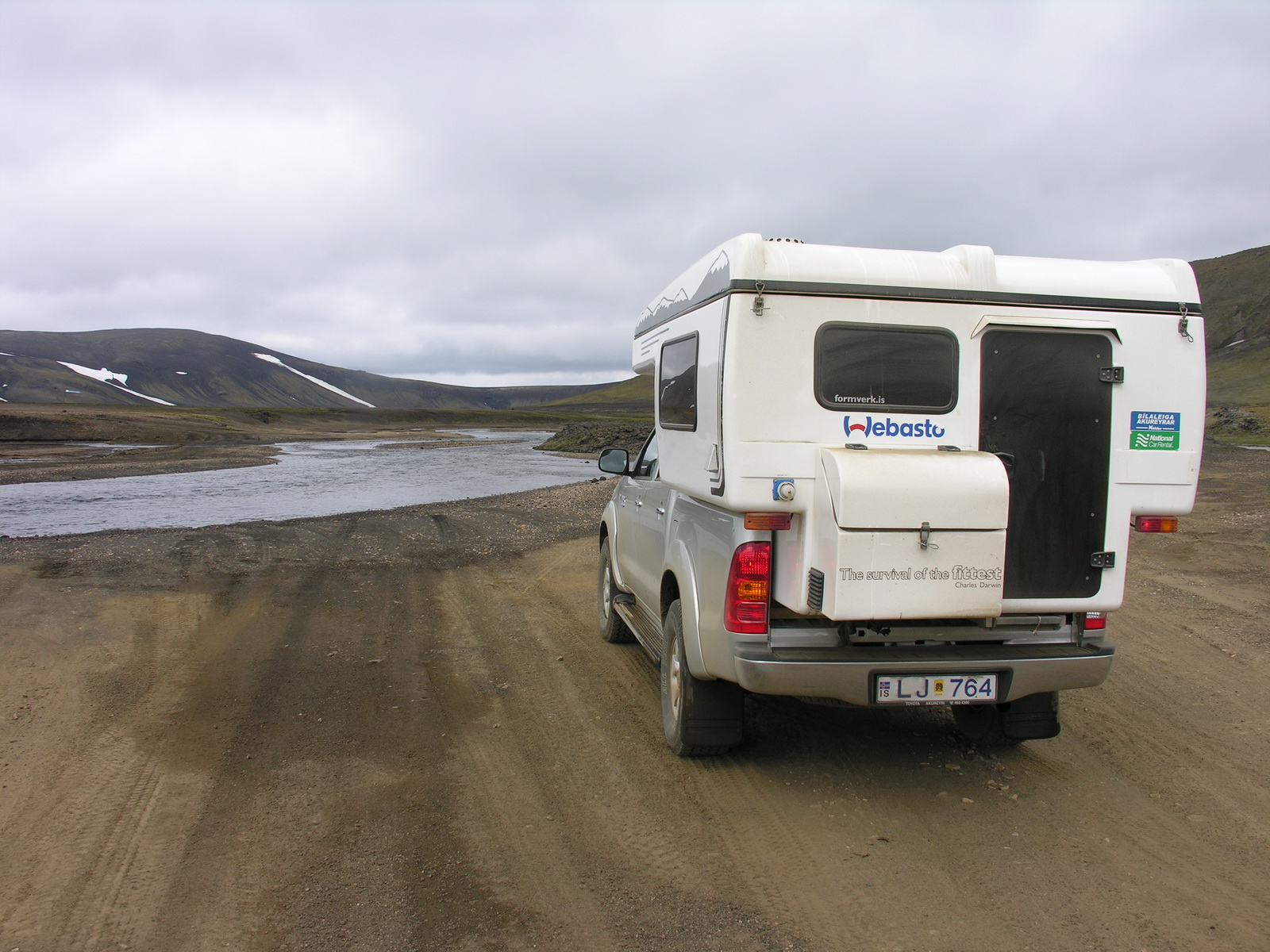
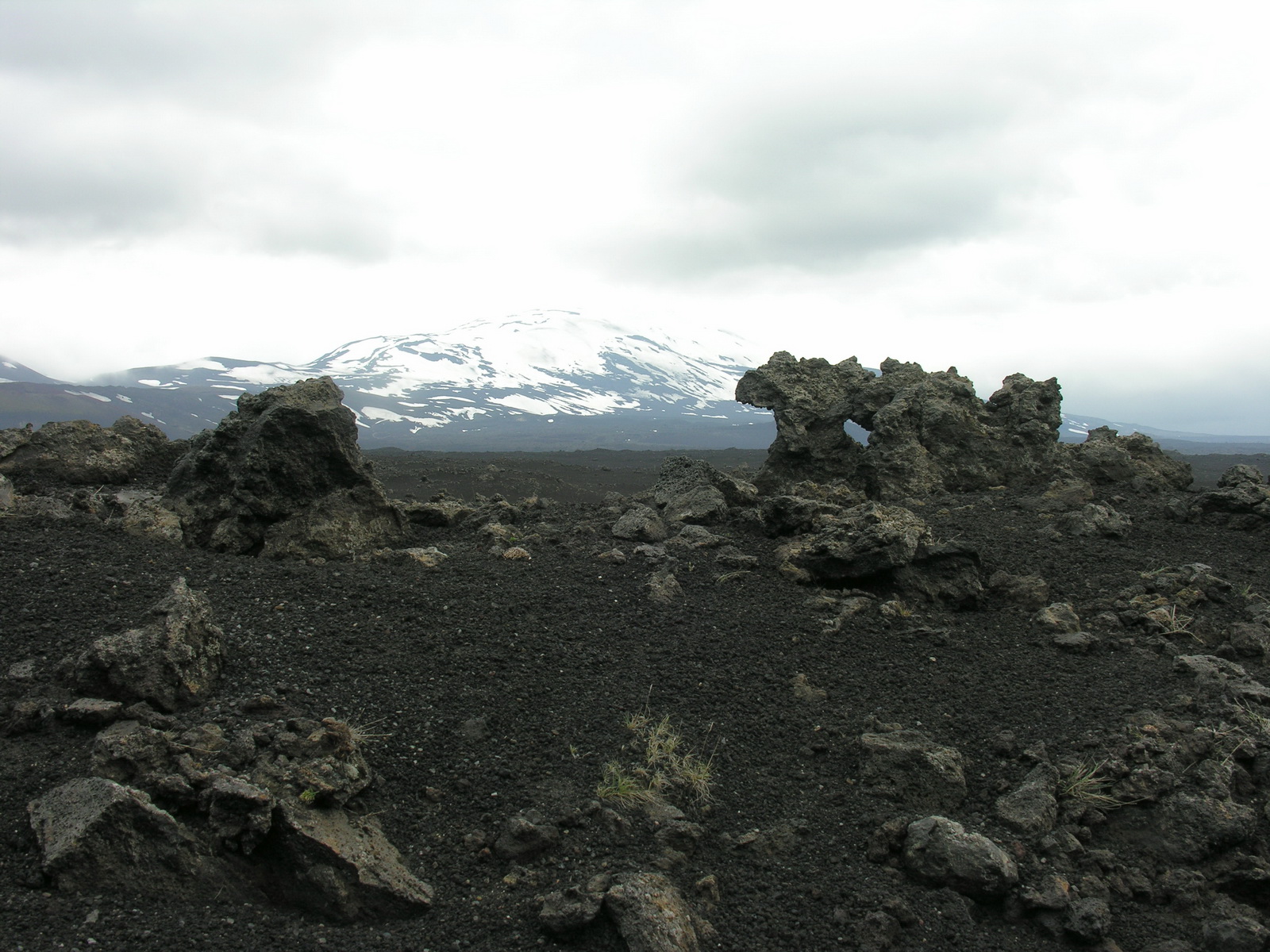
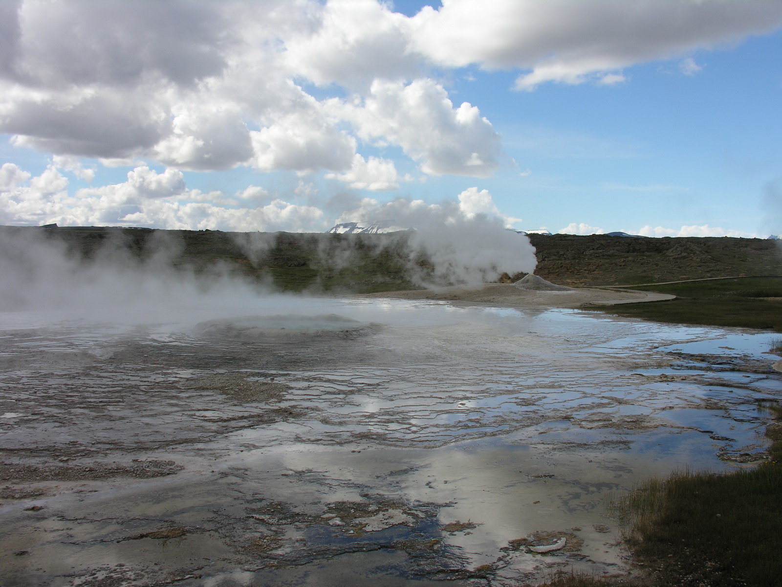
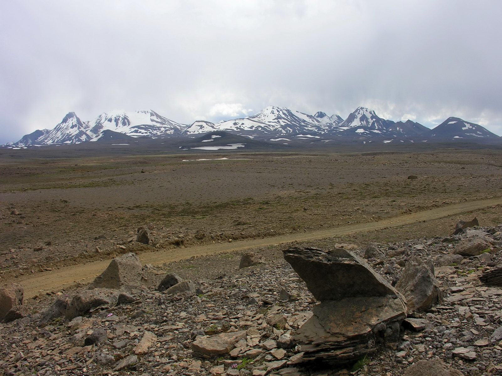
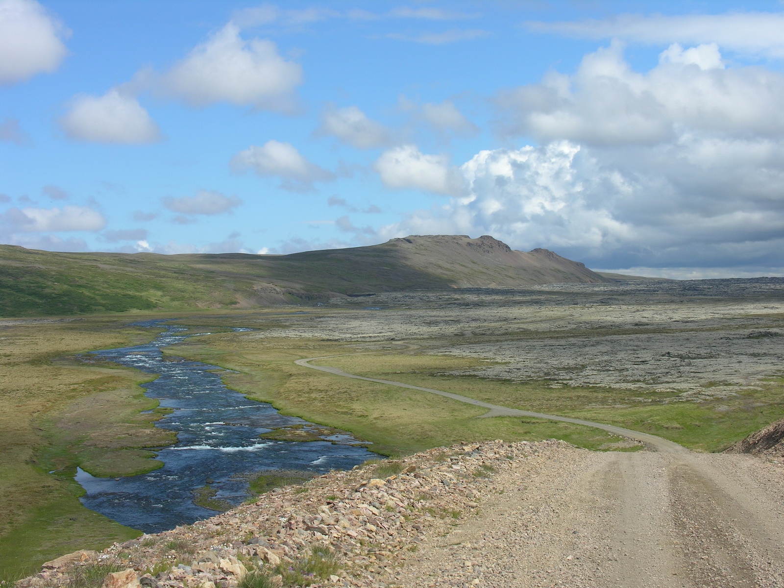
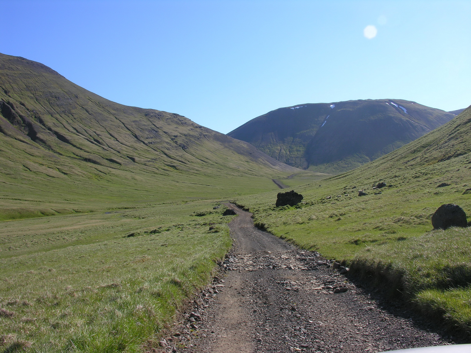
Our first night in our camper, Sonja slept quite good, i awoke around half past midnight, when our icelandic neighbour turned on the radio and banged the door of his camper when he walked the dog. There is a different feeling of time here, when the nights are so bright. We got up at 7 and were on the road at 9 in the morning. Through green farmland we drove to The Geysir, the one who gave his name to all other geysers in the world. Geysir himself has retired, he is working very erratic now. But his neighbour the Strokkur is erupting very reliable every 5-6 minutes. The next stop was the Gullfoss, a big, impressive waterfall in two stages. It's very touristy here, every Iceland Tourist visits this place, because its so easy to access. (We met also the Australians from the guesthouse here and at Geysir). After having lunch with a view on the waterfall, the mountains and the glaciers in the background, we decided not to stay overnight here, but to drive to our next destination, Landmannalaugar, today. Along wild, broad rivers we drove northeast to the highland, first on bitumen and the last 35 km on gravel. The last section led through wild country, over lava fields and pumice plains, which reminded me on pictures of the Mars probes. Nearly nothing is growing there, only some moss on the hill slopes. Shortly before Landmannalaugar we had our first two (harmless) river crossings. We camped within a great scenery, the colours of the surrounding mountains getting more intense with the low sun. |
 |
 |
 |
 |
|
Strokkur Geyser:
Bubble
|
..Eruption
|
..and Steaming
|
Hot Spring
|
 |
 |
 |
|
|
Gullfoss
|
The Track
to..
|
..Landmannalaugar
|
|
|
Day
|
Landmannalaugar |
|
|
Sa 14.06. |
Hiking at Landmannalaugar |
|
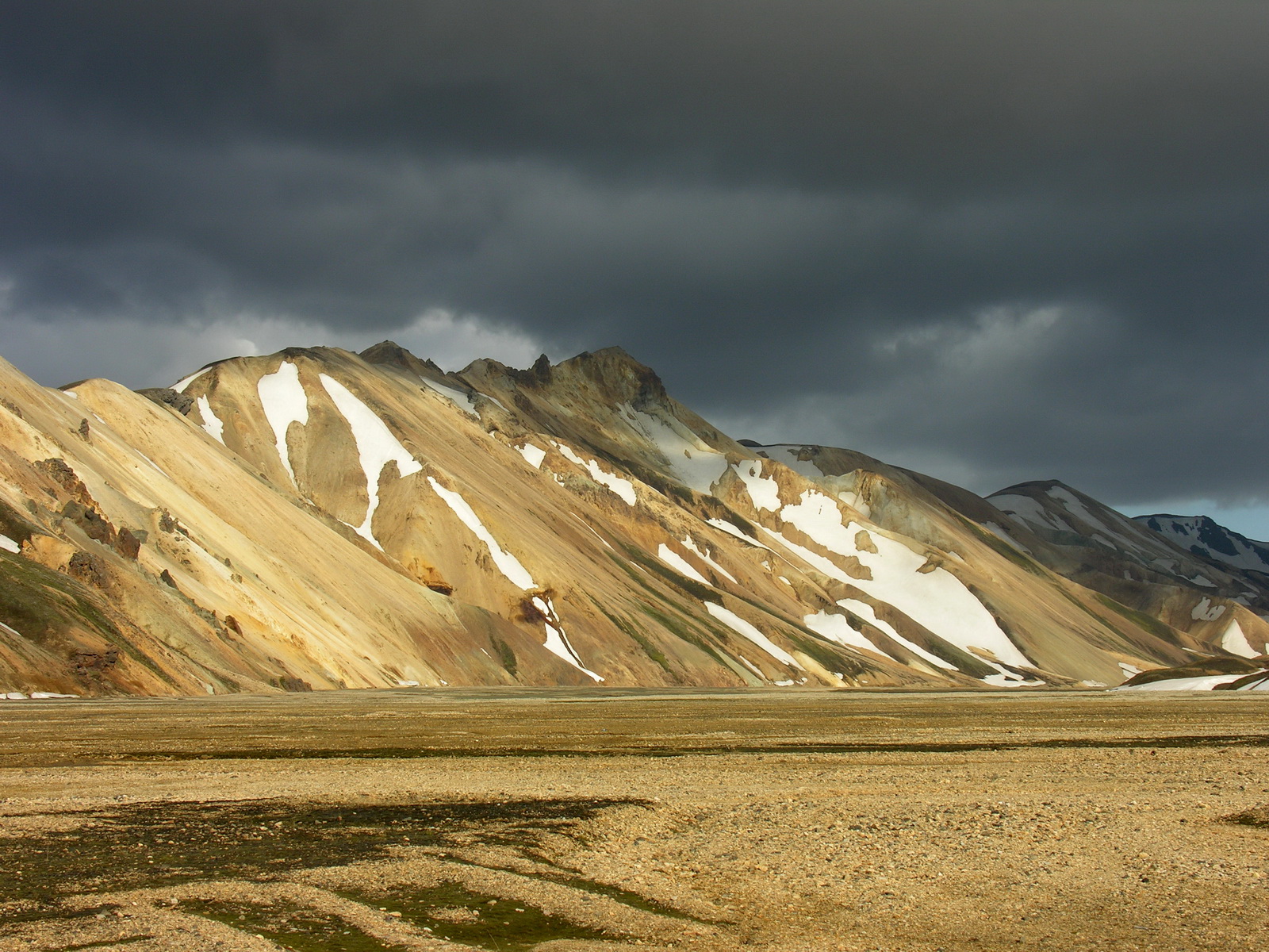
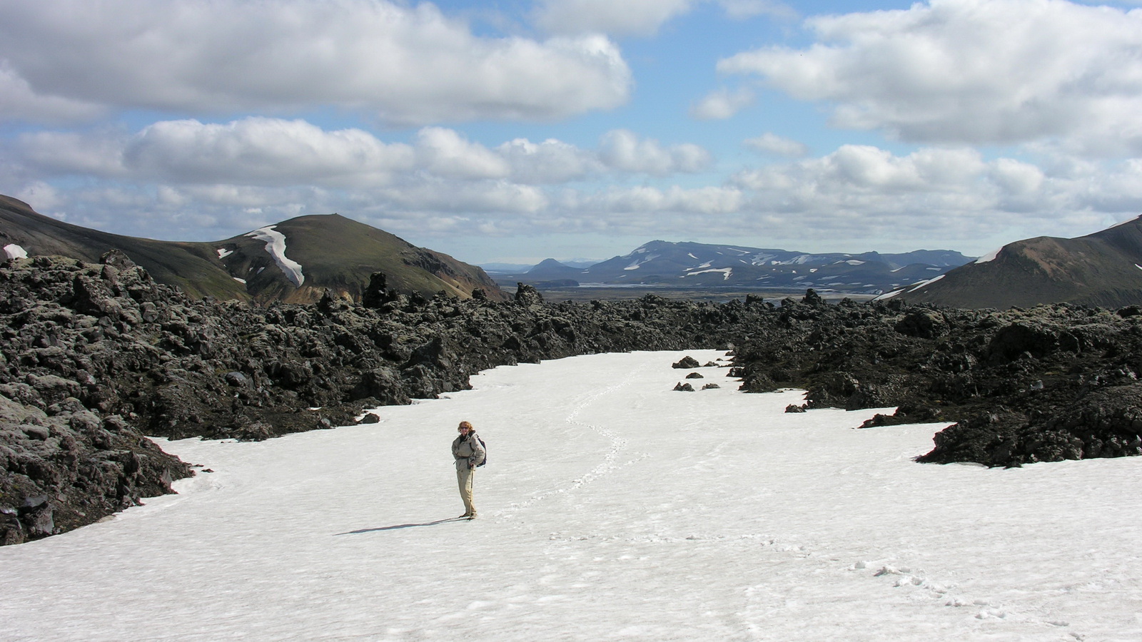
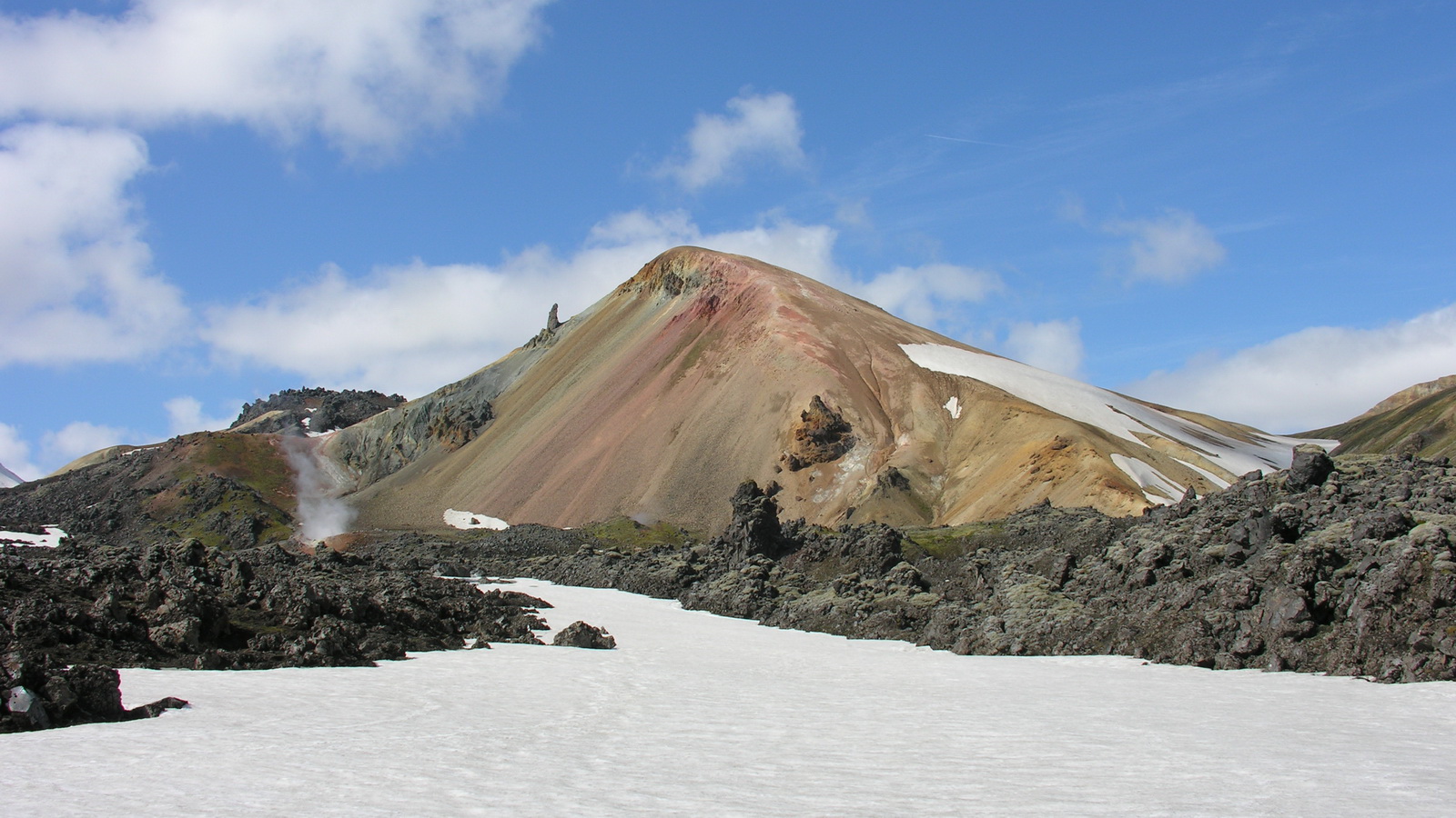
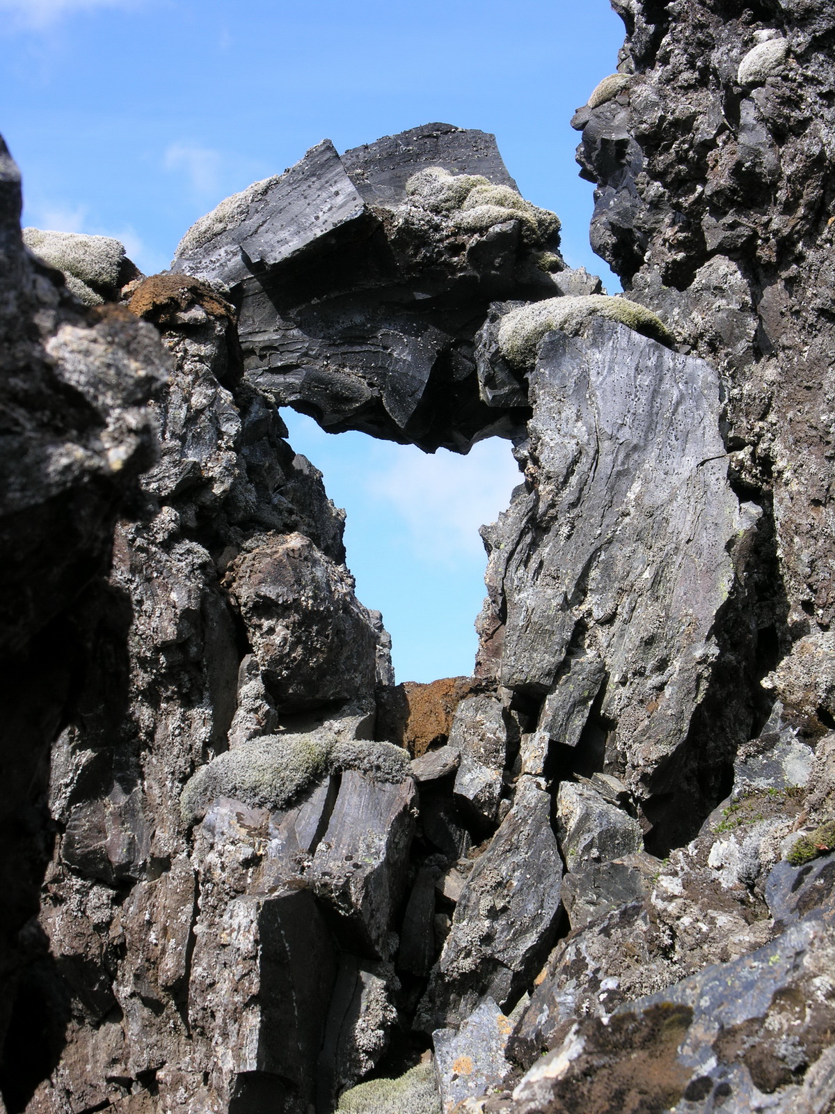
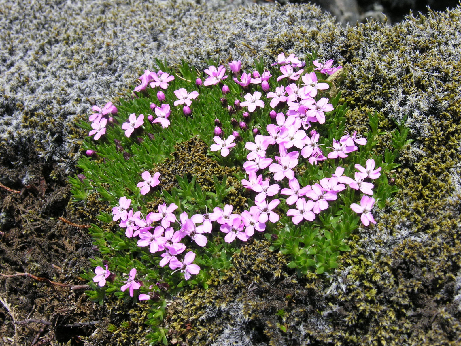
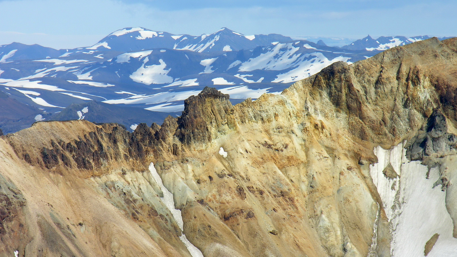
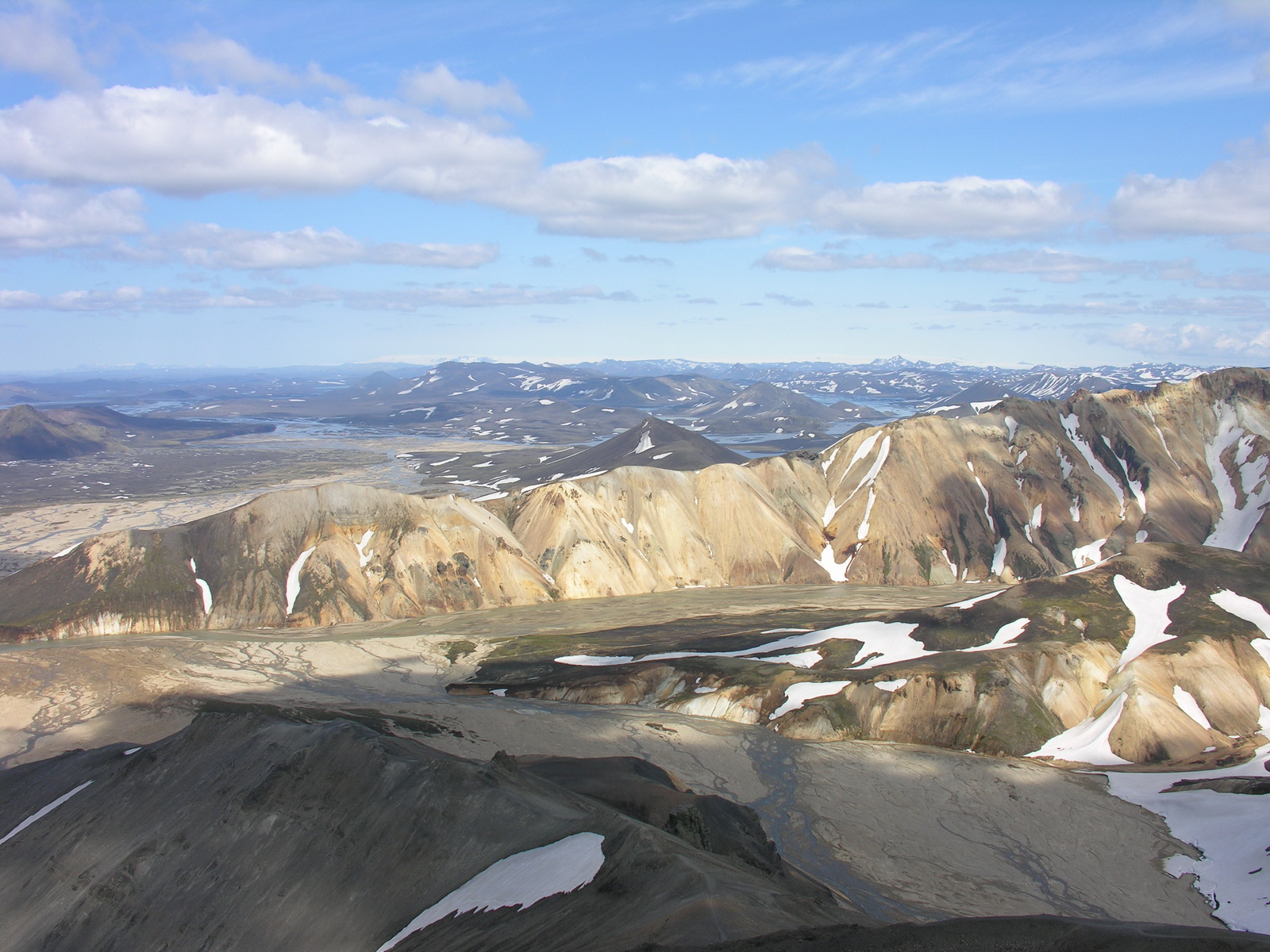
We started at 9 am
for a hike to the Brennisteinsalda, the weather still sunny. Following
a path into the lava field, we noticed shortly after the start, that it
might not be the official one. But the GPS showed, that we went into the
right direction, and so we continued and searched our way through the
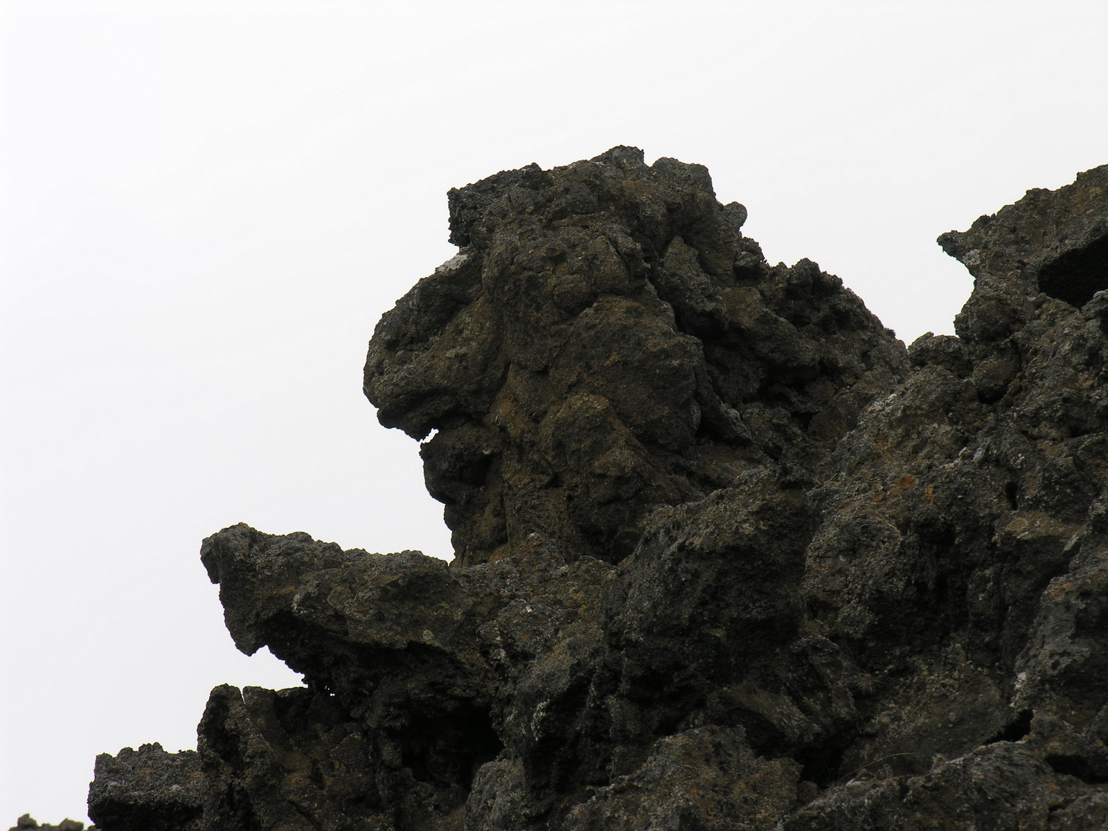
labyrinth of lava blocks. All around us weird natural sculptures of glass-like
lava, sharp as a knife. Finally we reached a snowfield, that led us to
the foot of the Brennisteinsalda, a volcanic mountain in all colours between
red and yellow, with white snow and black lava. A fumarole exhaled steam,
smelling of sulphur. We were back at 1 pm, and i went later in the afternoon
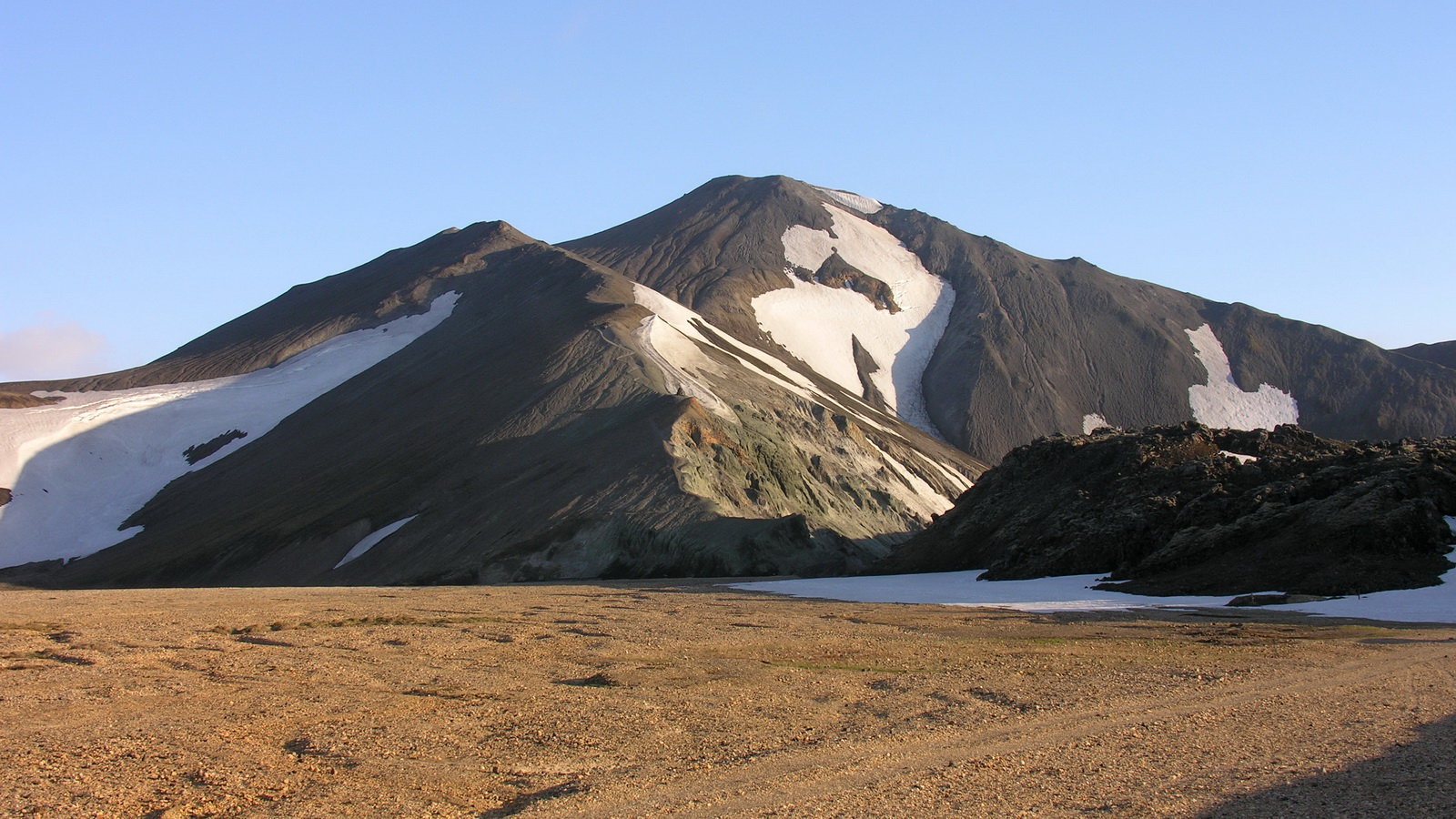
for another tour, while Sonja stayed at the campground. I hiked on the
top of the Blahnjukur, its not very high, but strenuous, because all the
way is loose volcanic ash and gravel. The tour was very rewarding, on
the top i had a surpassing view: the four biggest glaciers of Iceland,
steep mountain ranges, colourful and partly covered with snow, wild rivers
and no sign of civilisation except the campground and the track leading
there. And i had it all for myself, no one disturbing me up there, the
best mountain experience since being alone on top of Uluru! |
 |
 |
 |
 |
|
Hike through
the Lava..
|
to the Brennisteinsalda
|
Lava Sculpture
|
There is Life
here
|
 |
 |
 |
|
|
Blahnjukur
|
Phantastic
View..
|
..on the Top
|
|
|
Day
|
Vik |
|
|
Sun 15.06. |
Around the Hekla-Volcano to the Sea |
|
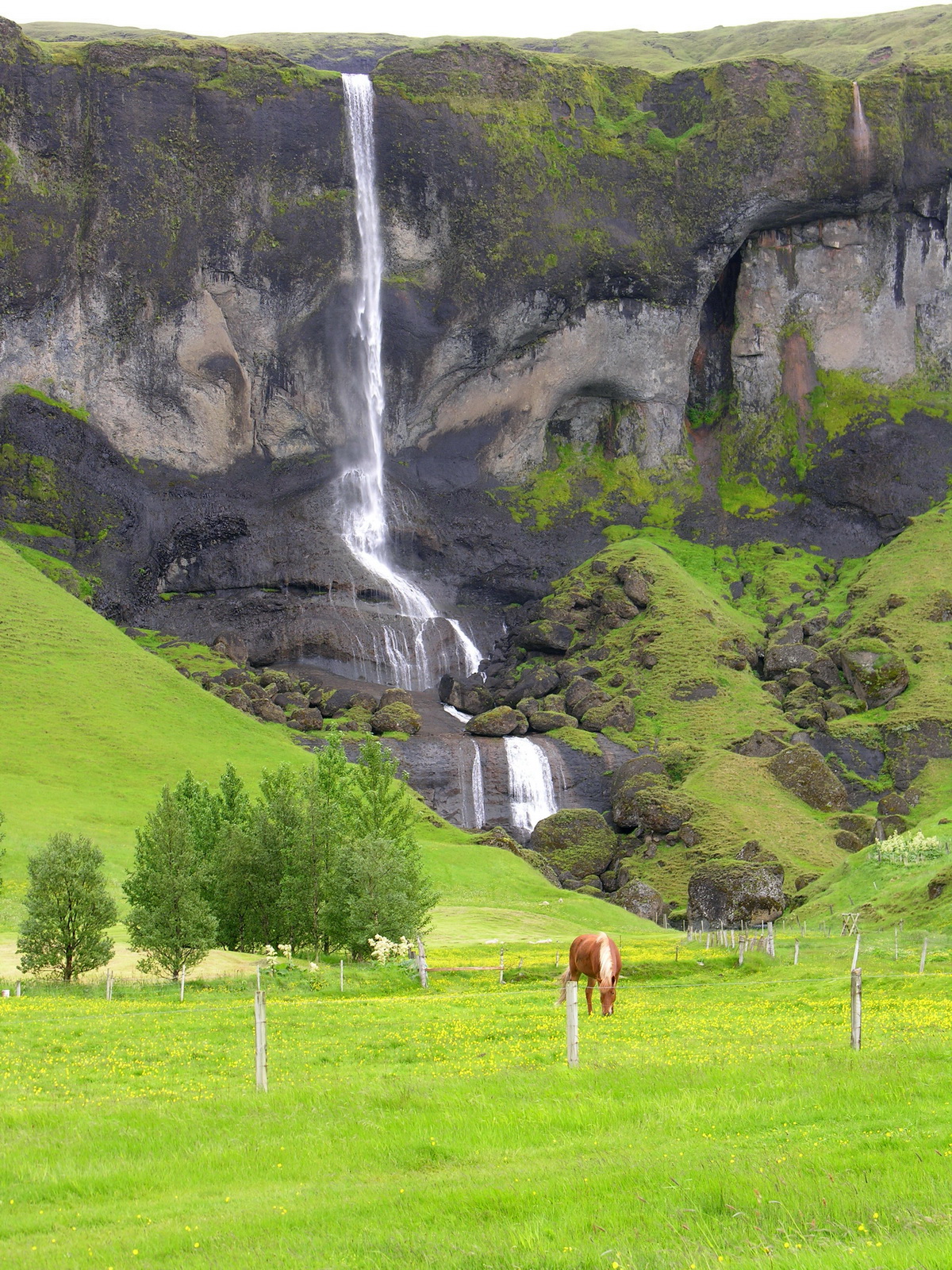
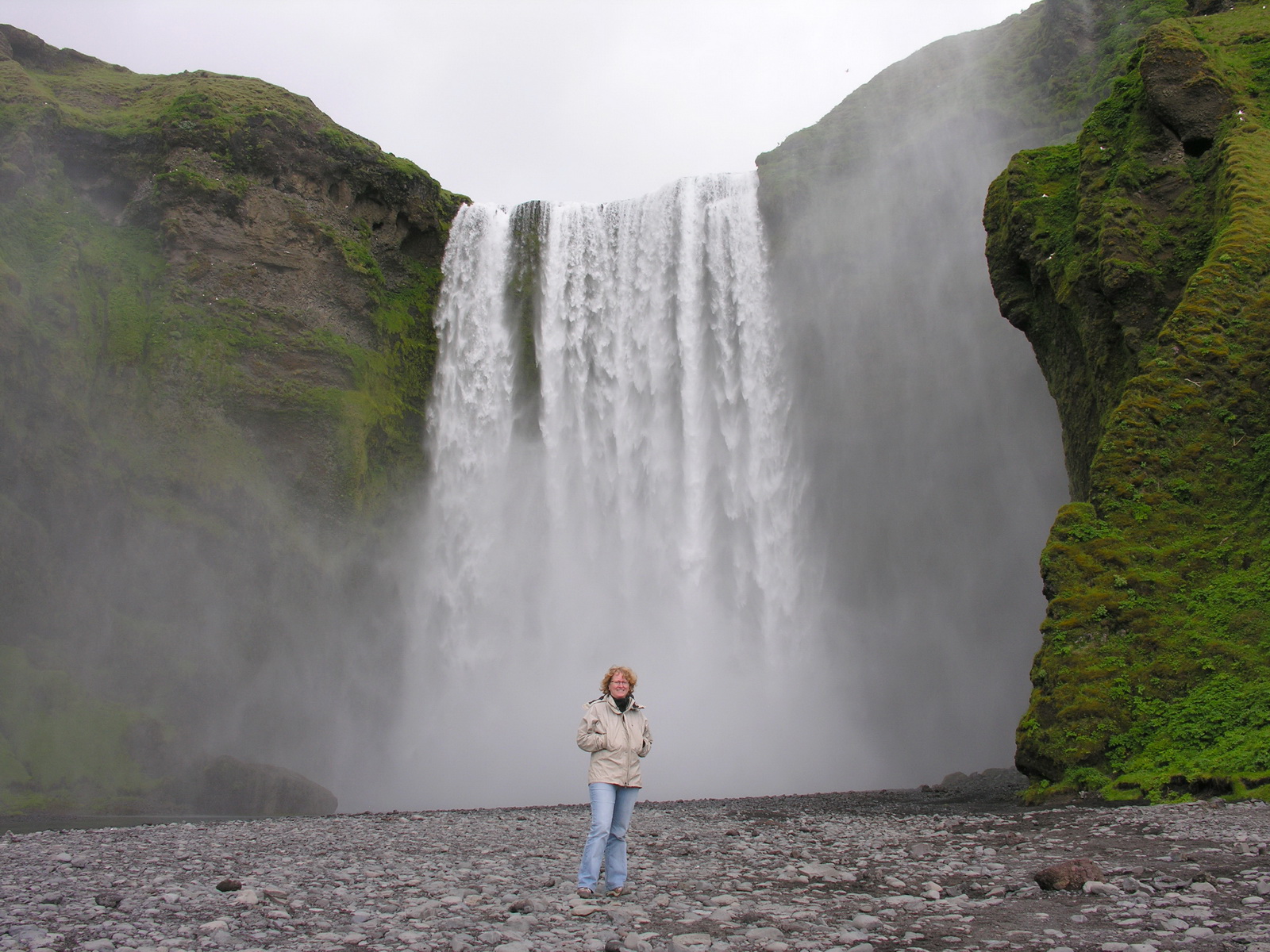
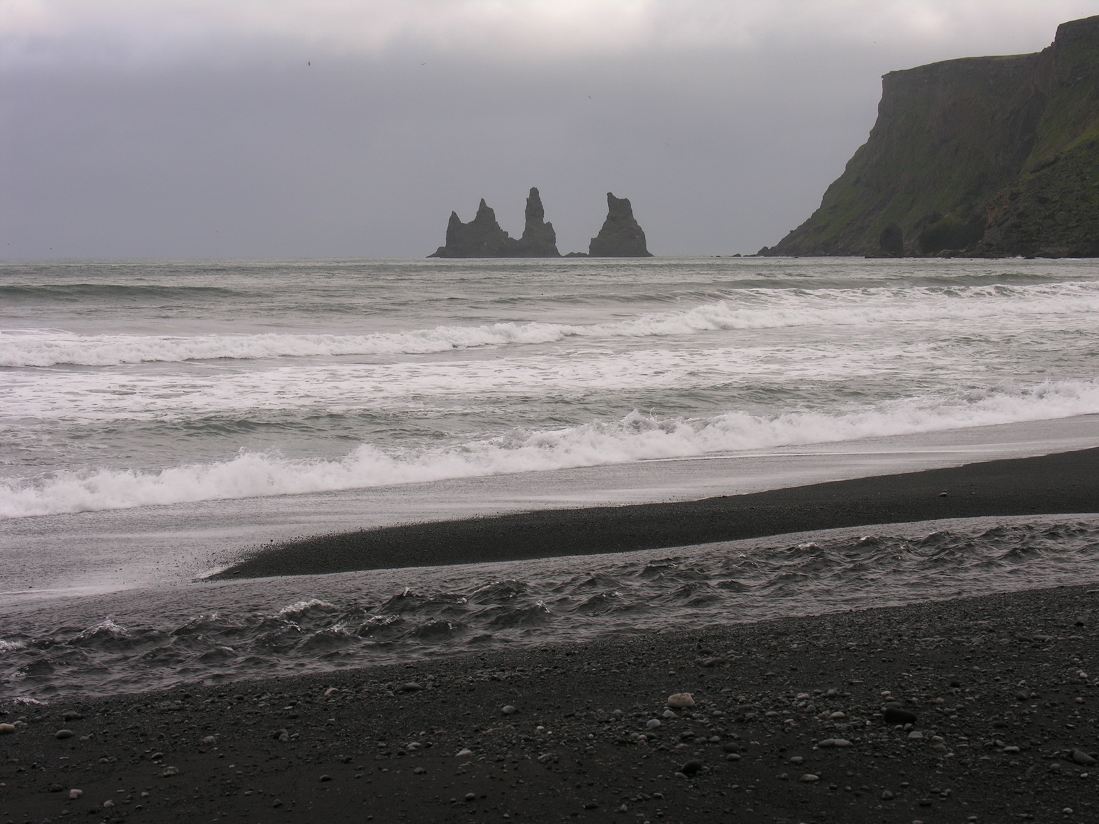
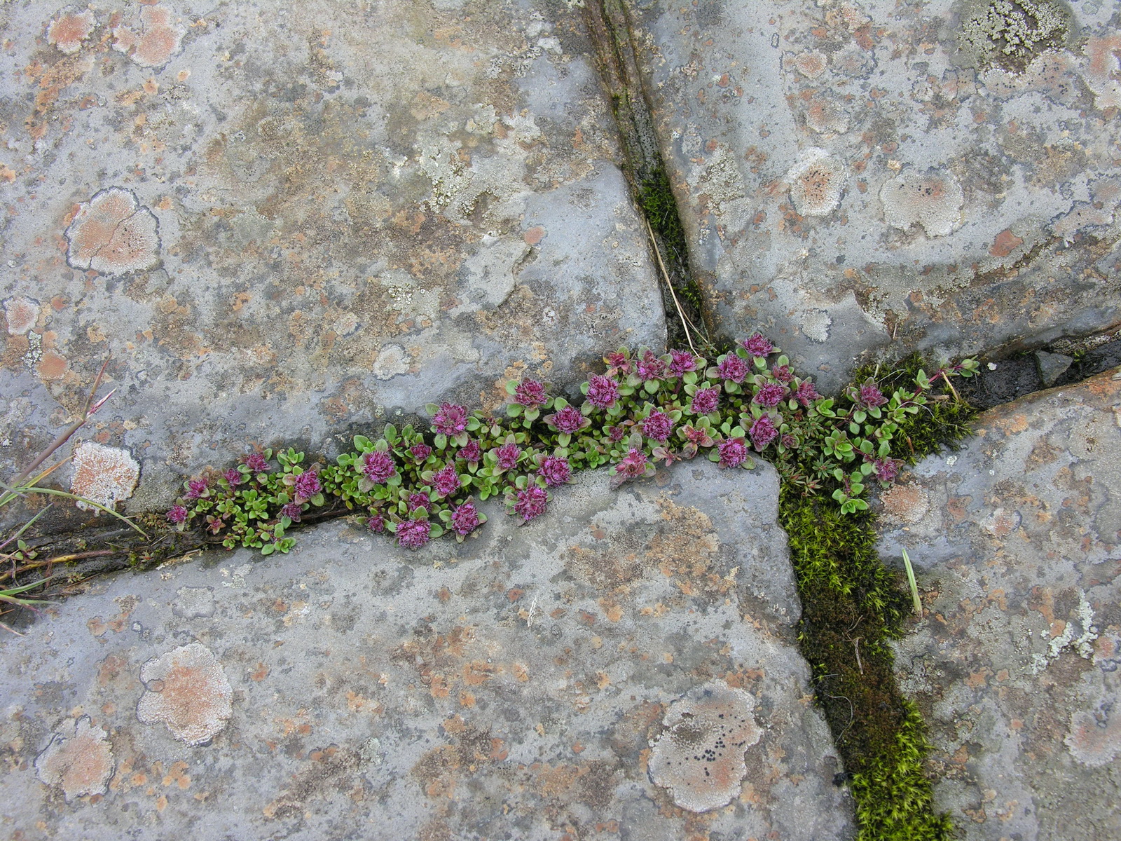
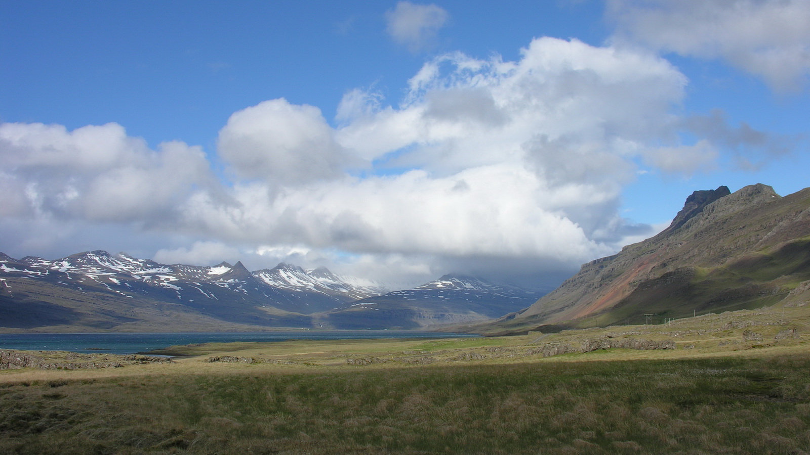
In the morning the weather was overcast, but still dry. We left Landmannalaugar and drove route F225 along the outskirts of the Hekla volcano back to civilisation. The track leads through wild land with several rivers to cross. Then it winds over volcanic ash and the lava streams of the Hekla. It was a eerie view together with the grey low hanging clouds. But the track was not difficult, and the water in the river crossings was not deeper than the wheels. We took our time, and after two hours we were back on bitumen. Only one car and the public bus came against us. We drove south towards the coast, and then on the road number 1 east. In the small town of Hella we bought supplies and diesel for the next few days. After a short stretch of flat landscape the steep cliffs of the south coast were rising out of the coastal plane. Numerous waterfalls are flowing from the cliffs, the most beautiful were the Seljalandsfoss and the Skogarfoss. The weather was very changeable, sun and rainshowers alternated every ten minutes. But despite the bad weather the strong colours of iceland came through: Black rocks, white waterfalls, the incredibly green of the grass and the red and blue roofs of the farmhouses. We stayed overnight in the small coastal town of Vik. After dinner (chili con carne) i made a walk along the black sandy beach, there were bizarre rock needles in the sea and thousands of noisy seabirds nesting in the cliffs. |
 |
 |
 |
|
River Crossing
on the F225
|
The Hekla
|
Postcard-Iceland
|
 |
 |
 |
|
Skogarfoss
|
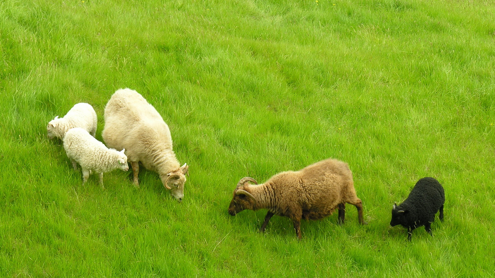
Sheep at the
Skogarfoss
|
Rock Needles
at Vik
|
|
Day
|
Svinadalur |
|
|
Mo 16.06. |
Over the Skeidarsandur to the Vatnajökull |
|
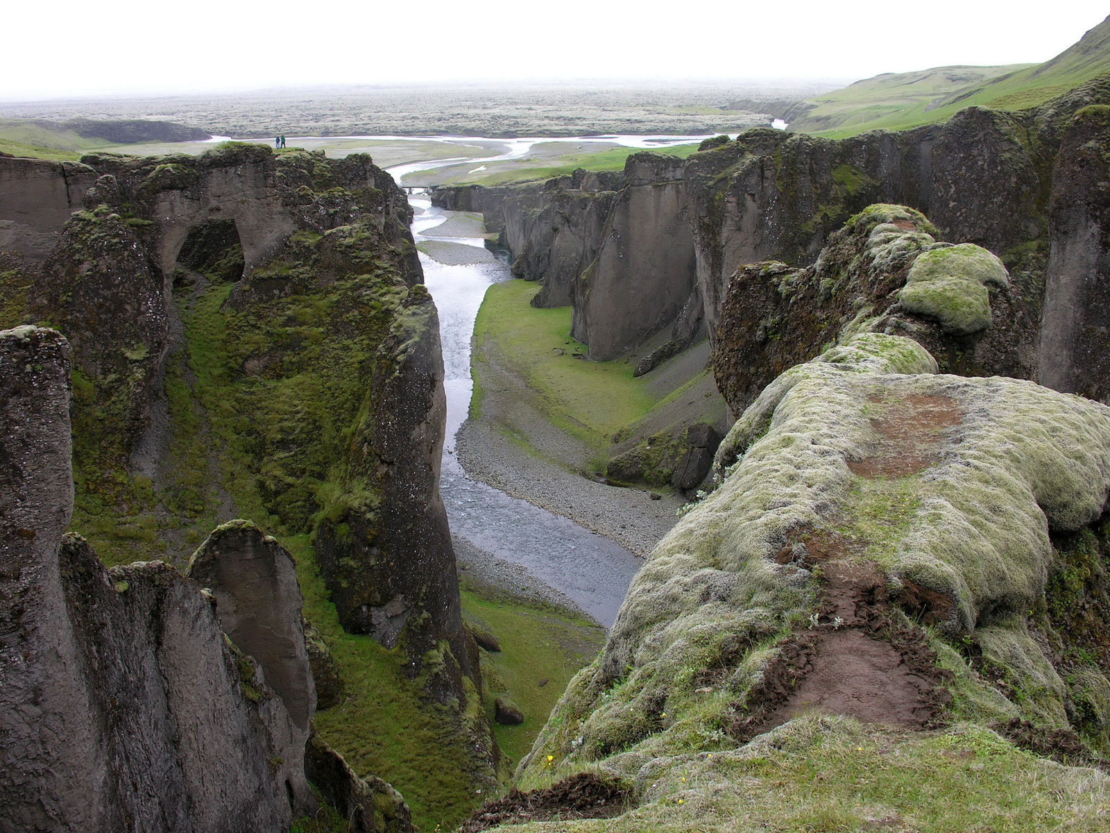
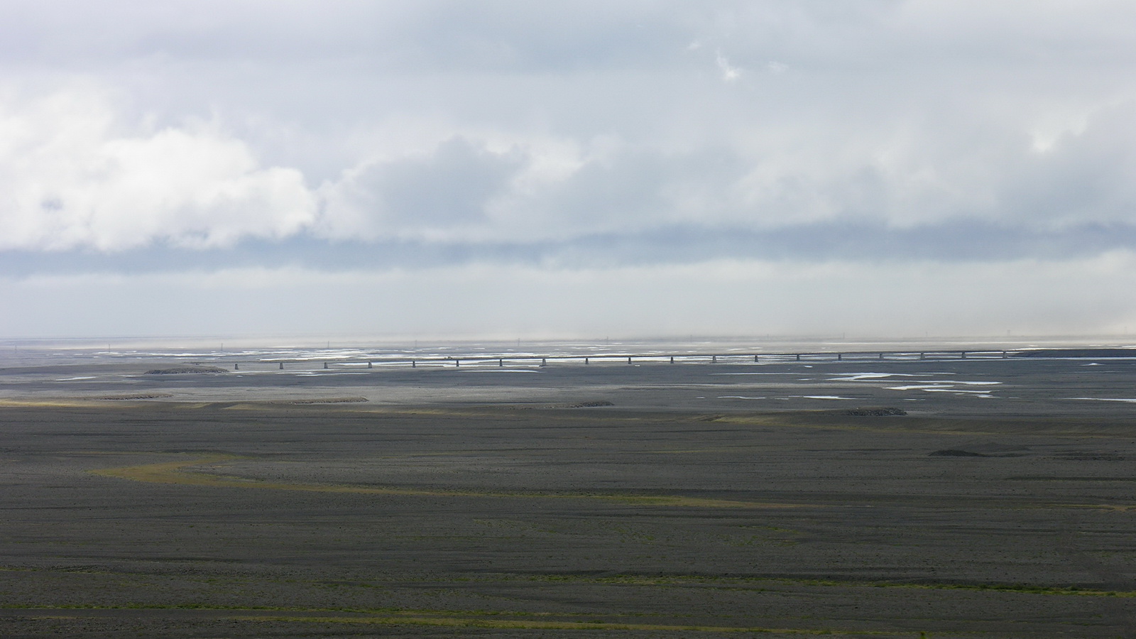
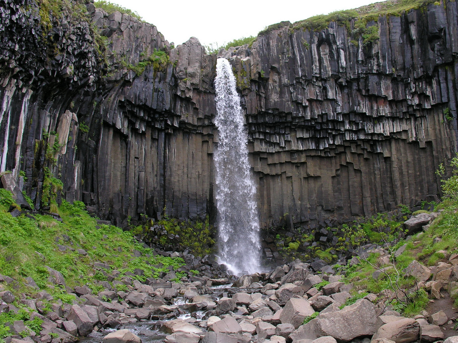
We slept very good, because it was so quiet, you could only sometimes hear the seabirds in the cliffs behind us. After breakfast we went to the local souvenir shop, which is also a factory for clothes made of iceland wool. They were very nice, but far too itching for us. We drove east on the no.1 and took the turnoff of the F206 to the Laki volcano, but the road was closed after few km. Instead we visited the nearby canyon Fjadrargljufur (Sorry they have this names here), where a river has carved through soft tuff stone and created high columns. Near our next stop, Kirkjubaejarklaustur, we saw a natural pavement of eroded basalt columns. The road leads on for many km along green cliffs with waterfalls, then the cliffs retreated and we came on the vast rubble plain Skeidarsandur. This plane was created by the water which emerges from the glacier, when there is a volcanic eruption under it. During these so called glacier runs, enormous amounts of water were released, 1996 the maximum was at 45000 m³/s (1/4 of the flow of the Amazon river!), and several kilometrers of the road No1 and some bridges were destroyed by the water and 10 m high icebergs drifting on it. During our drive over the black plain the water came only in form of heavy rain and something we would call a storm (in Iceland it's "some wind"). The glacier was only hard to see, and from time to time we had to cross one of the numerous wild glacier rivers on long one lane bridges. Finally we arrived at Skaftafell National Park. Here, in the lee of the mountains the weather was good enough for a short hike to the Svartifoss, a beautiful waterfall among black basalt columns. For the night we camped at Svinafell, next to a public spa. We enjoyed a typical icelandic tradition: to swim in a 30°C warm outdoor pool, despite the cold and strormy weather. After swimming we relaxed in a 40°C hot whirlpool, watching the rain clouds drifting over glacier and plain. |
 |
 |
 |
 |
|
Fjadrargljufur
|
Natural Pavement
|
A
Bridge at Skeidararsandur
|
Svartifoss
|
|
Day
|
Hamar |
|
|
Tue 17.06. |
Glacier Lakes, Icebergs and Fjords |
|
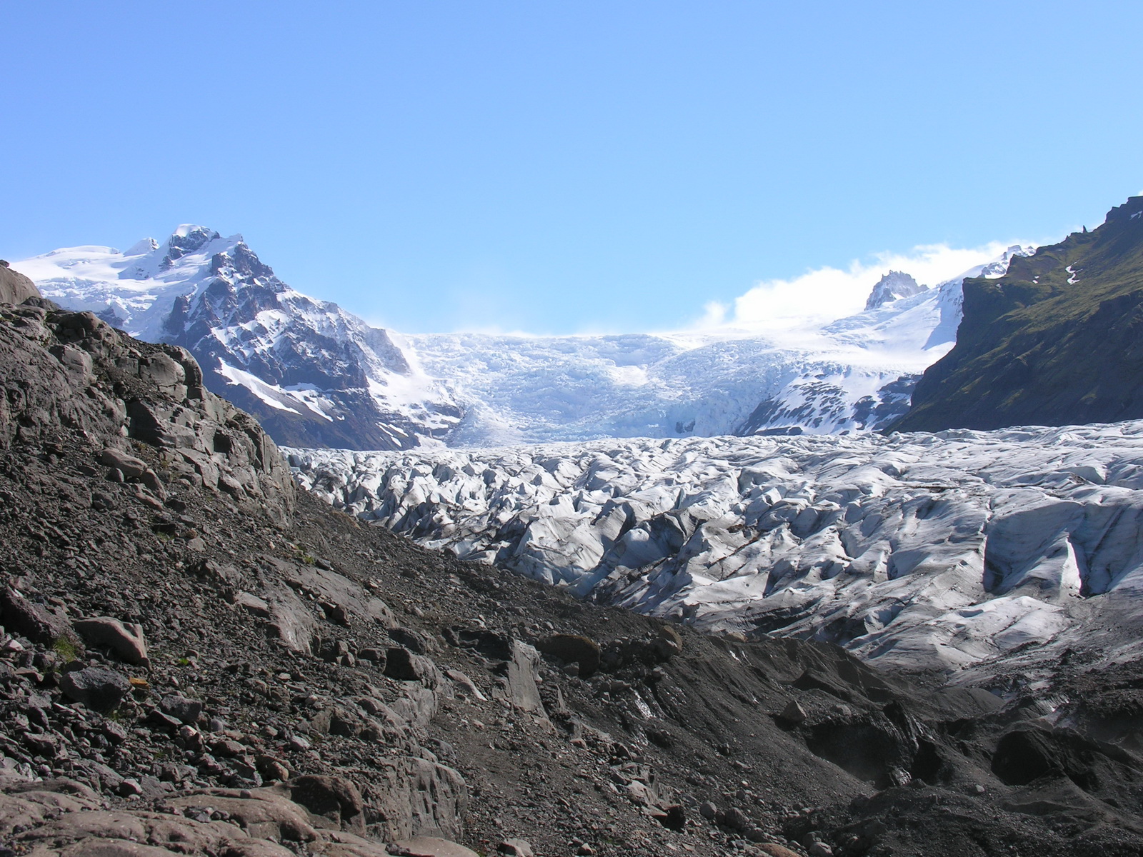
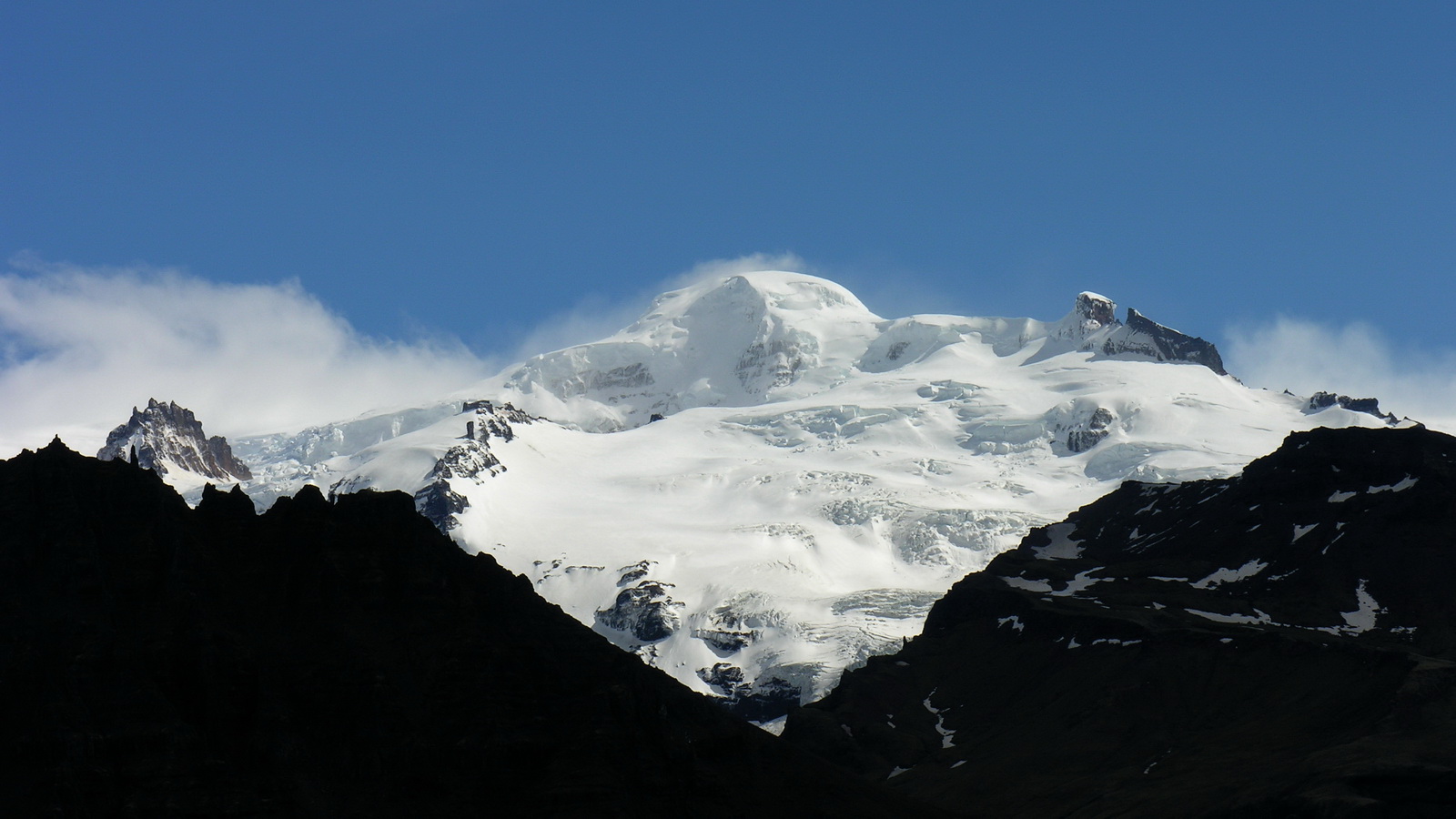
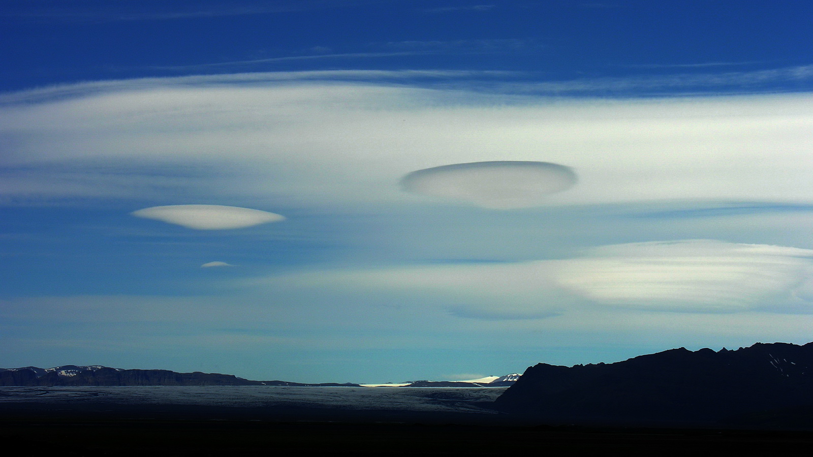
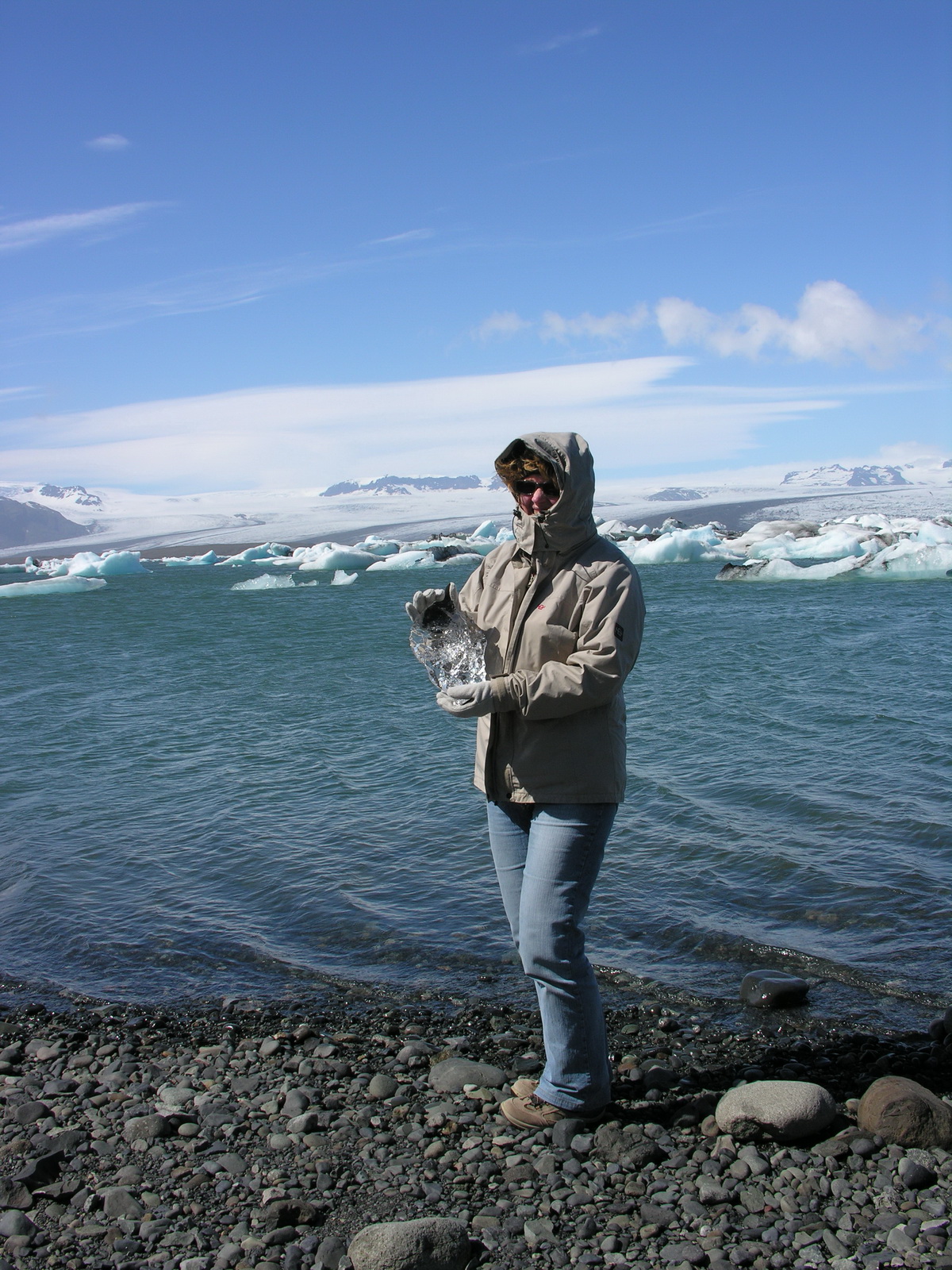
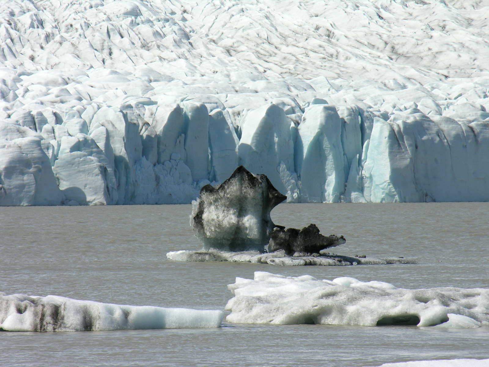
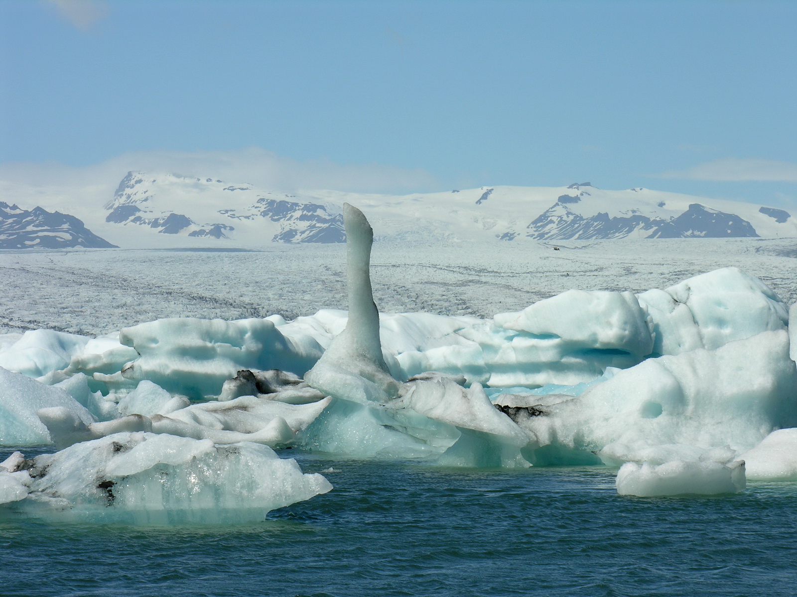
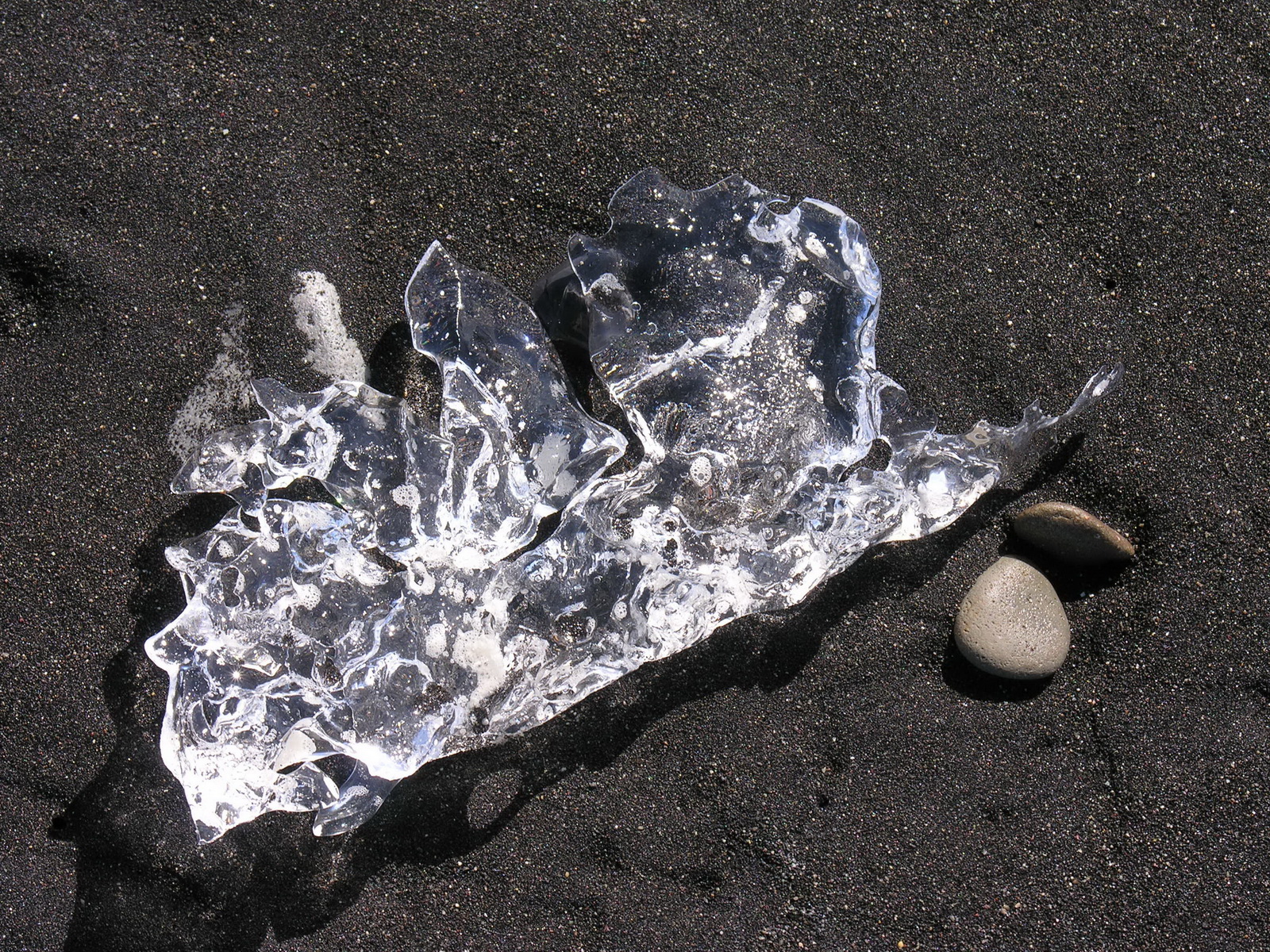
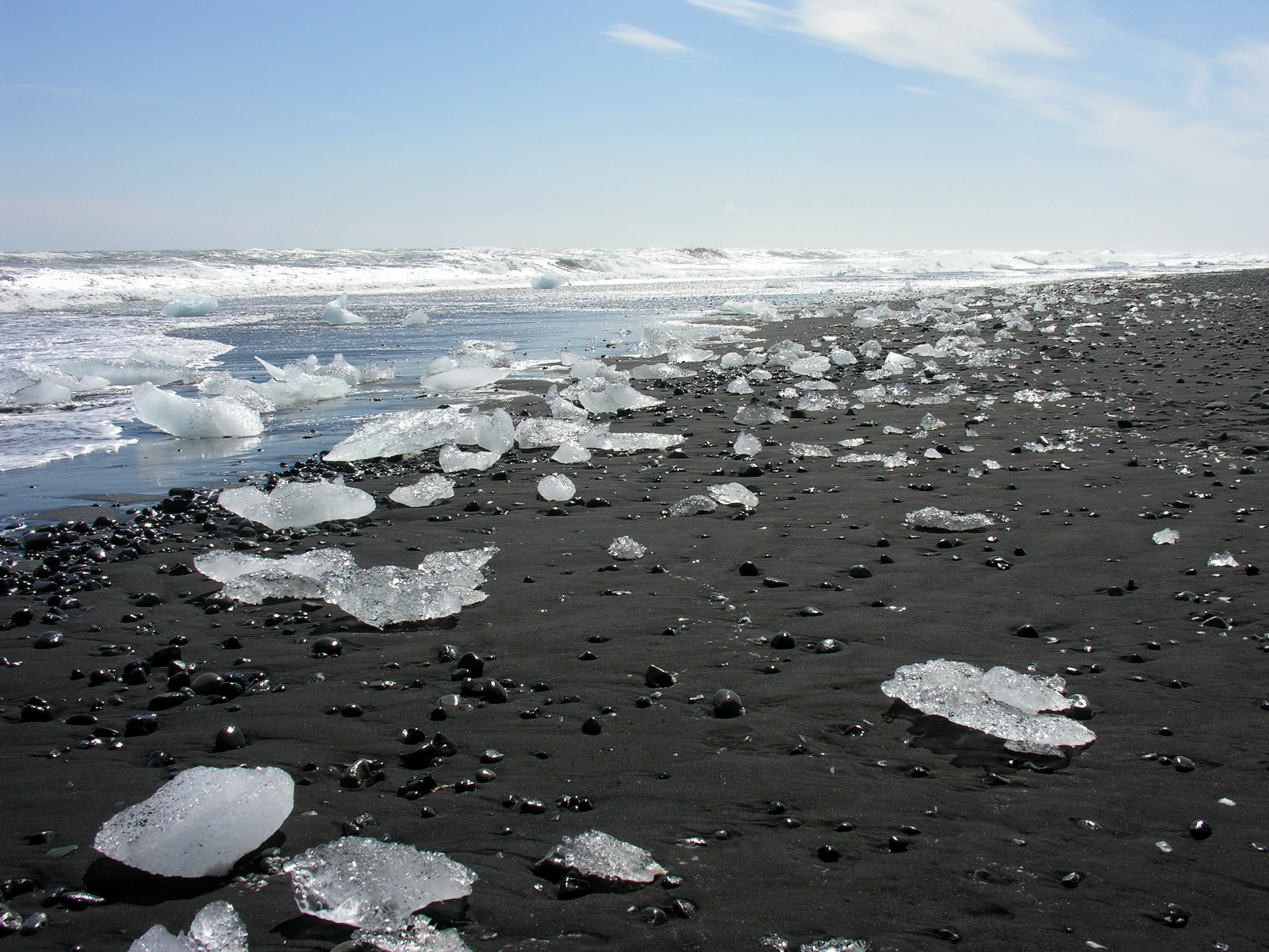
The night was quite cold, only 7°C in the camper, and in the morning the sky was clear blue. We drove a short way back, then on the gravel track to the Svinafell glacier. All mountain tops were bright white, and a strong icy wind was coming down the glacier, it felt like Greenland. We made a short hike in the lee of the mountains to the end of the Skaftafelljökull, but despite the sun was lighting the glaciers, we were all the time in the shadow of a stationary cloud, created by the mysterious wind conditions here. So it was too uncomfortable for a longer hike, and we moved on. After 50 km around the southeastern corner of Iceland, the huge Breidamerjökull appeared. Here the glacier formed several lakes at its base and ice is breaking off and forming icebergs. The most famous of the lakes is the Jökulsarlon, and only a small barrier of rubble is separating it from the sea. In the lake were drifting lots of icebergs in weird shapes, seals, ducks and gulls could be seen. On the other side of the barrier, at the sea, there were hundreds of small icebergs and pieces of ice on the black sand. They drift in the shortest river of Iceland out of the lake the 200m to the sea and were washed ashore again there. It was a photograpers paradise, and i could have spent there hours. But the wind was so strong and cold that even we had several layers of clothes on, we had to go back into the car after a hour. We continued along the coast and in the next town Höfn we had fish and chips for a late lunch. We could not find the campground, were we planned to stay for the night, so we decided to camp somewhere free. But it was not easy to find a spot which was protected from the strong northeasterly wind. Finally we found a spot in Hamar, at a small road leading inland, with a nice view of a waterfall and a hill protecting us from the sea wind. |
 |
 |
 |
 |
|
Svinajökull
|
Hvannadalshnukur
2119m
|
UFO's over
Iceland
|
Sonja
"on the Rocks"
|
 |
 |
 |
 |
|
Breidamerjökull
|
Icebergs at
Jökulsarlon
|
Ice..
|
on
the Beach
|
|
Day
|
Hallormsstadur |
|
|
Wed 18.06. |
Around the Eastern Fjords |
|
What a night! We awoke shortly before midnight, because the camper was shaking and the canvas of the pop-up roof was flapping so loudly that you could not think about sleeping anymore. The wind has turned and was now blowing down the valley directly on the side of our camper. So the only remedy was to close the roof and convert the seats and the table so that we could sleep there, we also had to go outside to lock the roof. Now it was quiet enough to find some sleep again, but at 3:30 am the sun was shining directly into my face, and i woke up again. We crept deeper into our sleeping bags and managed to sleep until 7. During the morning we drove along the beautiful fjord coast, the weather sunny but still stormy, so you could not think about outboard activities. Then we turned inland and drove over a pass (only 500 meters high but with drifting snow) to Egilstadir. There we went first to a rustic cafe, were we drank macchiato and had a huge portion of blueberry cake, before we bought supplies for the next week. At the nearby lake Lagarfliot we found a nice campground directly at the shore. The wind had diminished a bit, but there were rain and sleet showers. In a dry period i made a hike in the wood. Right, there was a wood, here was one of the few on Iceland. The trees were mostly planted in the 50s and not taller than 20m. |
 |
 |
|
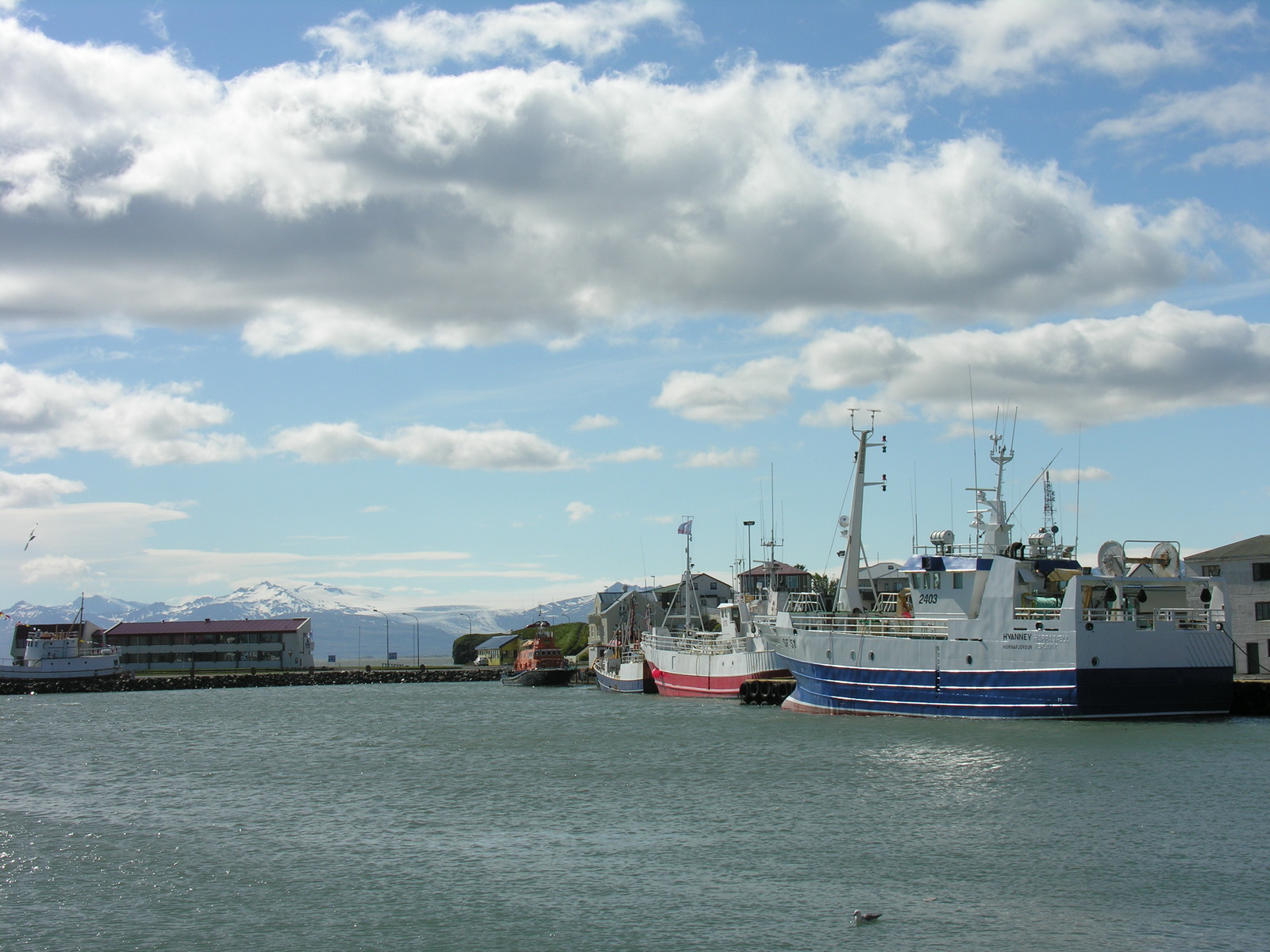
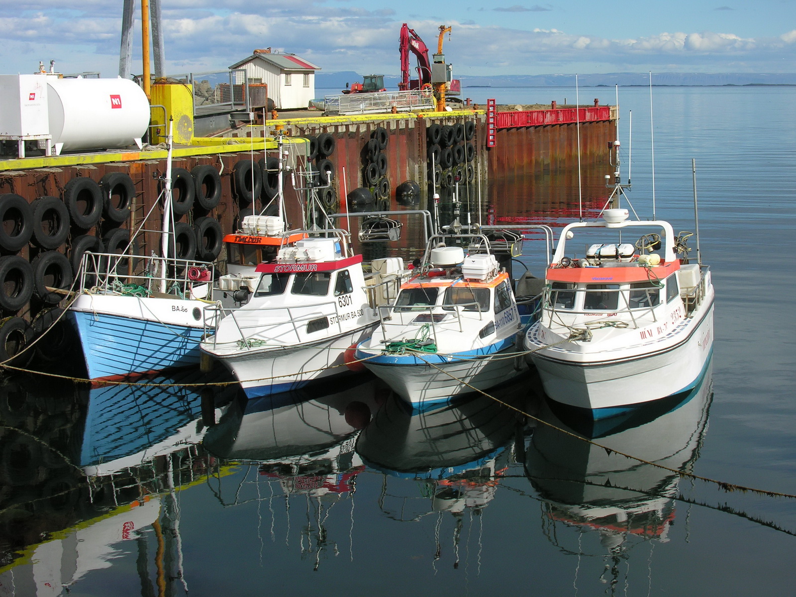
Fishtrawlers
und Glaciers in Höfn
|
The Morning
After the Stormy Night
|
|
Day
|
Asbrygi |
|
|
Thu 19.06. |
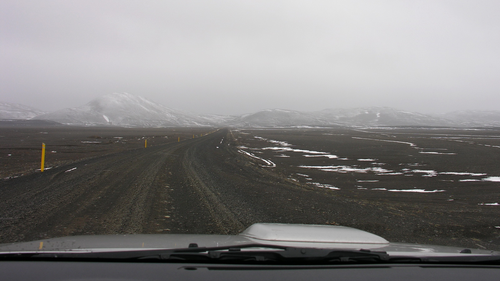
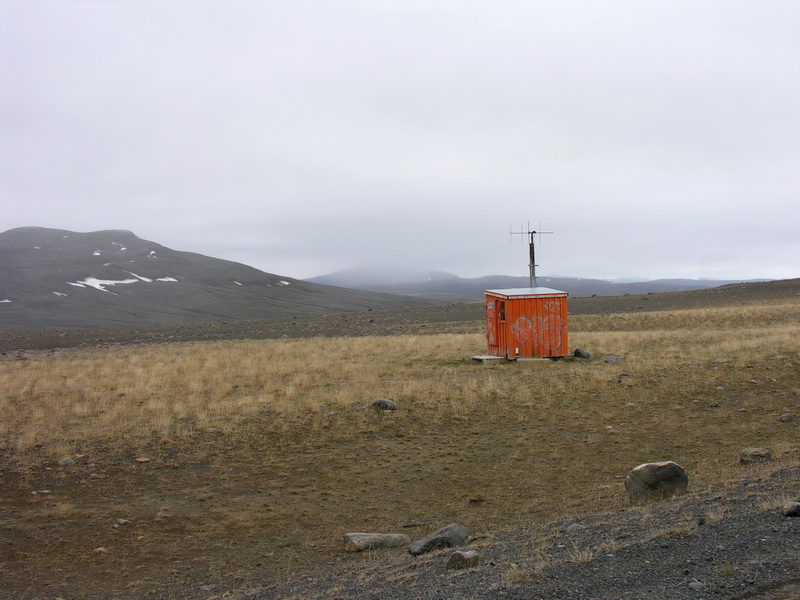
Through Drifting Snow over the Highlands |
|
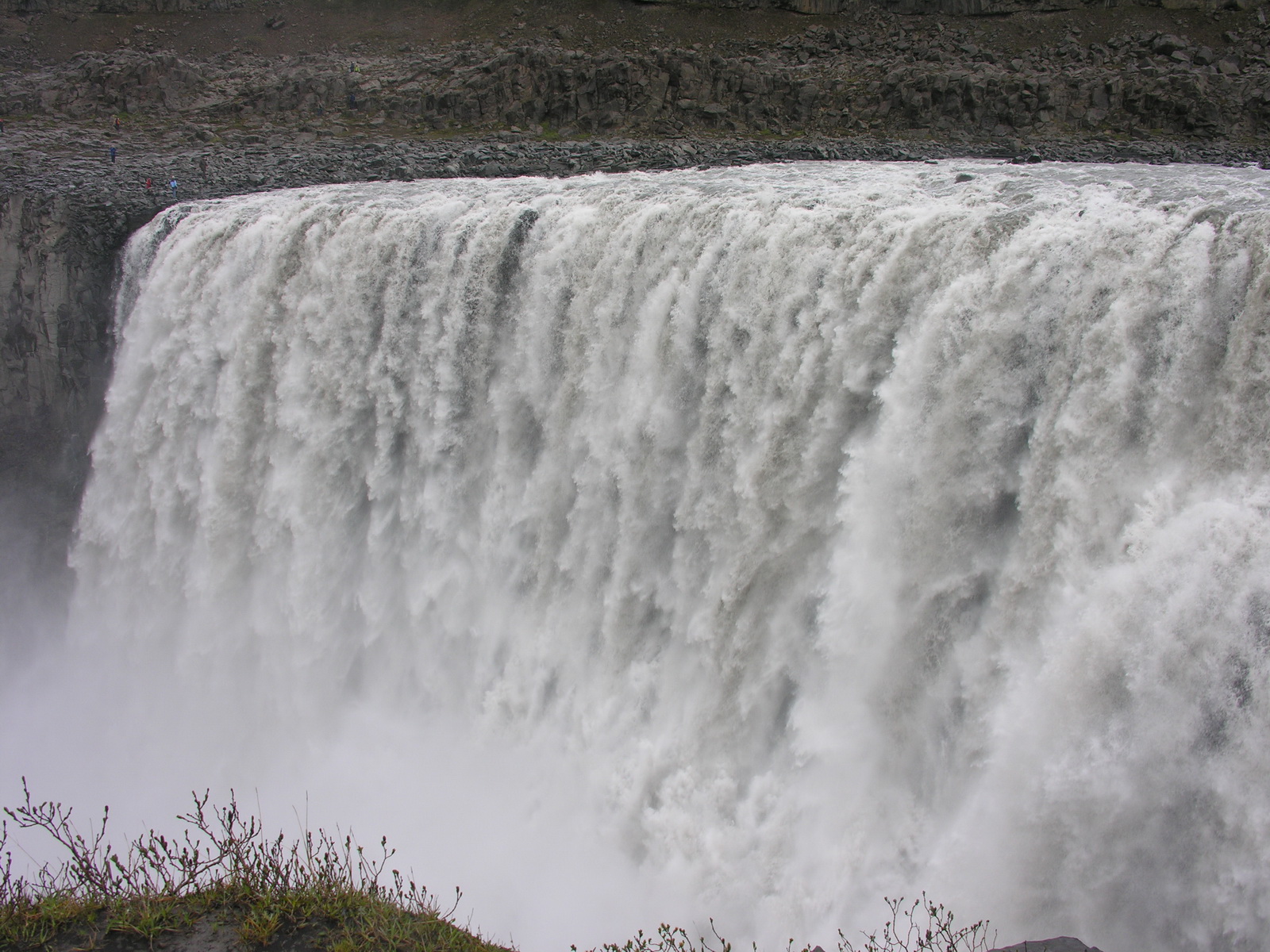
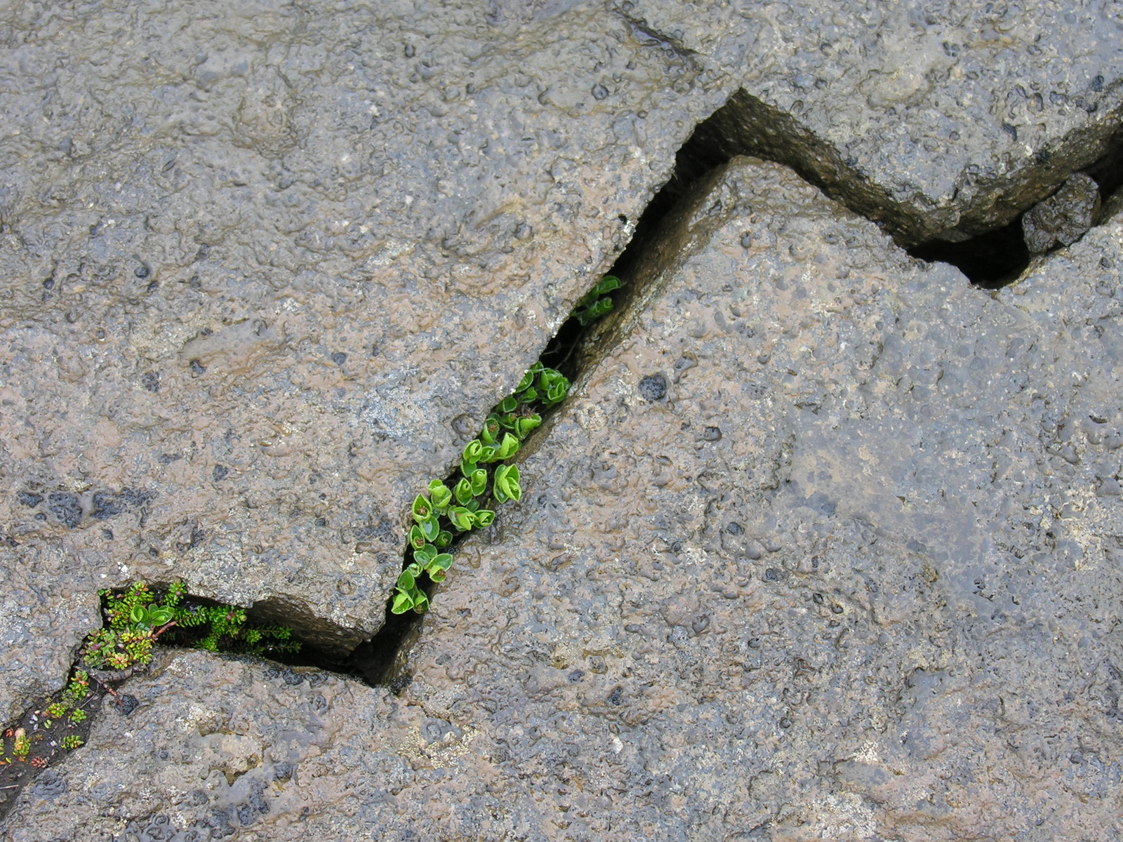
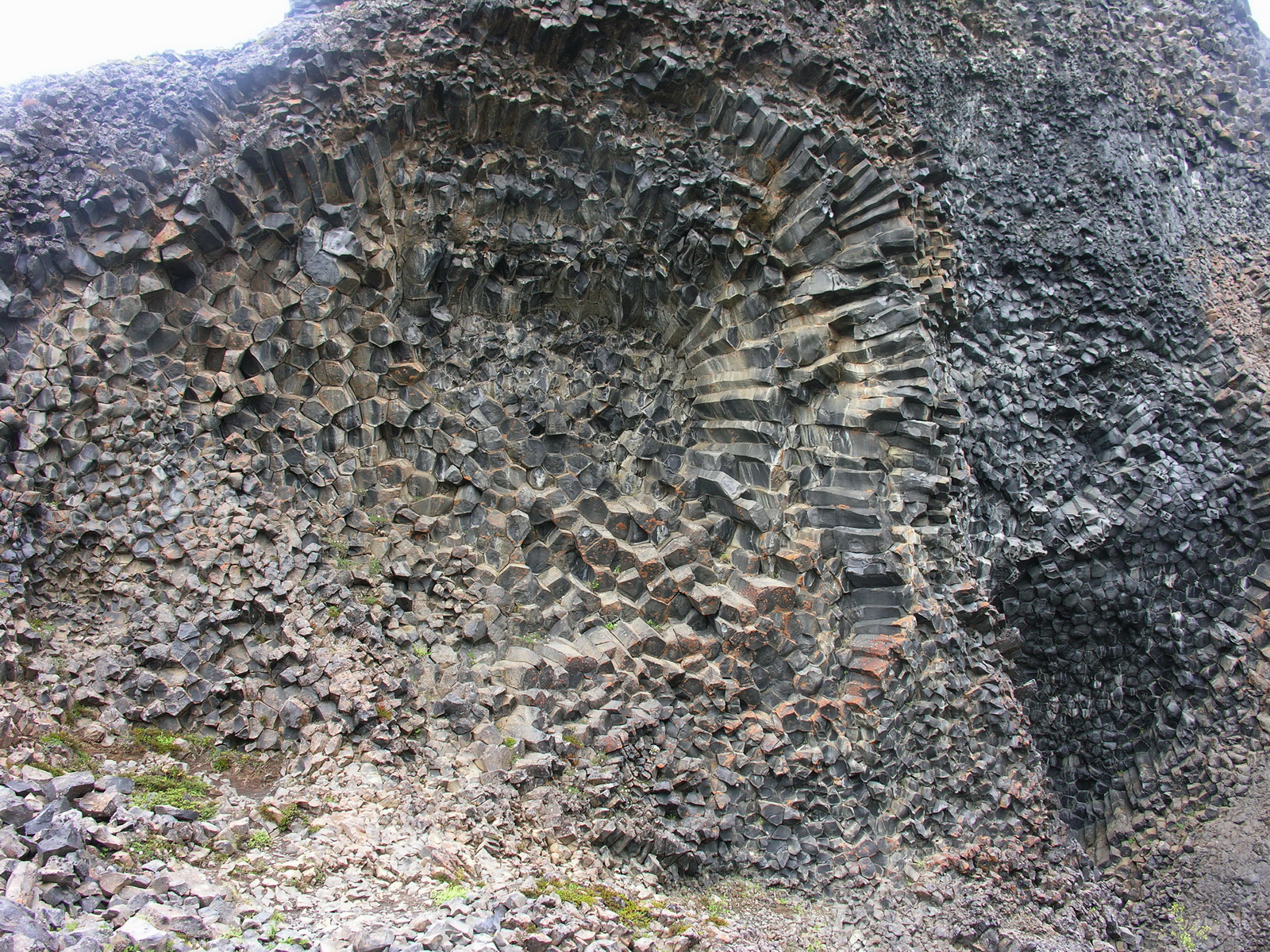
We slept wonderful, it was very quiet. We were on the road at 9am, fuelled up in Egilstadir and turned there on the No1 towards Myvatn. First we drove along the mighty glacier river Jökulsa al Dal, then up to the high plains (600m). We turned off on the alternative road 901, which was very lonely, not a car came against us during the whole section. The clouds hung low and the 2°C cold wind drifted snow over the black volcano ash, a desolate place! We were happy to sit in our warm car and thought of how the people in former times crossed these plains with their ponies or by foot. Finally we met the No1 bitumen road again and after 30 kms it crosses another glacier river, the Jökulsa a Fjöllum on a one lane suspension bridge. Shortly after the bridge is the turnoff to the Askja volcano, where we planned to go, but it was still closed due to weather conditions. So we continued and turned after another 16 km off on the F862 to the Dettifoss waterfall. After 33km on a rough and winding one lane track we reached the parking lot of the waterfall. It's 1pm, so we first had some lunch, then we dressed in all warm clothes we had with us, plus rain jacket and rain trousers. Then we deboarded our camper down the ladder looking like Neil Armstrong doing his first step on the moon. The waterfalls were great, first the horseshoe-shaped Selfoss, then a km downstreams the mighty Dettifoss, Europe's biggest waterfall. The grey waters were falling thunderous into the deep, smothering everything around with spray, so we noticed only as we returned to the car that it wasn't raining anymore. Further along the track we visited another place with strange basalt shapes, which were exposed by the erosion of the river (Hljodaklettar). Finally we met the bitumen road at the north coast and camped at a nice quiet campground at Asbrygi. We had scrambled eggs with ham and a cucumber and capsicum salad for dinner, and pineapple with skyr ( a icelandic curd) for dessert. |
 |
 |
 |
|
Drifting Snow
on the 901
|
Emergency
Hut on the Highland
|
Lonely Farmhouse
at Senautasel
|
 |
 |
 |
|
Dettifoss,
Europe's Biggest Waterfall
|
A Crack in
the Rock
|
Basalt Columns
|
|
Day
|
Myvatn (Vogar) |
|
|
Fr 20.06. |
Around the Tjörnes-Peninsula to Myvatn |
|
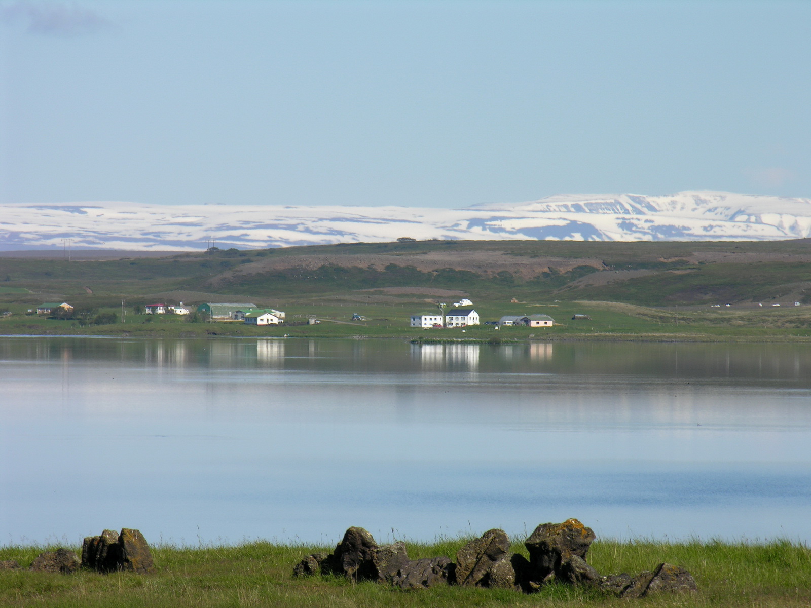
In the morning the weather was promising, we drove along the bluffs of the Tjörnes peninsula. At a viewing point high above the sea we watched gulls maneuvering elegantly through the air and puffins swimming way down in the waves. In Husavik, a small nice fishing village we made a short stop, before we drove inland to the Myvatn lake. Myvatn is icelandic for "midge water", normally during summer you will be eaten by the mozzies here, but due to the cold weather we had no problems at all. At Dimmuborgir there is a accumulation of weird lava sculptures, formed by lava erupting under the lake when the water level was higher. With a little fantasy you could recognize goblins and fairys and you understand why most of the Icelanders believe in their existence. And the drizzling rain intensified that impression. We camped on a campgrond at Vogar. The hot water in the shower came from a geothermal bore, like in many places of iceland and smelled strongly after sulphur. After dinner (noodles with smoked salmon) i did a evening walk at the lake, the weather was sunny again. |
 |
 |
 |
|
Lavatunnel
at Dimmuborgir
|
Goblin(petrified)
|
Myvatn
|
|
Day
|
Sigridarsstadir |
|
|
Sa 21.06. |
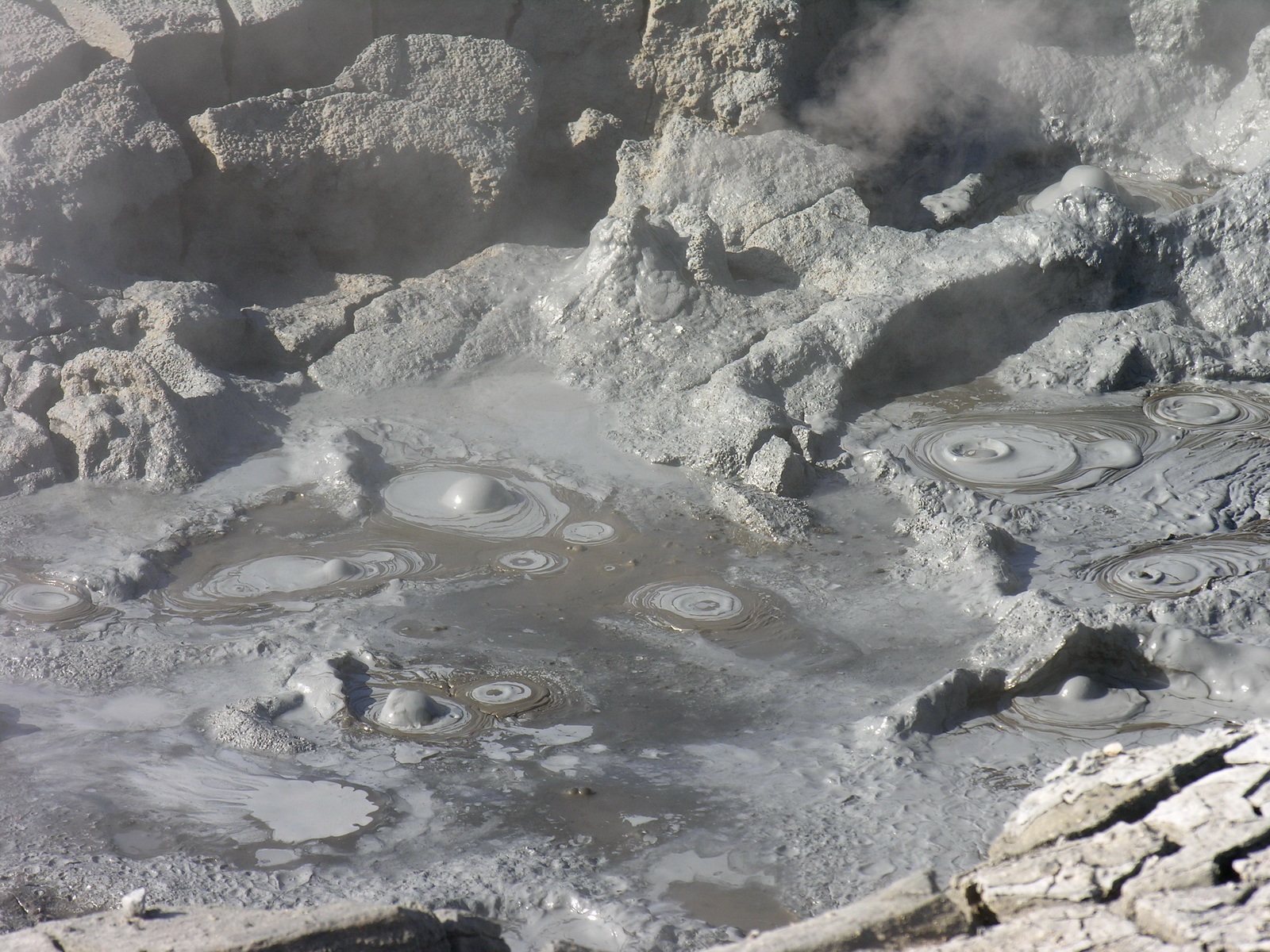
At Myvatn: Bubbling Mudholes and Lava |
|
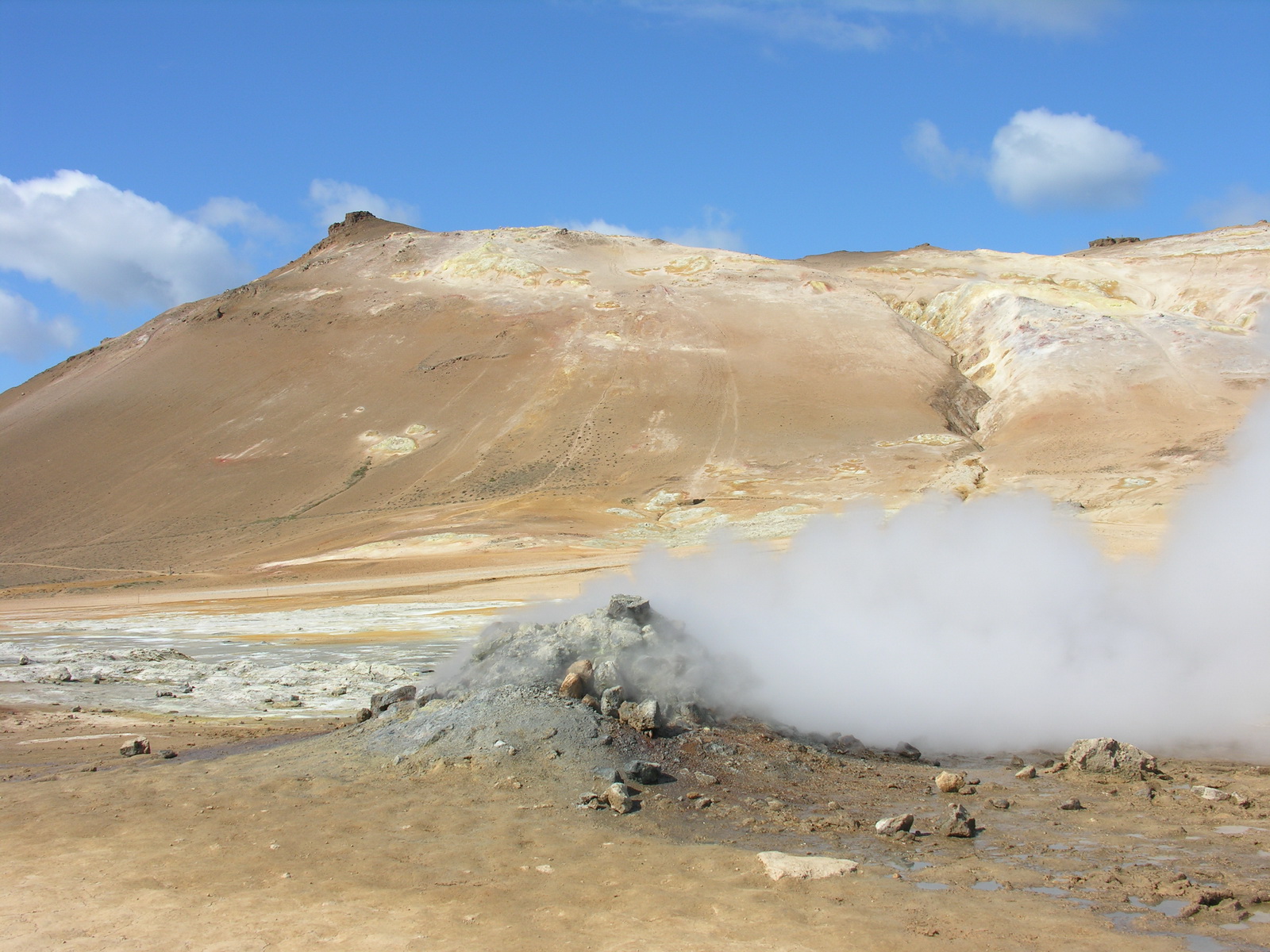
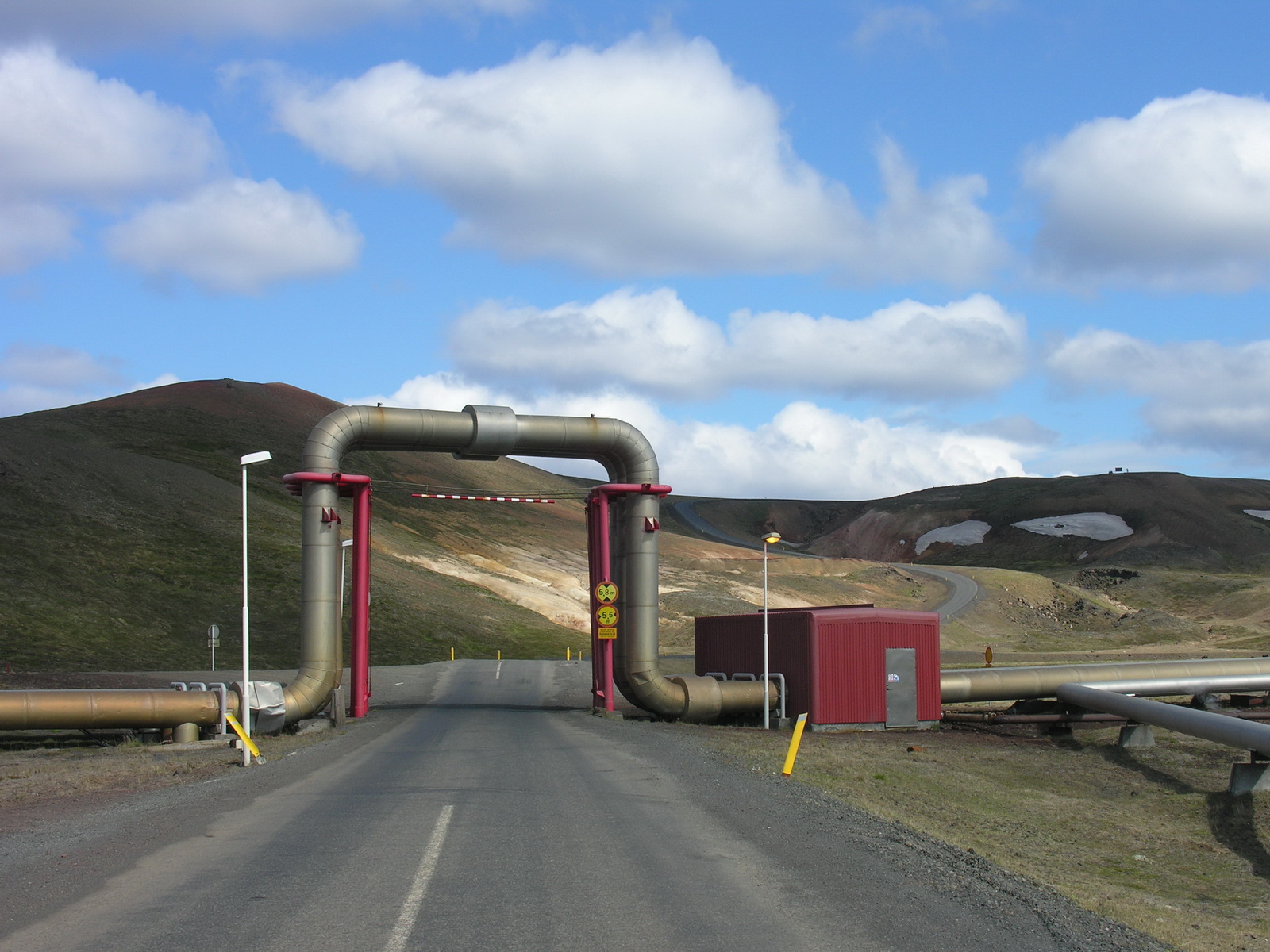
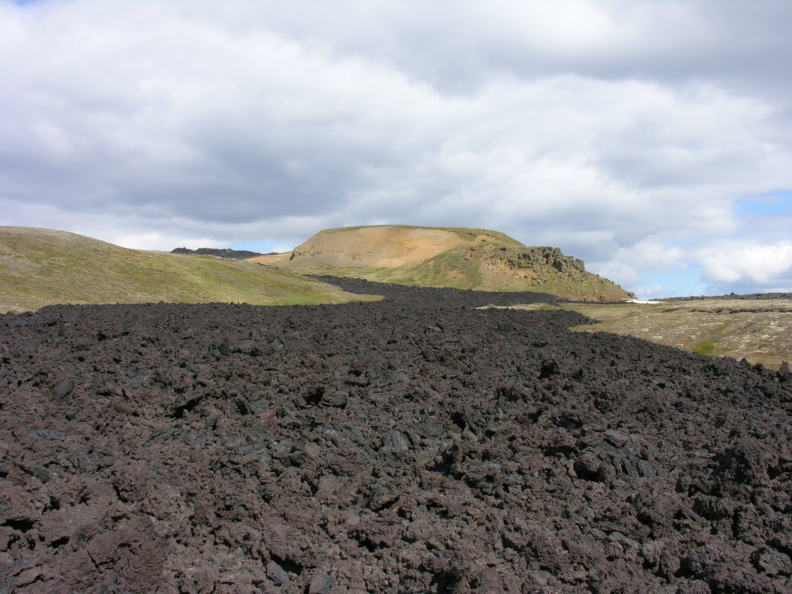
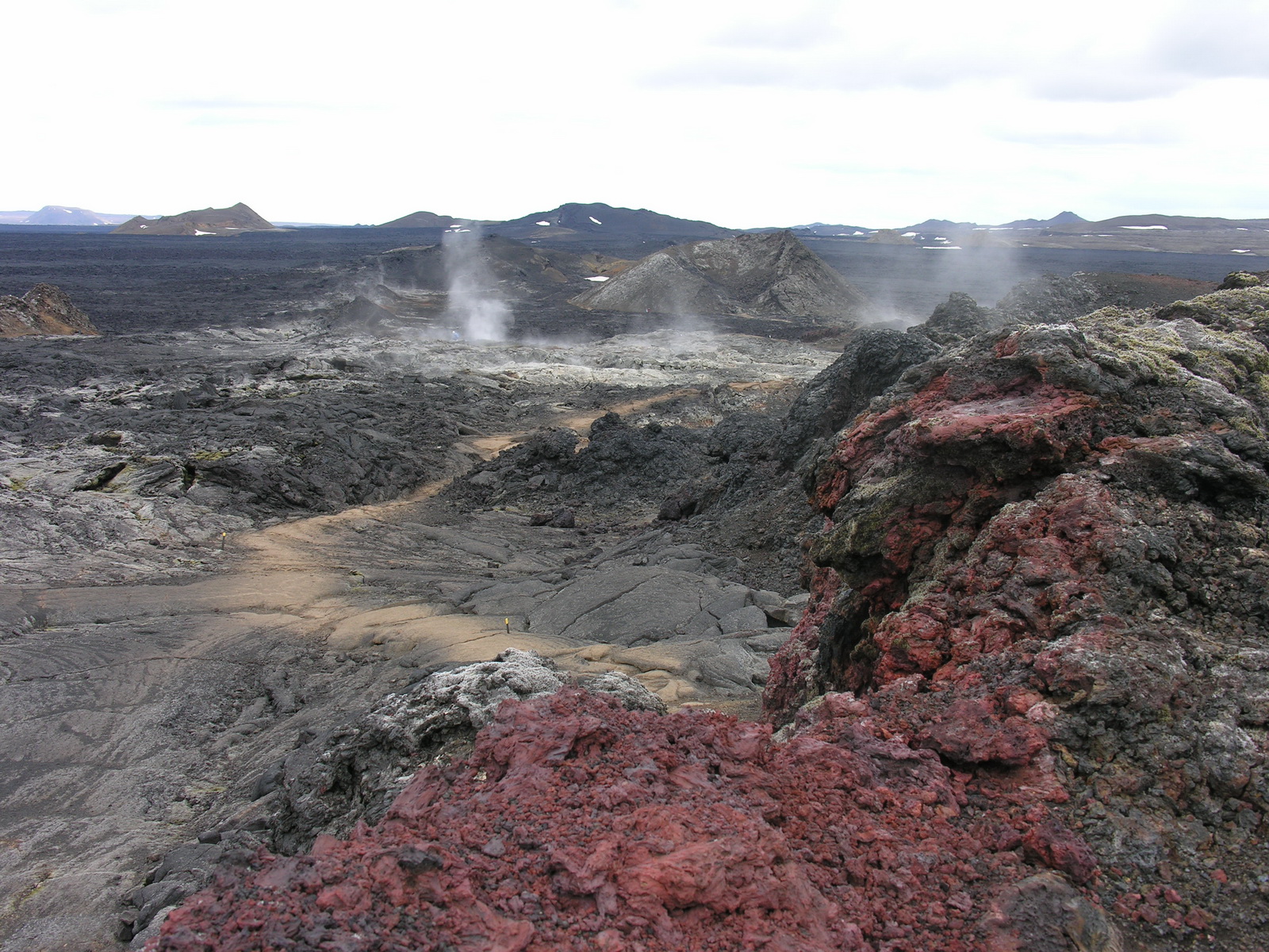
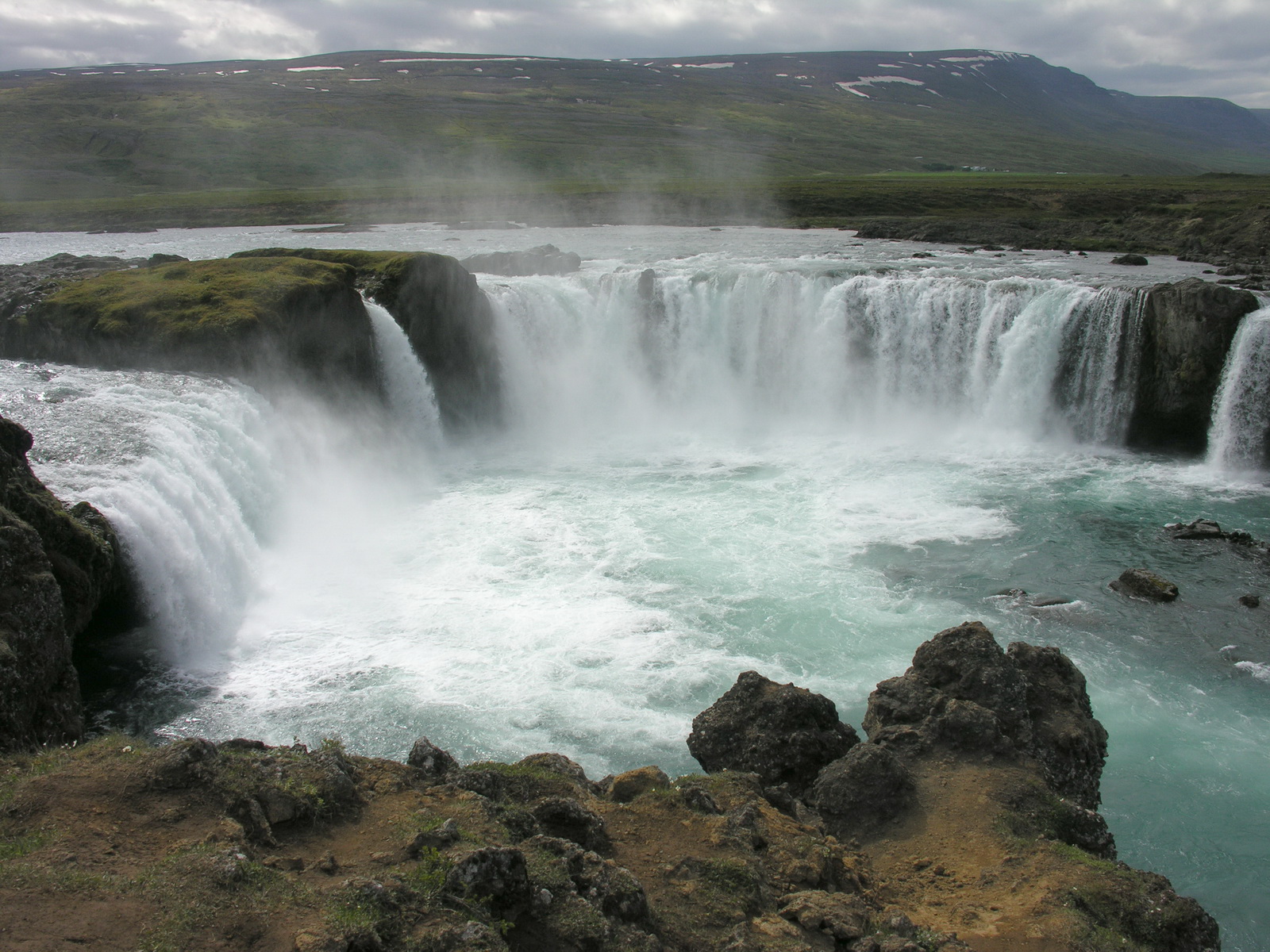
The night was icy, only 2°C in the camper, but with fleece trousers and -jacket in our new sleeping bags we had it warm. In the morning at 6am it was already 18°C again, thanks to solar heating since 3 am. Beautiful weather, only a few clouds at the horizon. We took off early to the geothermal region of Namaskard. The road leads up to hills in every hue of yellow, brown and red. At our destinatinon sulphury steam was fizzling and grey-blue mud bubbling in numerous holes. The colours of the hills were in contrast to the black lava, blue sky and the white snow on the mountains in the background, another photographer's paradise! Here in Namaskard were a lot of flies, not biting, but like the australian bushflies very annoying. Then we moved on to the nearby Krafla area. First we fouind a scenery like out of a science fiction movie: some futuristic buildings steaming in a lunar landscape, with silvery tubes everywhere on the ground. This was the geothermal powerplant, built in 1977. Behind that the road leads to the most active volcanic area on Iceland, the Leirhnjukur rift. The craters date from 1984, when a series of eruptions covered a vast area with fresh lava. We made a hike to the craters and the ground is stilll hot there, steam hissing out of holes in the ground. Then we said goodbye to Myvatn and moved on to the west. We made a stop at another scenic waterfall, the godafoss. Here we could watch a strange phenomenon, the "tourist migrating locust effect". 5 buses were entering the parking lot and about 300 tourists flooded the place. They were moving along the waterfall and the river the short distance to the souvenir shop, vanished into the waiting buses and were gone again within 15 minutes. Later we heard, that they come from the big cruise ships landing in Akueyri, and 50 buses are needed to take them all on their day trips. They must get the wrong impression that Iceland is crowded with tourists. Not our kind of holiday! After the buses were gone, we dared to enter the souvenir shop too, and Sonja bought a warm woolen beanie (lined with fleece) made by a women from a nearby farm. We moved on in a westerly direction and found a sign on the road "Camping 1000m". We followed the narrow road across a farm to a hidden lawn with a lonely wooden toilet hut. There we camped with a beautiful view and had this quiet place for us alone for the midsummer night. Iceland is not really crowded! |
 |
 |
 |
|
Sulphur Steam
at Namaskard
|
Mudhole
|
Geothermal
Powerplant
|
 |
 |
 |
|
Lavafields
of 1984..
|
At the Leirhnjukur
Rift
|
Godafoss
|
|
Day
|
Akueyri |
|
|
Sun 22.06. |
Whirlpool with Mountain View and Wooden Sheep |
|
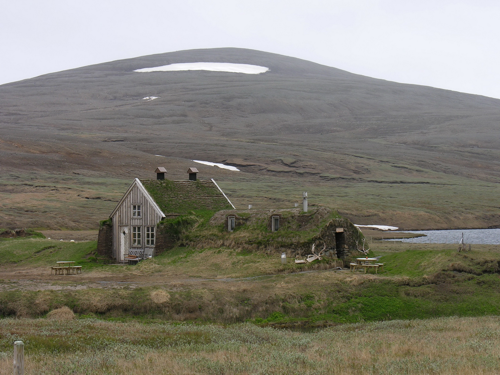
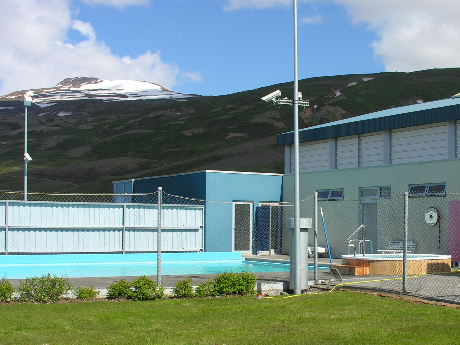
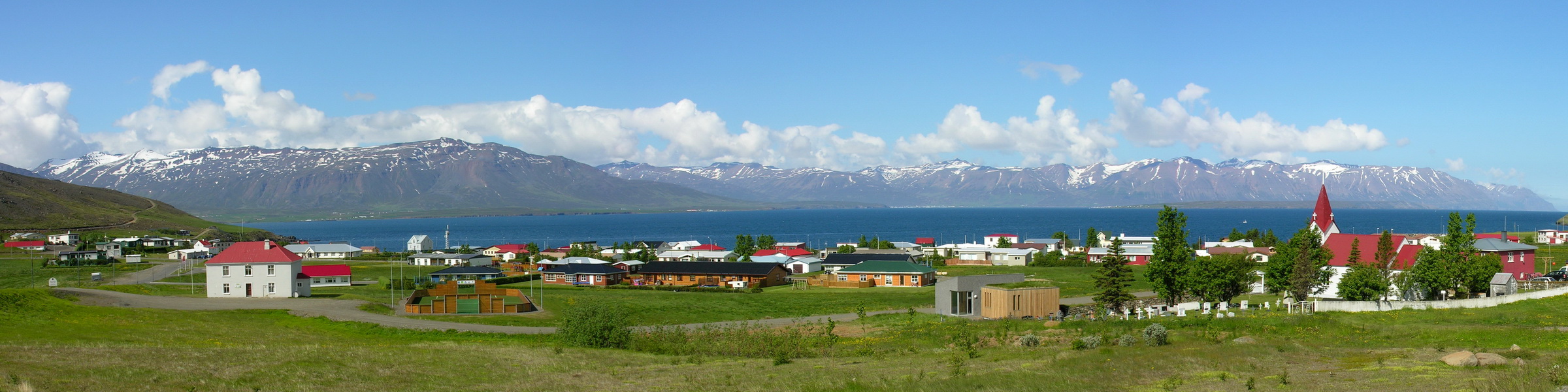
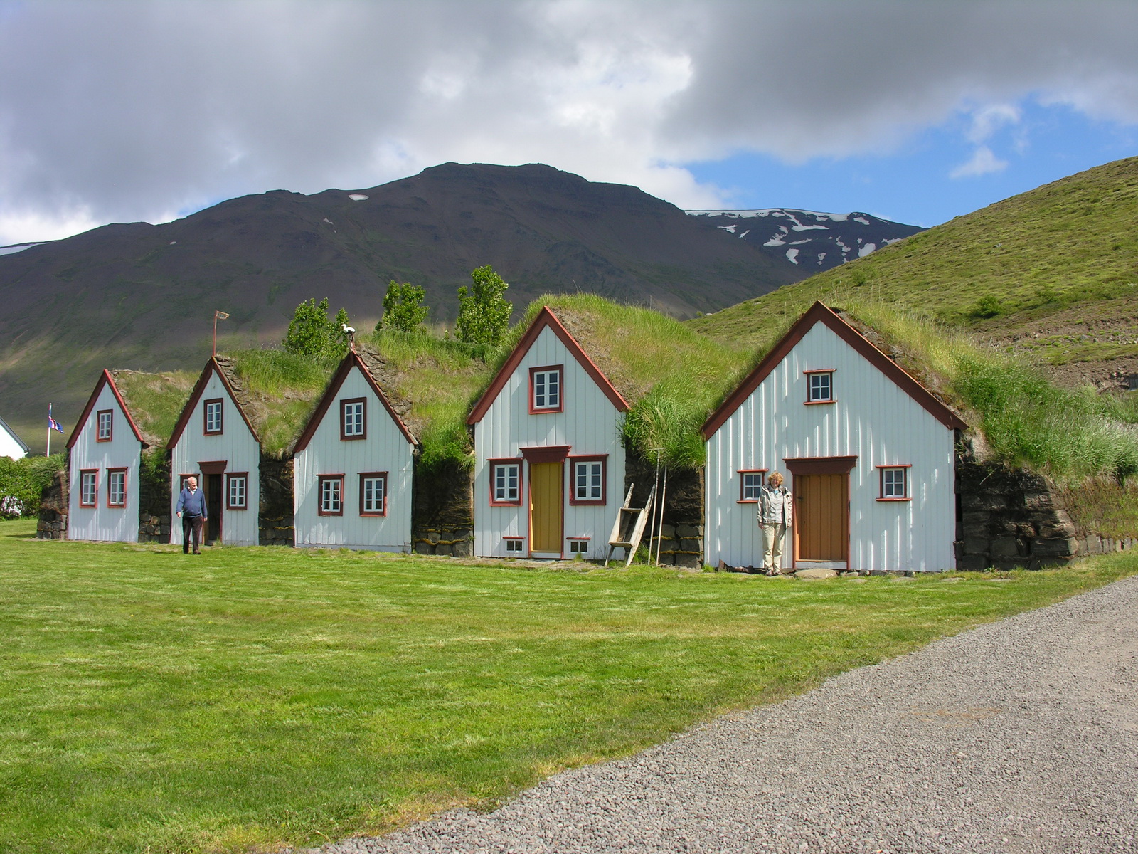
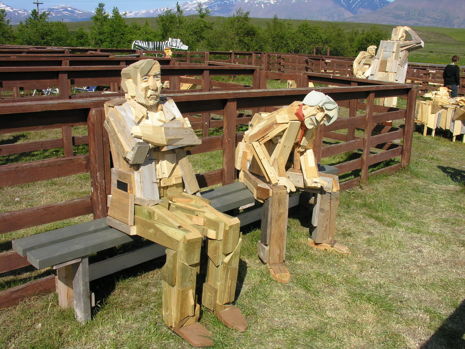
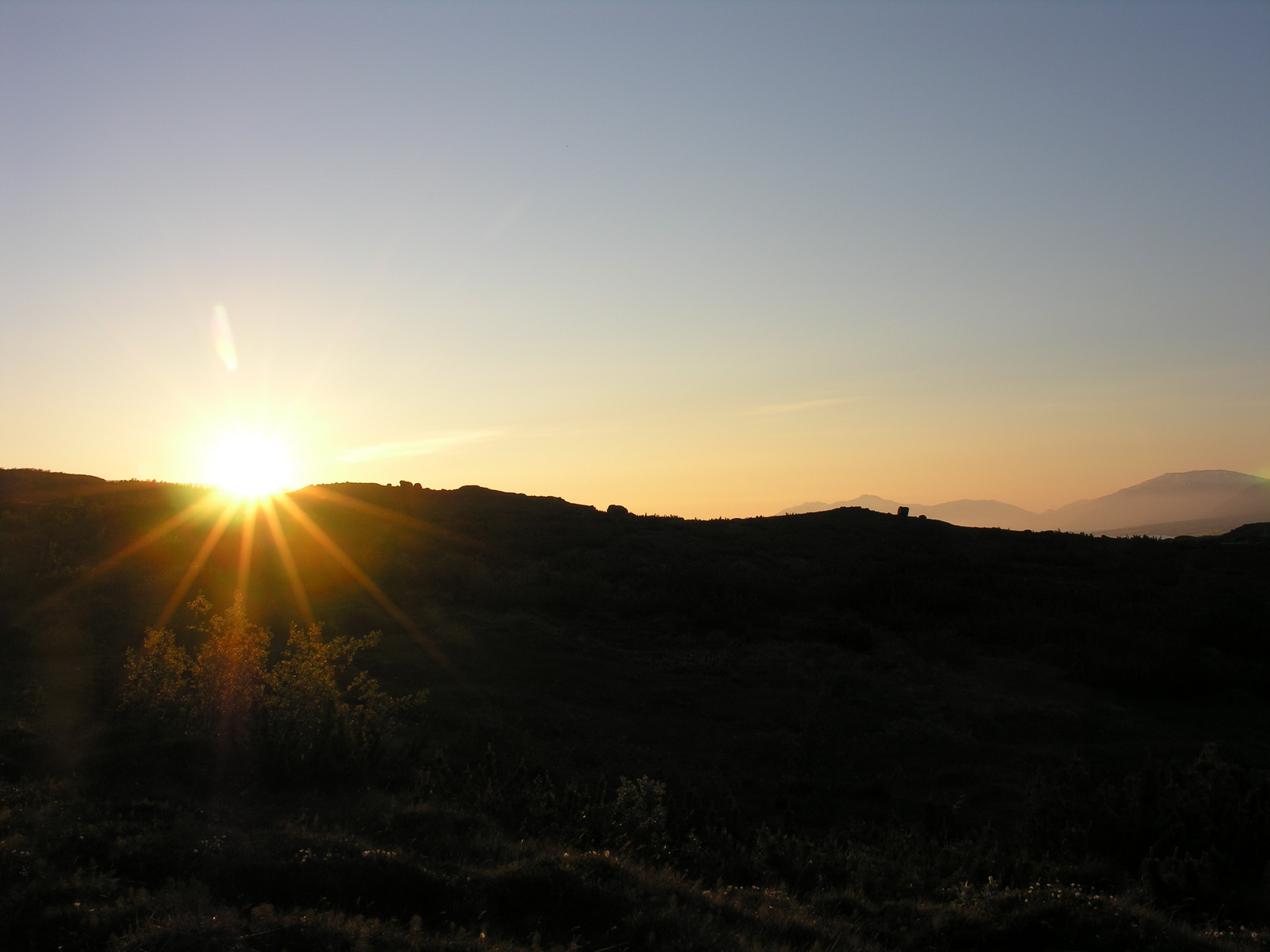
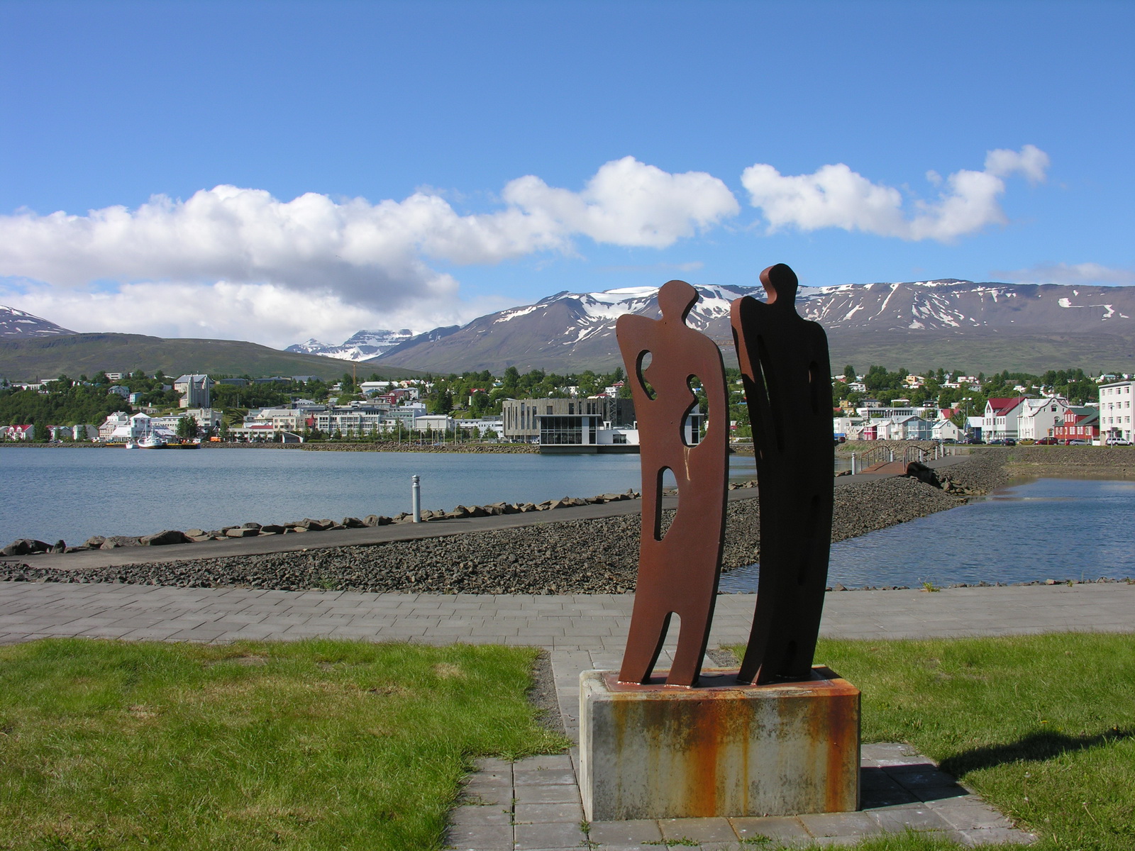
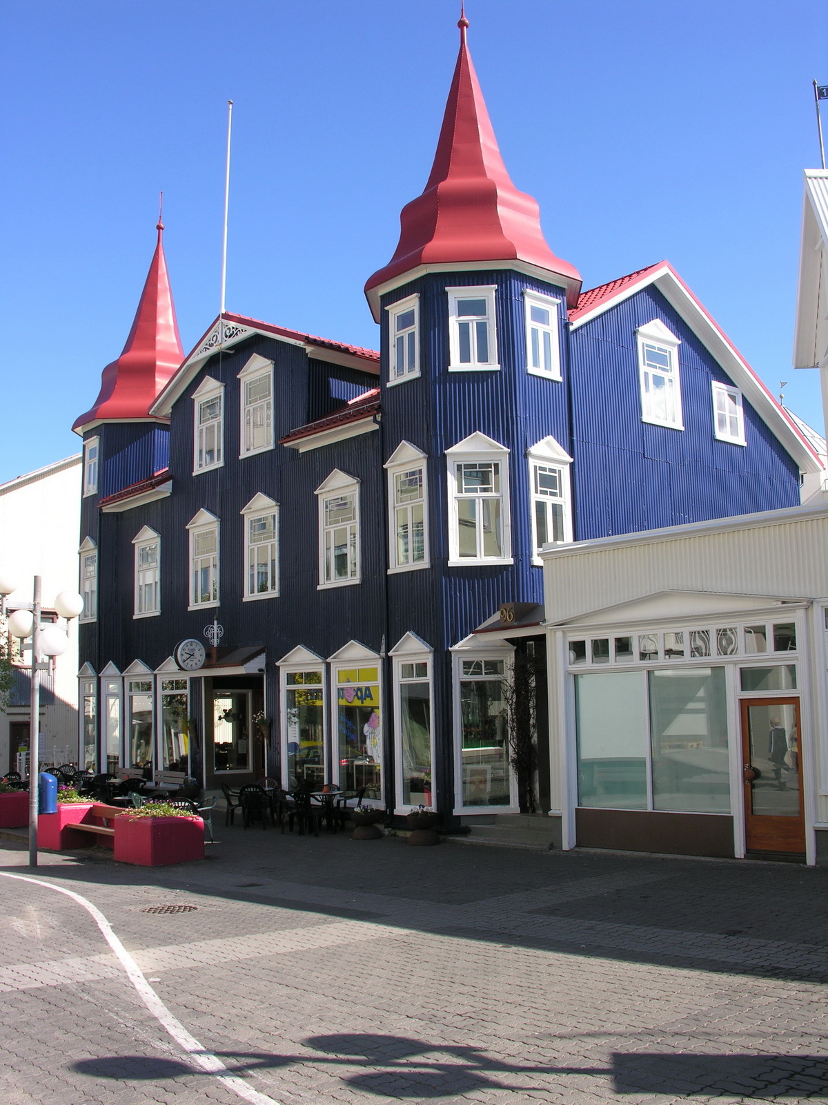
We slept very good and long, because we found out why i had a pain in the back every morning. Under the mattress was a kind of slatted frame, maybe to air the mattress. But it was not across the full width of the bed, so i laid all the time on the edge of this slats. Thats why we converted from that time the table as the second bed and i slept very good down there for the rest of the journey. After breakfast we hit the road and turned off towards the tiny fishing village of Grenivik at the Eyjafjord. The drive there went through a scenic valley with lush pastures, wood was covering the slopes and snow the top of the mountains. In Grenivik i stopped for a panoramic picture above the village. We saw that the public pool there was open and decided to take a bath. For only 2€ per person we enjoyed the swimming pool with 30°C and the whirlpool with 40°C at a sunny day and a air temperature of 10°C, having a magnificient view over village, fjord and mountains. A real Iceland experience!. After that we drove to Laufas, a nearby museum farm. In the museum cafe we enjoyed a strong coffee and some real iclandic specialities: Bread spiced with iceland moss and smoked salmon, blueberry cake and a sweet potato pie with chocolate cream (sounds crazy, but tasted really good!). Then we explored the museum, a traditional icelandic farmhouse made of a wooden framework and walls and roofs of piled peat and living grass as a top layer. Only the southern walls are made of wood, and a few windows on the roof leading light inside. These houses were very well insulated for the long cold winters. The house was very big with 15 rooms, and up to 30 persons lived here in the past. There were all the objects of daily life on display, so you could imagine how it was to live here in the past. From there we moved on to Akueyri, the second biggest city in Iceland. It was sunday, so we planned to visit the art museum, but there was a exhibition of chinese contemporary art on display. We liked to see some icelandic art, and a employee of the museum told us about a exhibition of a local artist 20 km outside the city. We found it and enjoyed it very much. Adelheidur Eysteinsdottir (www.freyjulundur.is) creates funny sculptures out of scrap wood. This weekend she had a exhibition on a old sheep pen on her property: Everything was made of scrap wood: men, sheep, dogs, very simple, but with a amazing life in their physiognomy. We went back to Akueyri, bought some food and camped on a nearly empty, but incredibly big campground. A look at the internet told us that the Kjölur track across the highland is now finally open, and the weather forecast for the next few dasy was good. After dinner (Noodles with garlic prawns) we read in our books. I could not sleep, so i went for a walk up the hills to watch the sun touch the horizon shortly before midnight. |
 |
 |
||
|
Heated Pool...
|
...with this
View in Grenivik
|
||
 |
 |
 |
 |
|
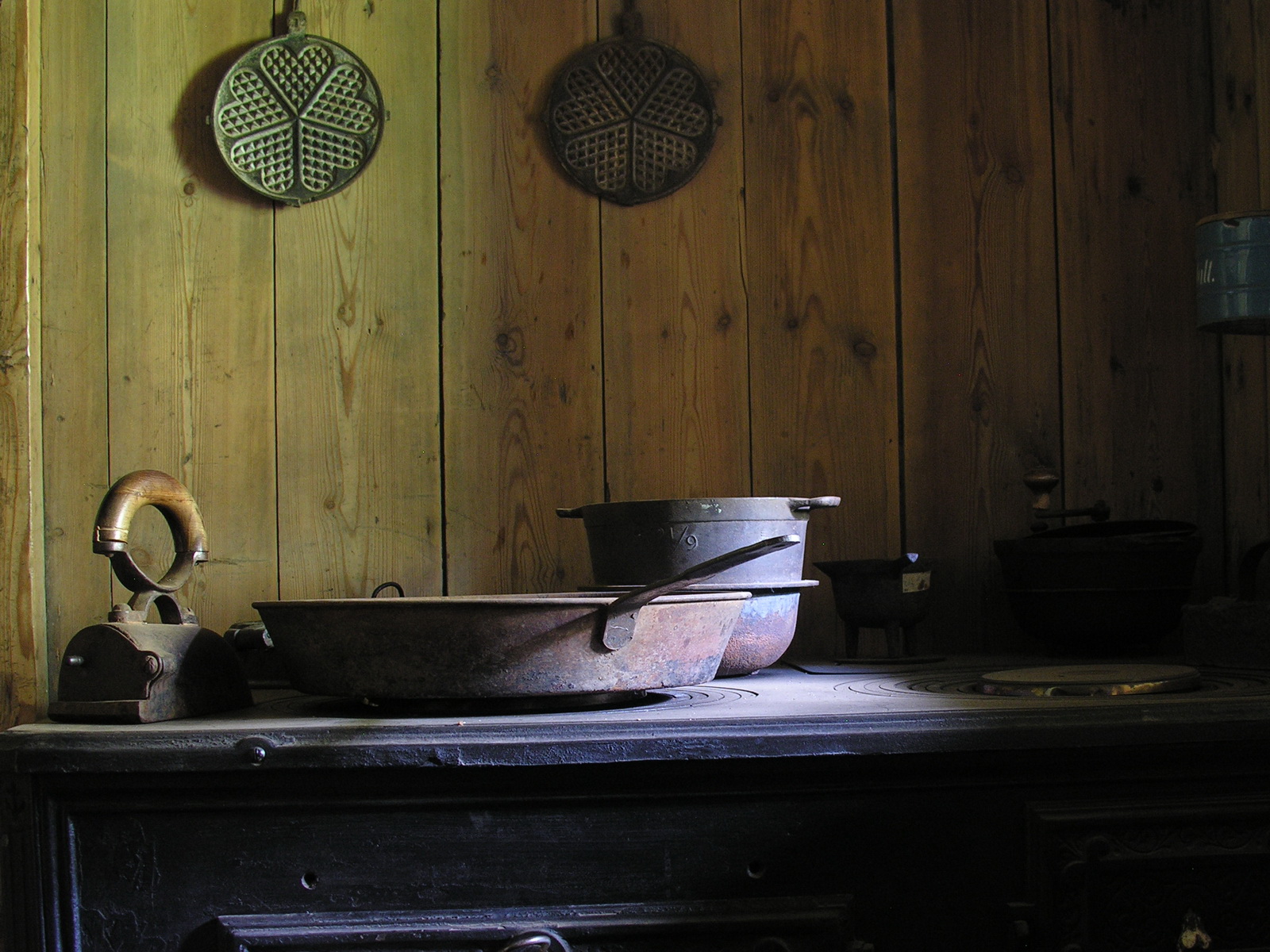
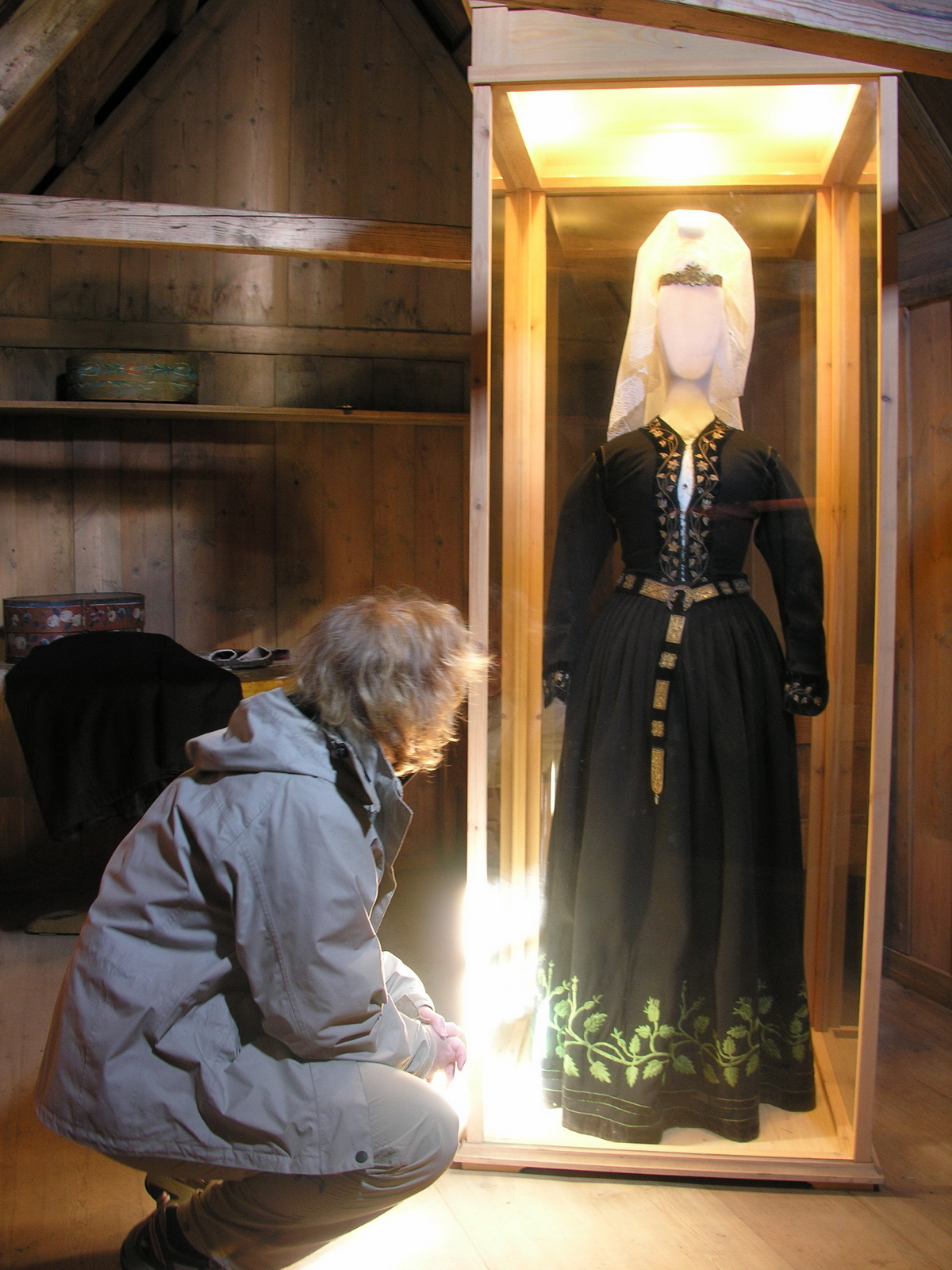
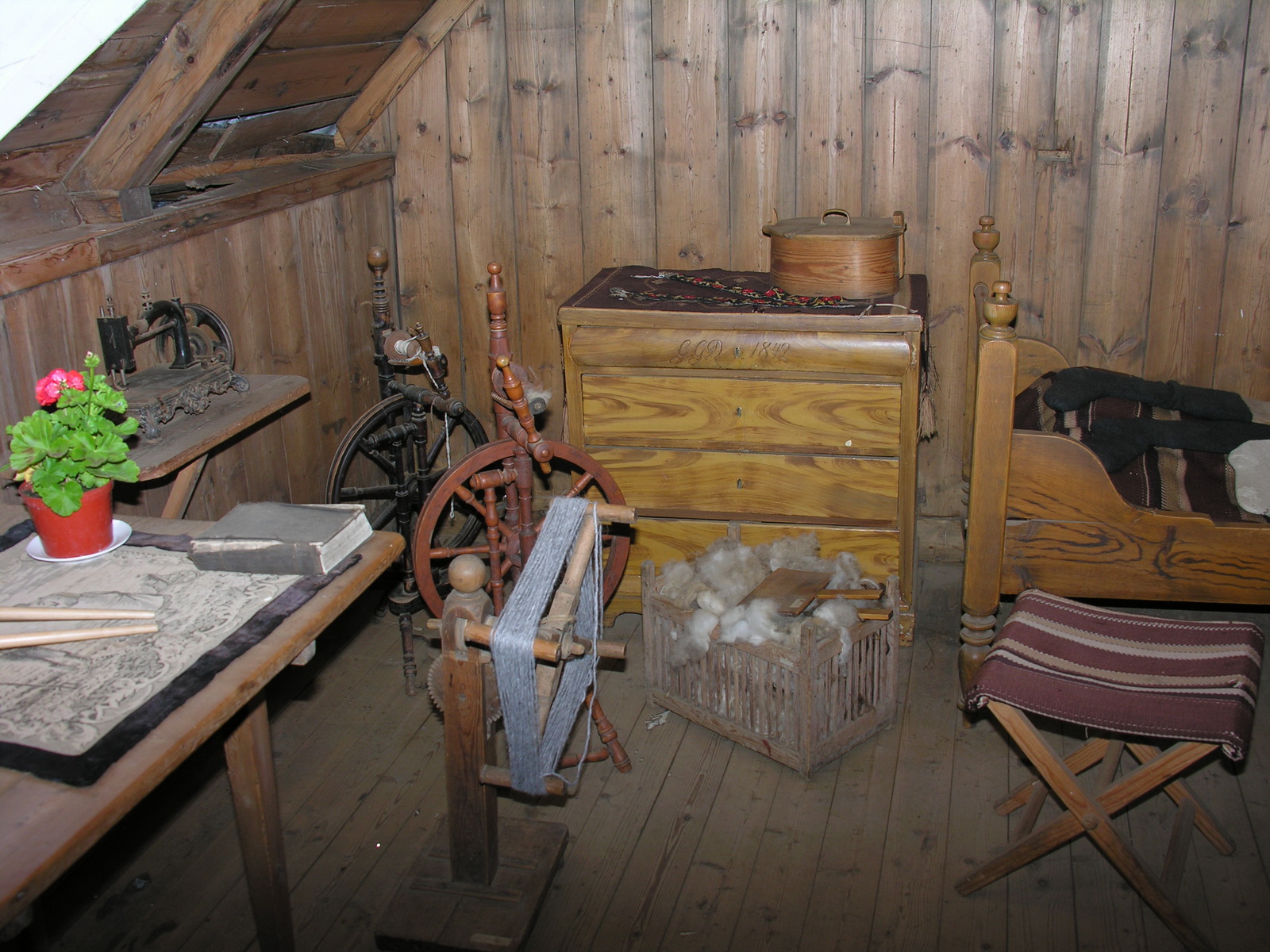
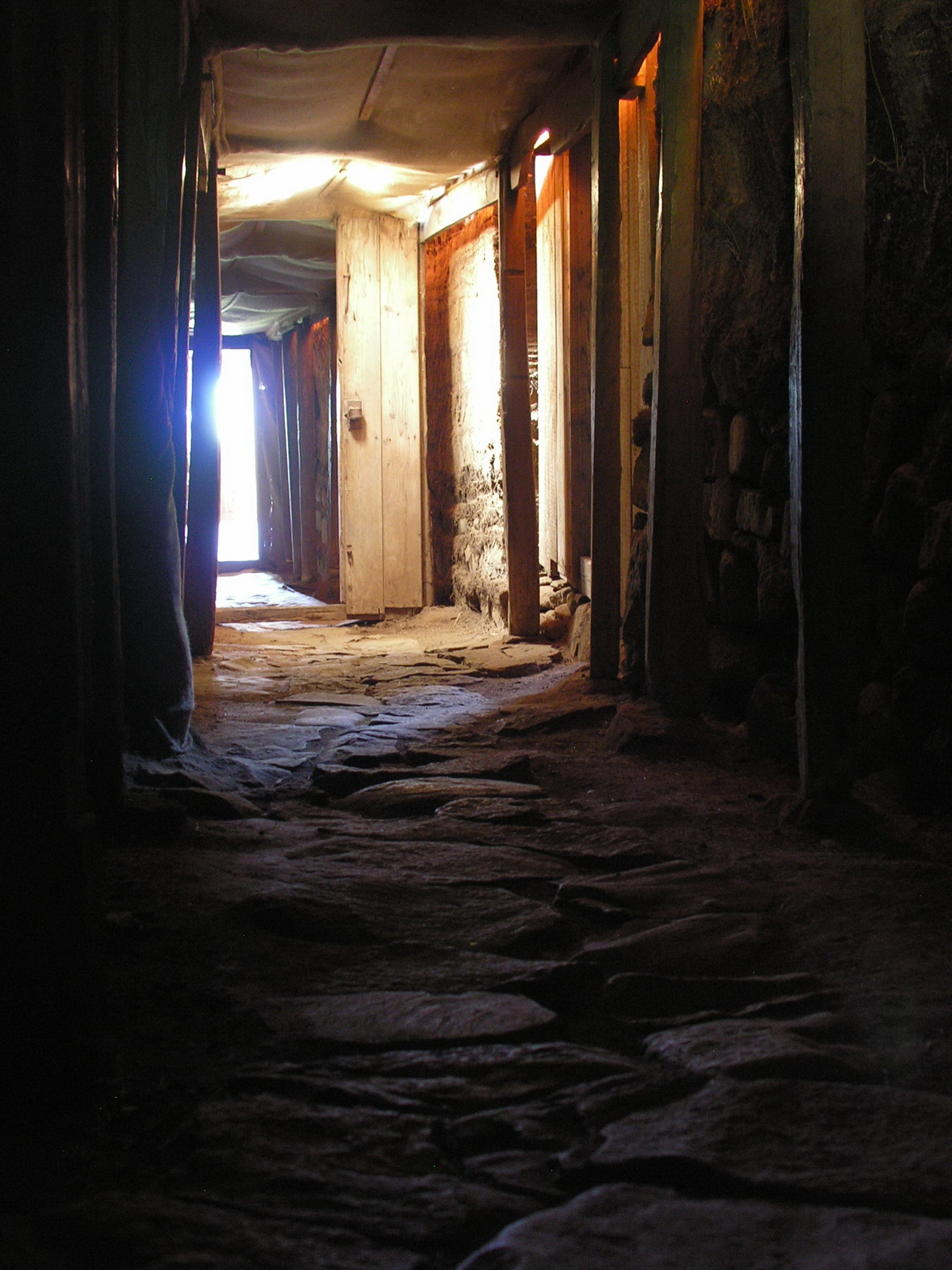
Museum Laufas:
|
Kitchen
|
Old Wedding
Dress
|
It's Comfortable
Inside
|
 |
 |
 |
|
|
Peat Walls
in the Corridor
|
Wood Sculptures
|
Midnight Sun
|
|
|
Day
|
Bakkaflöt |
|
|
Mo 23.06. |
Herring at the End of the World |
|
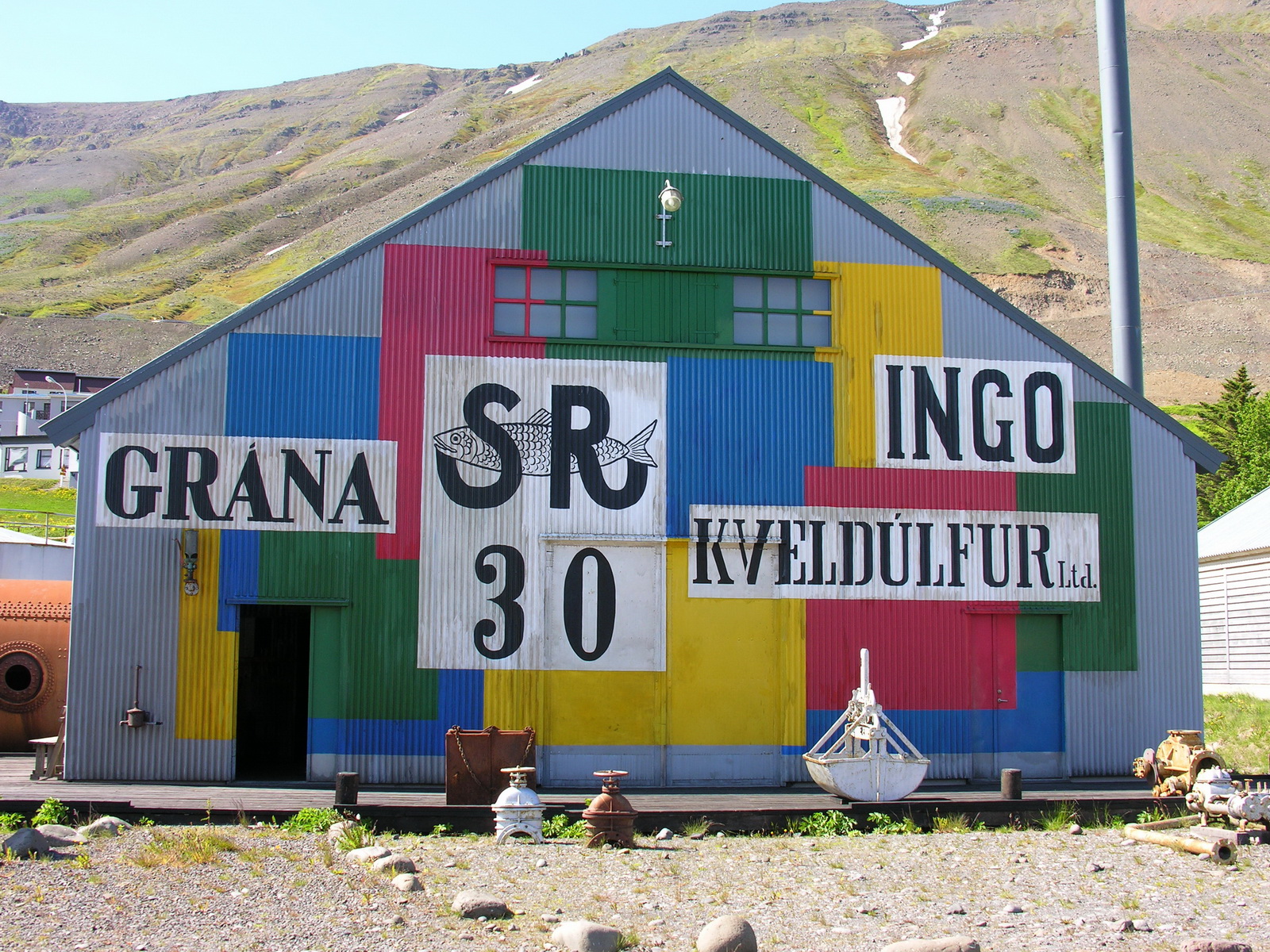
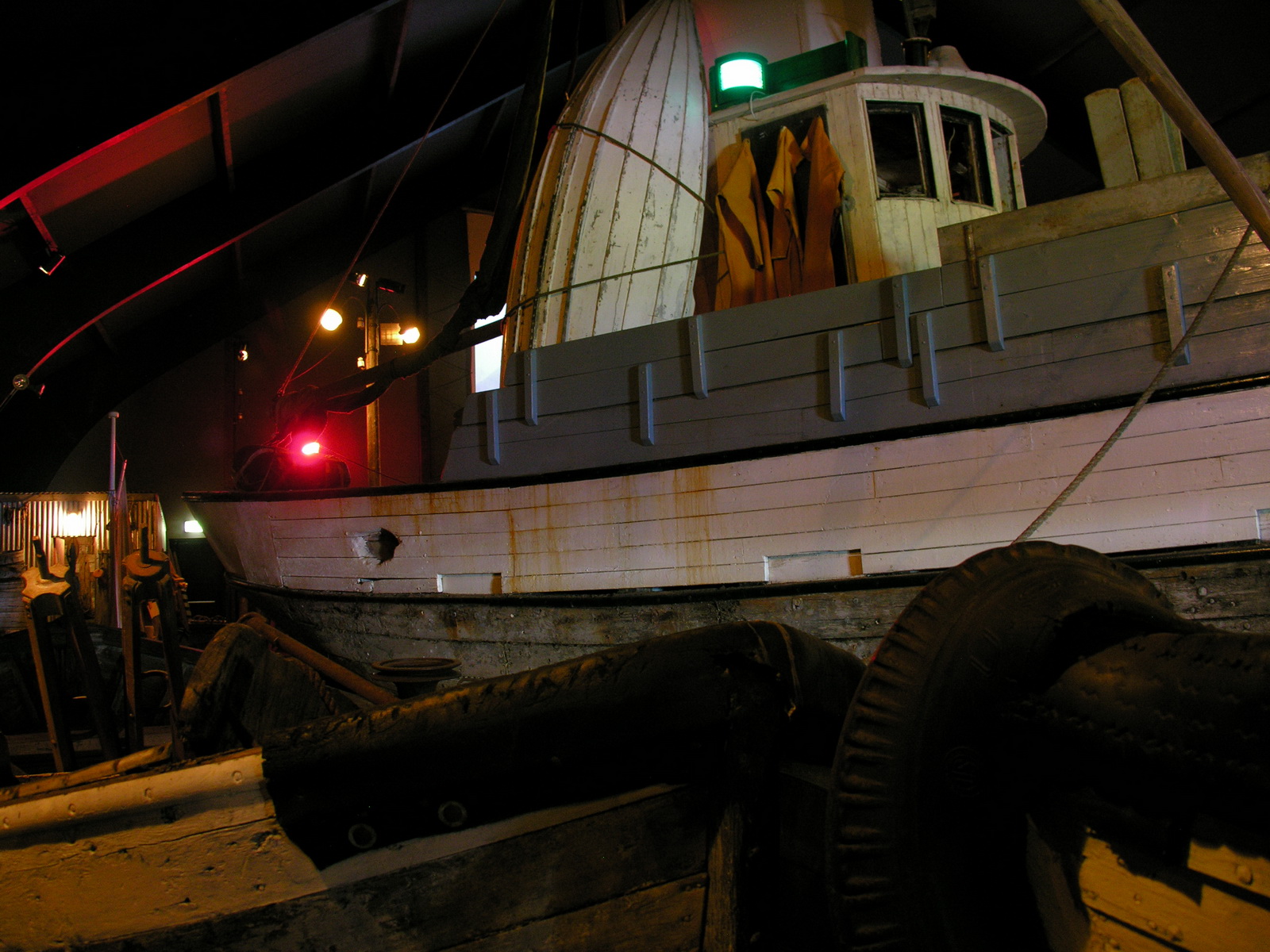
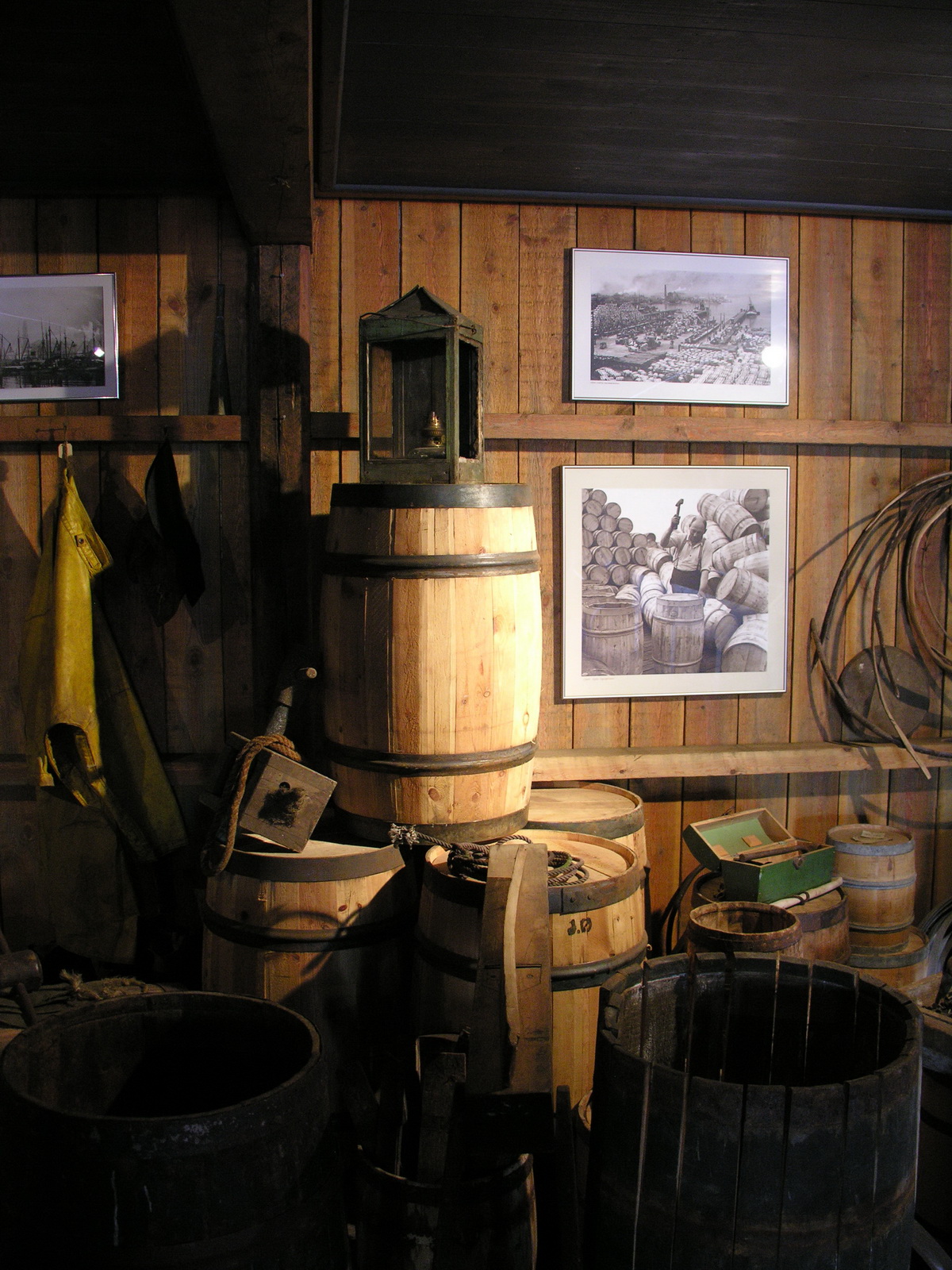
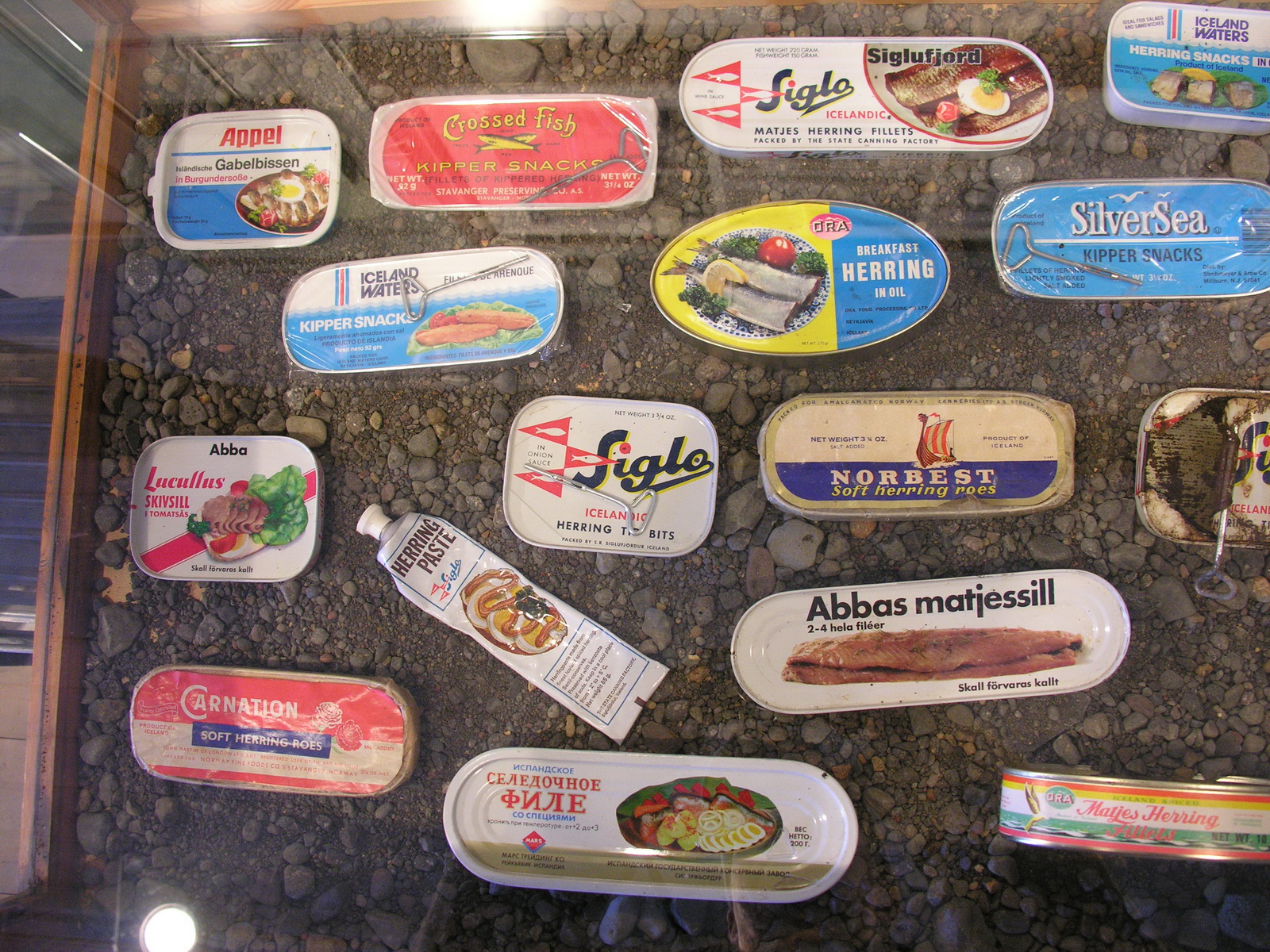
In the morning we strolled through Akueyri, drawing money fron the ATM and buying bread and sweet pastries in a good bakery. Then we drove along the Eyafjord to the north. It was great weather, the water of the fjord was blue-green with the snow covered mountains in the background. Before we came to Olafsfjördur we had to drive through a 3.6 km long one-lane tunnel (with some turnouts to pass). Then we crossed the peninsula on a gravel road over a 400 m high pass with a postcard scenery: horses grazed on flashing green pastures under ragged mountains. We drove further on on a rough bitumen road along the cliffs to the north. After another 1 km long one-lane tunnel we came to Siglufjördur. One day here was centre of the herring industry, before the population broke down in the 70s due to overfishing. In 1950 there were 3000 people living here and working in the factories producing salt fish and fish oil. We visited the impressive herring museum in the old factory. After buying some smoked herring (there are still some) we left this village at the end of the world and drove south again along the Skagafjord. We camped a little off the no1 road in Bakkaflöt at the banks of a nice river. |
 |
 |
 |
 |
|
Akueyri
|
in the Town
|
Funny Mural
|
Eider Ducks
in the Harbour
|
 |
 |
||
|
Typical Iceland
Car
|
On the Road
to Siglufjördur
|
||
 |
 |
 |
 |
|
The Herring
Museum in Siglufjördur
|
Fishing Cutter
|
Herring Barrels
|
Herring in
all Variations
|
|
Day
|
Thingvellir |
|
|
Tue 24.06. |
On the Kjölur Track Across the Highlands |
|
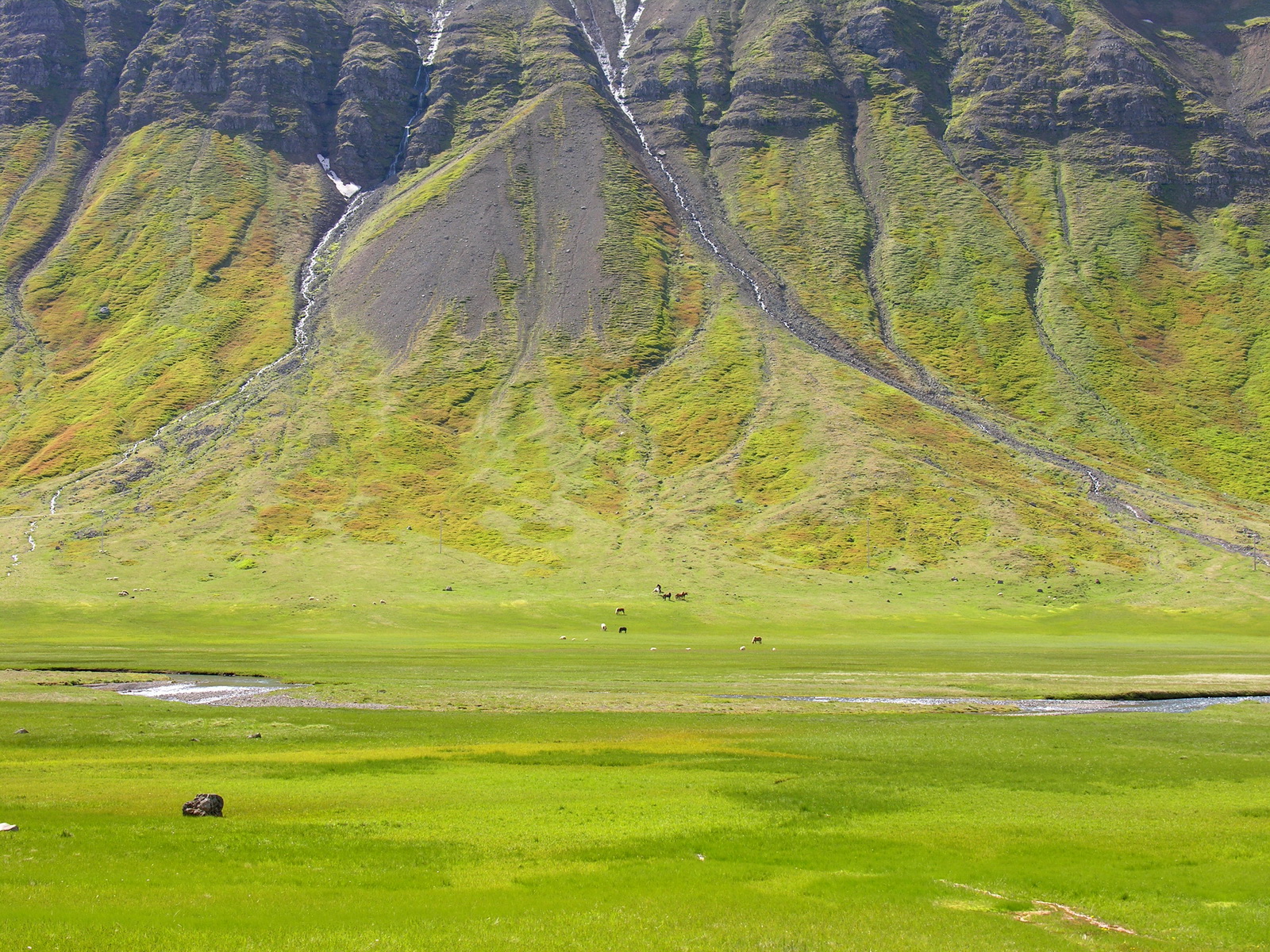
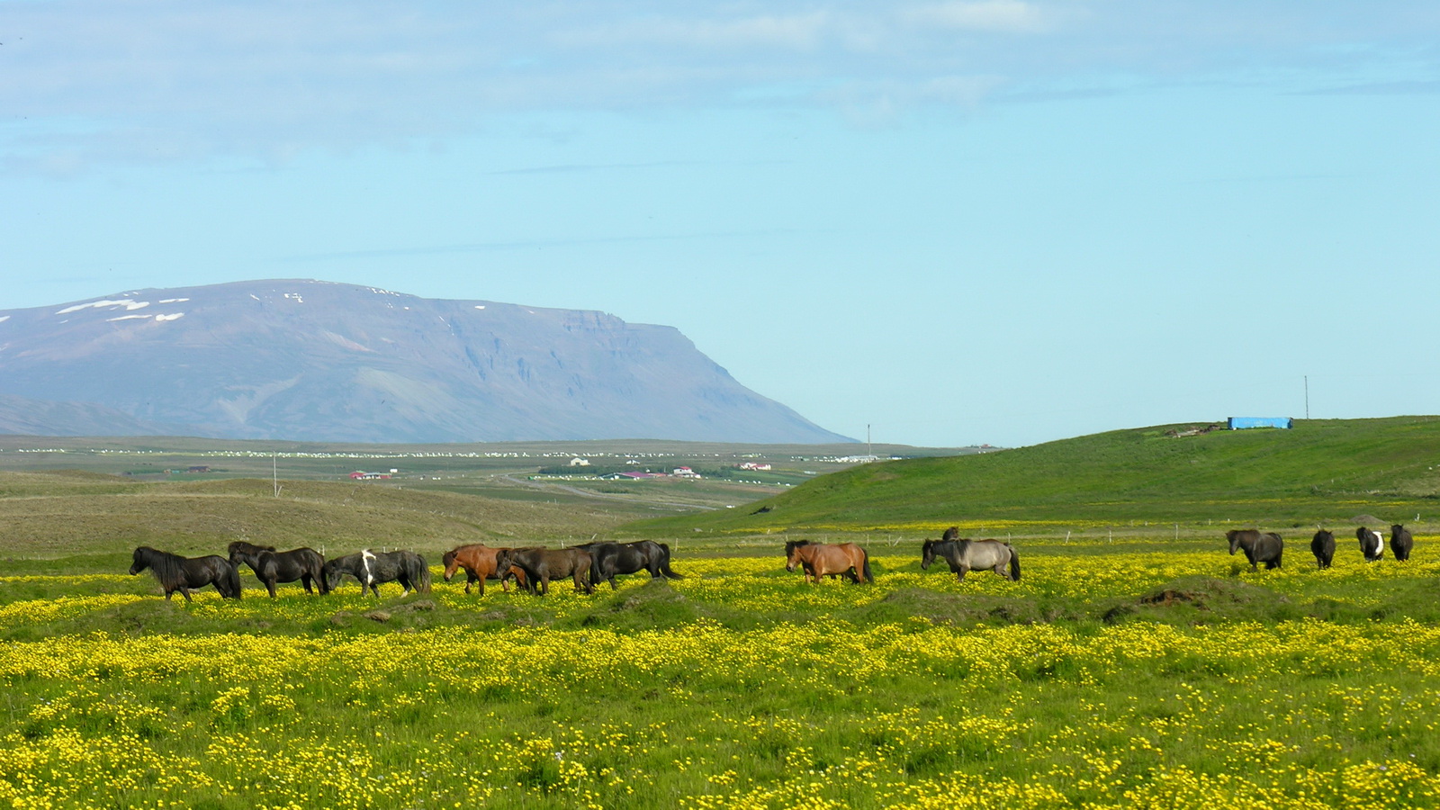
We woke up this morning, because it was too warm in the camper! The sun was already shining since hours. After breakfast and fuelling up we hit the road to the west, over the Vatnskard pass and then on the F35 track inland. The road was in a reasonable state until we passed the grader which was grooming it so nicely. After that it was quite rough, but still passable with a 2WD, because there were no river crossings. But i would not do it with my own car, this road may age it for years! At Hveravellir, our destination, we were rewarded with views of steaming hot springs in front of 2 big glaciers. But the weather was overcasting and sleet showers crossing the land. Originally we had planned to camp here and do some hikes, but the campground Was just a parking lot and the amenities were (sorry) shit (in the real meaning of the word). So we continued with the second section of the track. We crossed fascinating rubble deserts with glaciers and the rugged Kerlingarfjöll mountains in the background, drove along the glacier lake Hvitarvatn and over the Blafjell pass. Here we had a fascinating view of the meanders of the Hvita river, before it falls down the Gullfoss. After 155km gravel road we reached bitumen again and at 3pm we were the parking lot of the Gullfoss waterfall. After a short stop we moved on on already known roads to to the good campground of Thingvellir. There we first had to clean the camper inside, because the door was not sealed very well, and lots of dust has got inside. After that we enjoyed a long hot shower to wash off the road dust from ourselves. We had chicken ragout with curry rice for dinner. A thunderstorm came in the evening but i looked up the weather forecast for the next days in the visitor center, and it was quite good, especially in the west. We were 6 days ahead of the original plan due to all the road closures, so we decided to explore the western fjords too. |
 |
 |
|
|
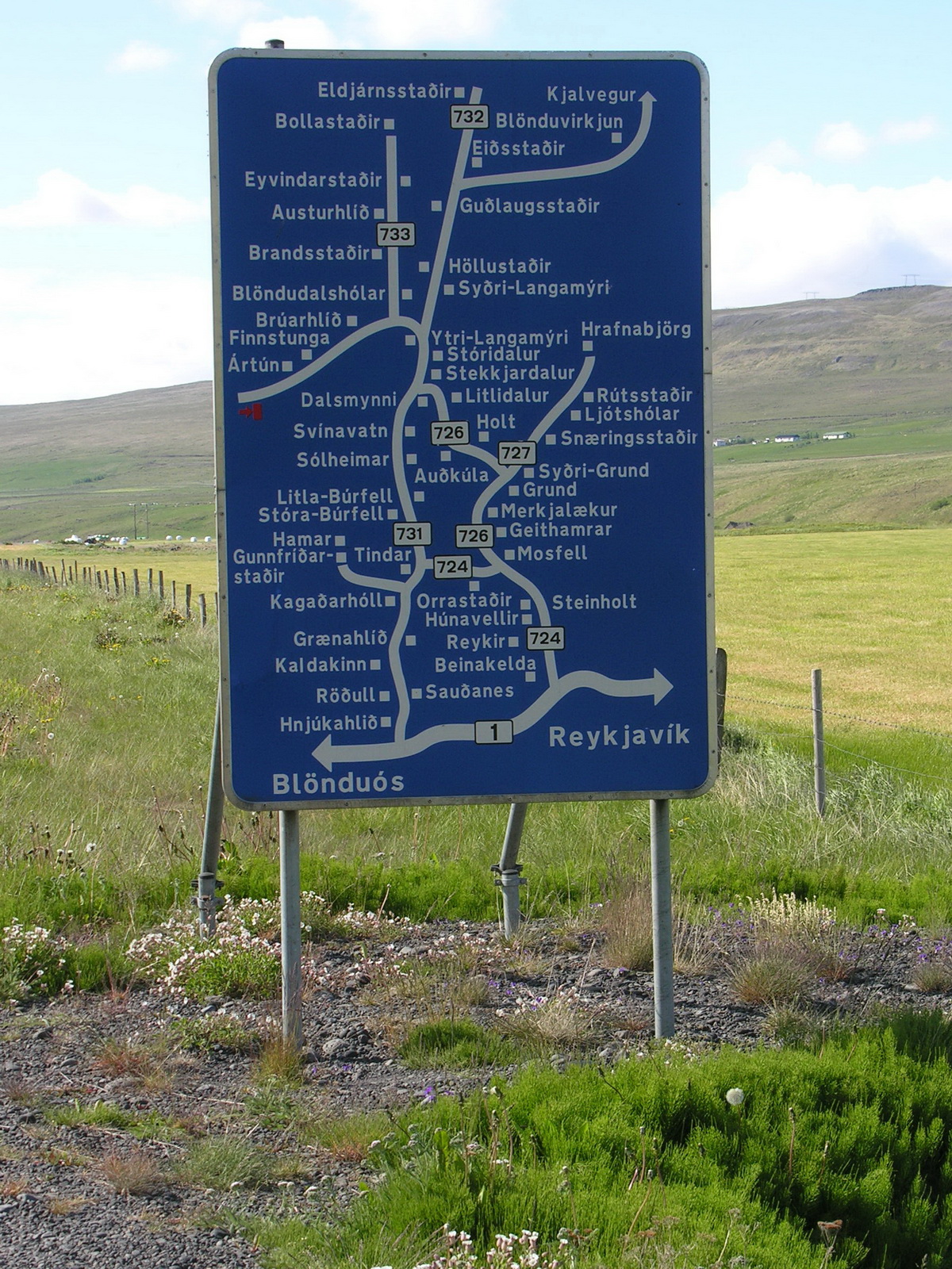
Horseland
|
Informative
roadsign
|
|
 |
 |
 |
|
Hot Spring
in Hveravellir
|
Kerlingarfjöll
|
A little Bit
Dirty
|
|
Day
|
Kroksfjardarnes |
|
|
Wed 25.06. |
Glacier, Ice Cave and Driftwood from Siberia |
|
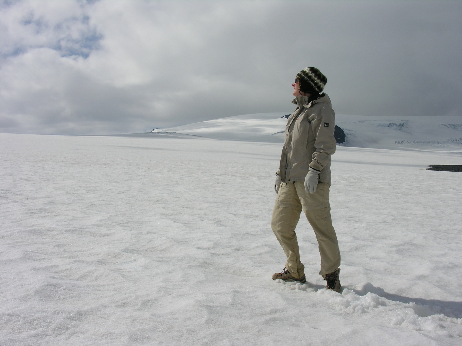
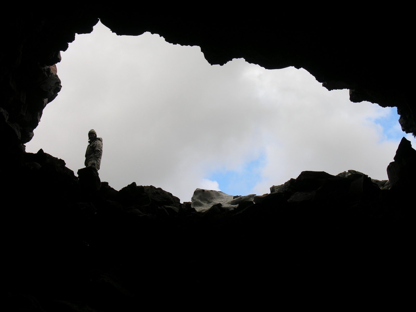
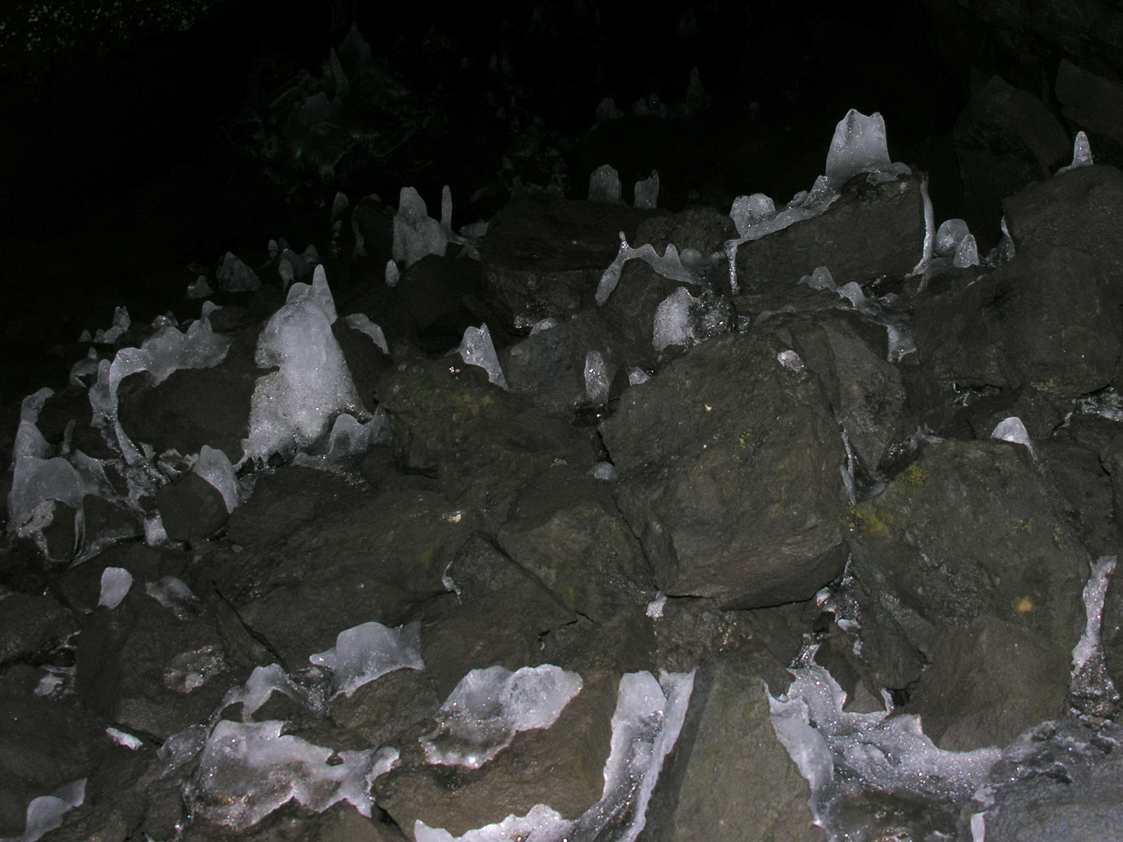
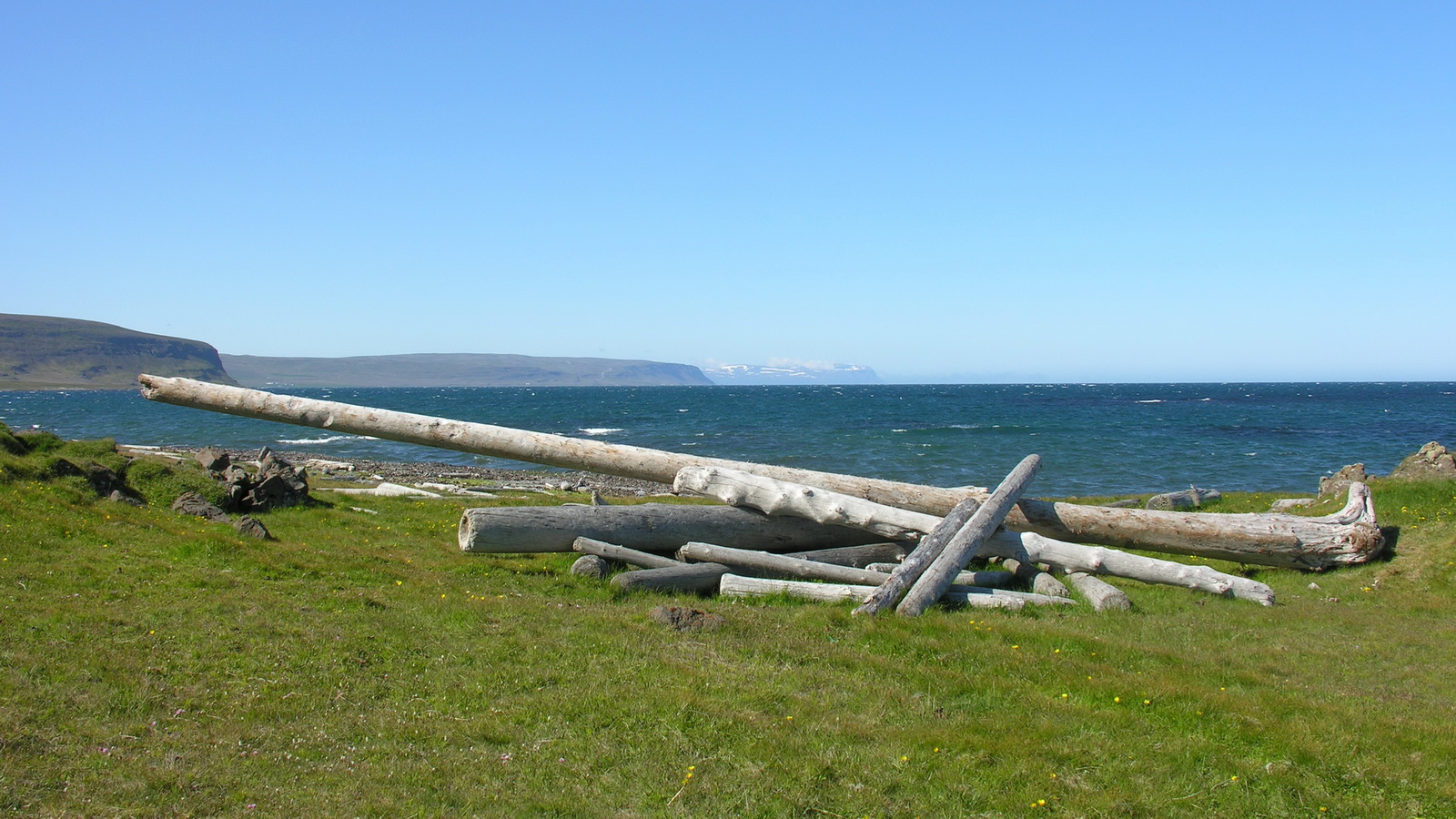
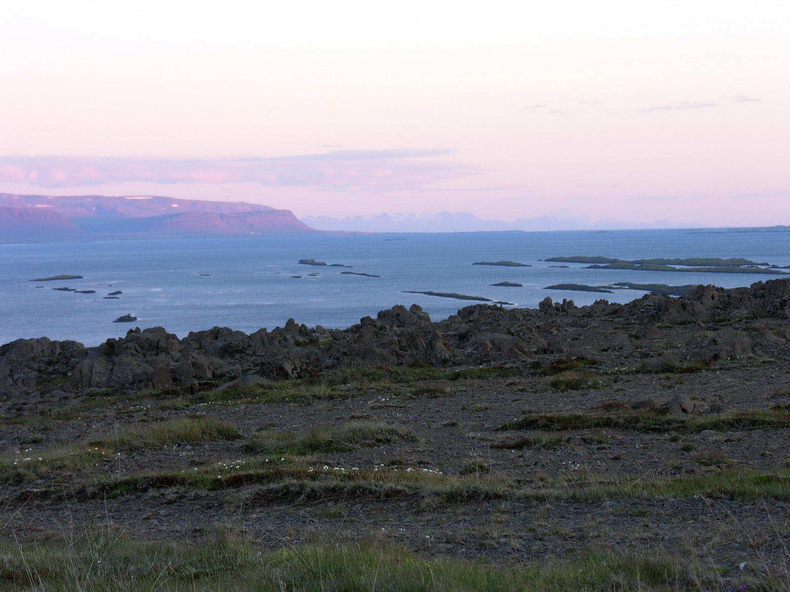
From Thingvellir our route went north on the Kaldidalur track, according to our guidebook "Highland for beginners". That is right so far, that there are no river crossings, but the track is rough and slow. But it was absolutely rewarding, through wild mountain landscape we drove along the Langjökull glacier. There was a lonely campervan at the pass summit, and in front sat a friendly guy from Bavaria at his breakfast. We talked, and he told us that he is retired and came with the ferry to Iceland to spend 3 months here. He was fully equipped with all kind of sports gear: kayak, mountainbike and ski. He told us to take a turnoff a few km further down the road, which leads to the glacier. We did that and climbed higher and higher on a steep track, passed a mountain hut at 800m above sea level and suddenly had to stop because the track led directly on the glacier. You could drive on the glacier there if yo like, but i didn't dare and left that to the skidoos you could rent at the mountain hut. But we made a walk on the Langjökull, enjoying the view of the bright white ice plain. Down in the valley we turned north again. After a short drive through another lava field we came to the Surtshellir, a old empty lava tube. At a point you can climb in, where the roof has broken down. It is so cold in the cave, that there are stalactites of ice on the bottom of the cave all year long. In the dim light they look like pale ghosts. At the surface there was a real plague with the flies here, myriads of them were buzing around in the lee of our camper. So we moved on fast and drove through fertile valleys with geothermally-heated greenhouses towards the road no1 and then north. After passing through some showers we came to the north coast again where blue sky and a strong cold northerly wind were greeting us. We stopped at two beaches to walk a bit, there was lots of driftwood there. Whole logs were thrown on the beaches. Mostly they are pines and larches, which are washed to the sea by siberian rivers and land here after 4 to 12 years in the water. There are so many that it's a industry here to salvage them, they are good for building and fenceposts, because the do not decay. We had planned to camp somewhere on this coast, but the wind is too strong. We had to go to the lee of the island. At the Kollafjord a narrow track ("road" No 69) turned off inland and we followed it through beautiful valleys and gorges to the other side. No chance to camp here, there was no flat space to find big enough to park for the night. Fortunately no car came against us. Finally we found a nice spot above Kroksfjardarnes with a great view across the whole Breidafjord, even the volcano Snaefell, 115 km afar could be clearly seen. We were very hungry after the long drive and made a salad with chicken, eggs, cucumber and corn for dinner. |
 |
 |
 |
|
Nearly on
the Glacier
|
On the
Langjökull
|
Endless Ice
|
 |
 |
 |
|
Hallmundarhaun
Lava Field
|
Surtshellir
|
Ice-Stalactites
|
 |
 |
 |
|
Siberian Driftwood
|
The"Road"
69
|
Kroksfjardarnes
At Midnight
|
|
Day
|
Raudasandur |
|
|
Thu 26.06. |
Puffins at the Latrabjarg Cliffs |
|
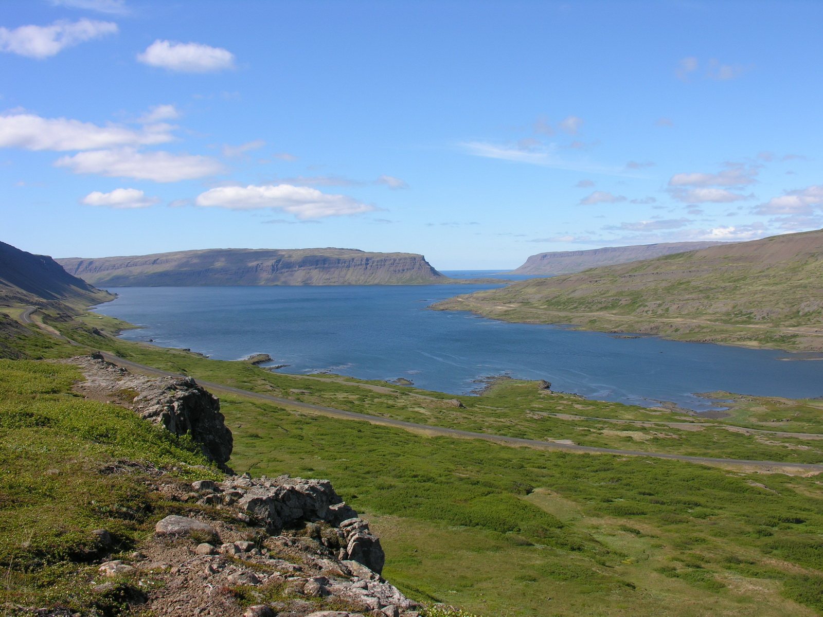
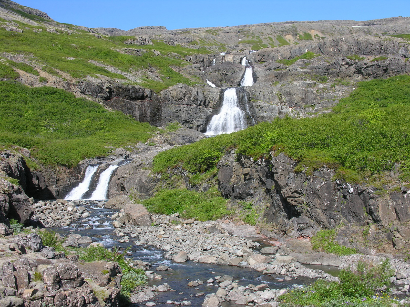
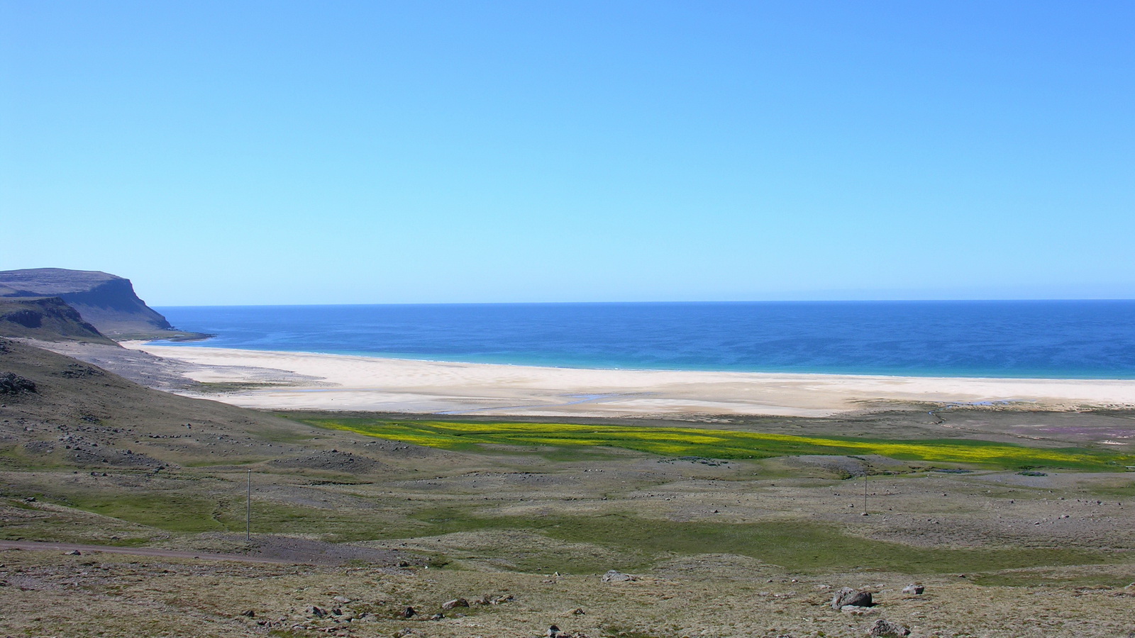
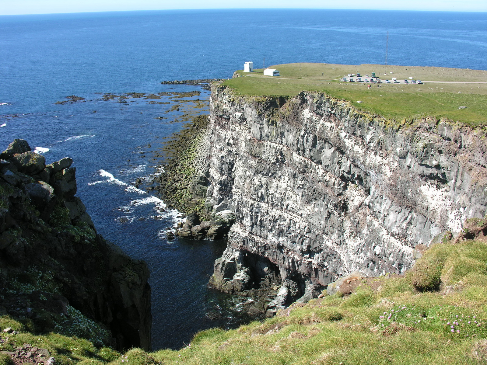
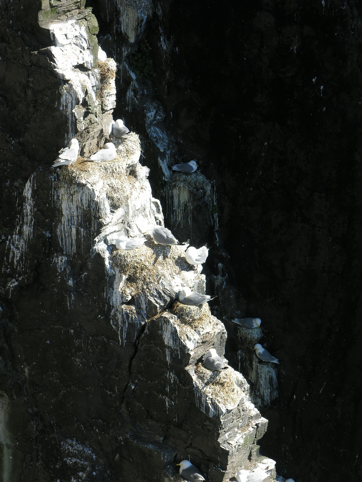
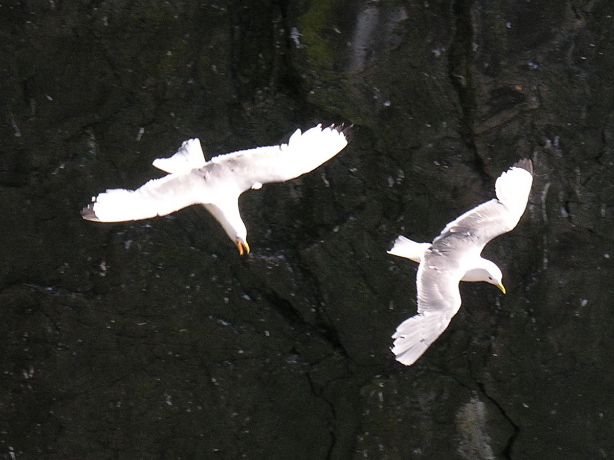
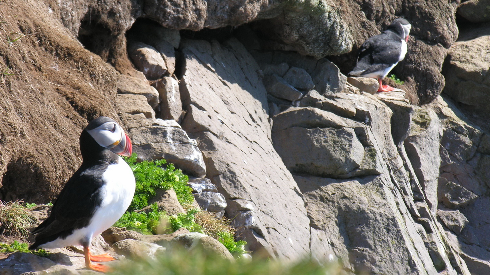
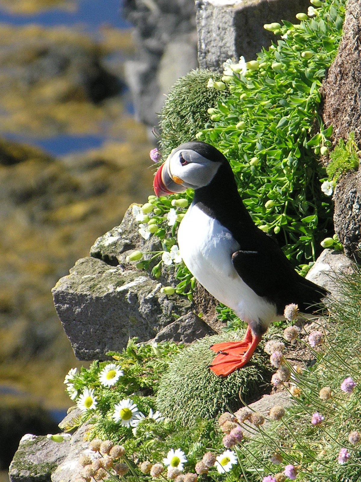
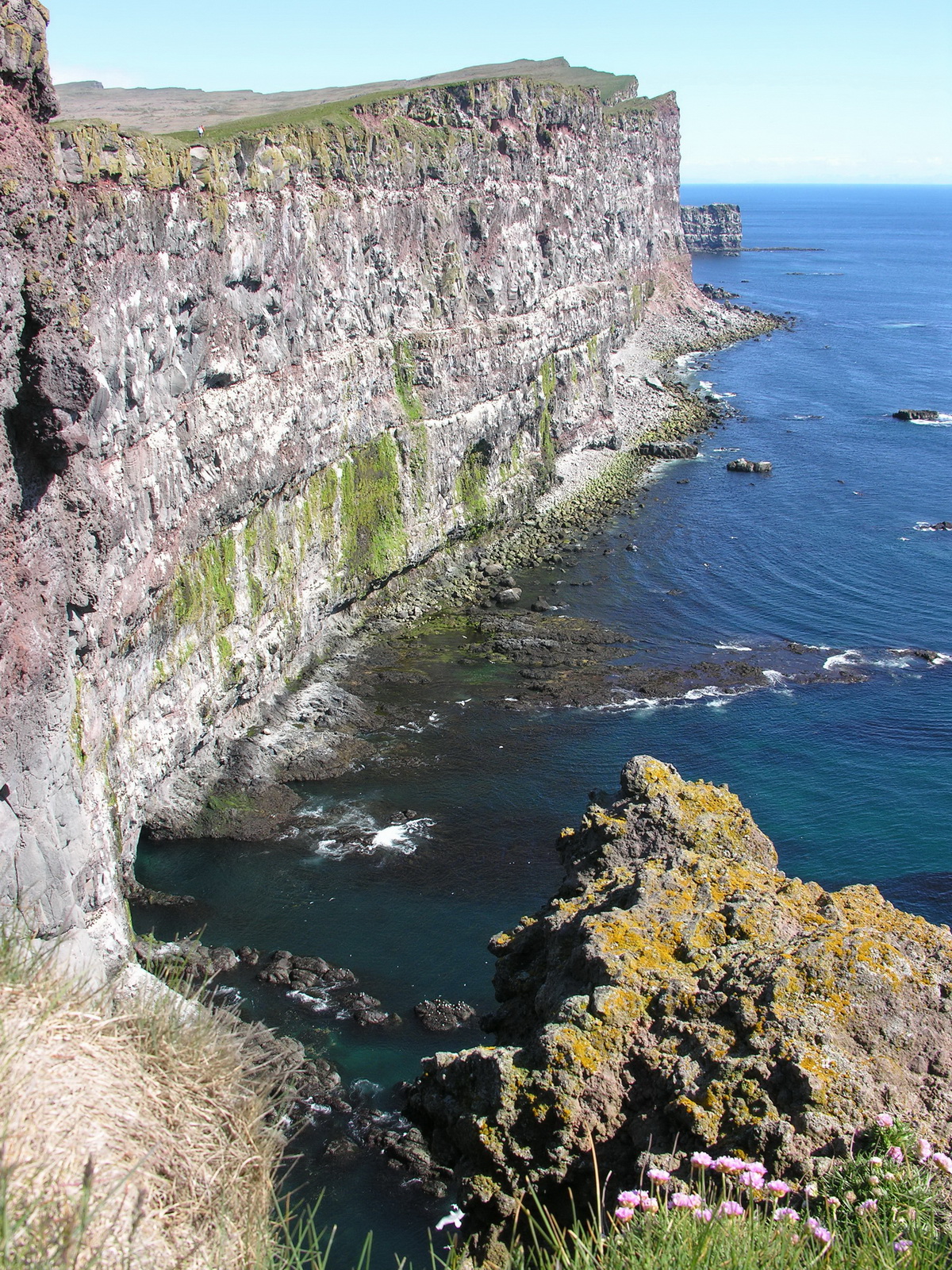
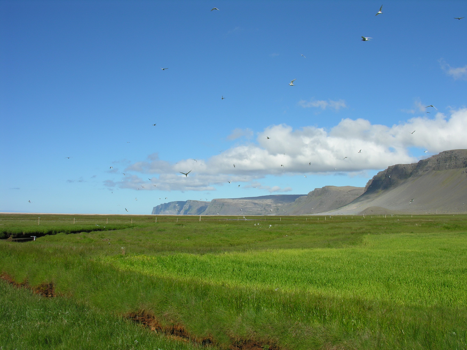
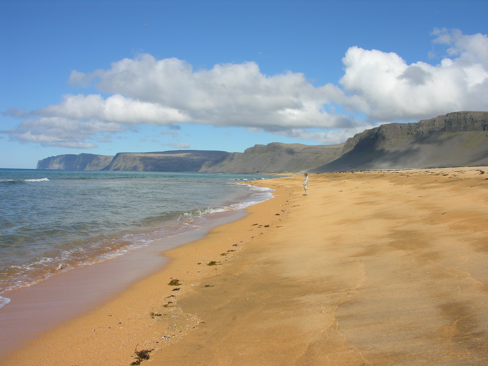
We started early on our drive to the western tip of Iceland. It was a long drive around many fjords and over many ridges. The road is partly a steep, narrow, gravel track, and on other sections a well-built 2 way bitumen road. If there is a scheme behind all that, that remains one of the secrets if Iceland. But it was nearly no traffic, we came across only 10 cars on the whole section. The scenery is beautiful and the also is the weather. Around noon we arrived in Brjanslaekur, where we informed us about the ferry schedule over the fjord. We had lunch at the Flökalundur hotel, smoked lamb meat sandwiches. Then we continued along wonderful white sandy beaches with turquoise water to the Latrabjarg, the westernmost point of Iceland. Directly at the lighthouse we could watch the cute Puffins. They dig tunnels under the grass at the high cliffs, where they breed. We could go as near as only two meters afar from them. And there were thousands of other seabirds like gulls and boobies nesting on every flat spot in the vertical cliffs, which are up to 400m high! Most of the visitors stay near the lighthouse, so when you walk away only 15 minutes from there, you are alone with the gulls and the fantastic view across the fjord to the Snaefell. A great experience! We drove back and crossed the ridge again to the south side on a narrow steep gravel road. There was the Raudasandur, a magnificient reddish sandy beach under the high cliffs, where we found a nice spot to camp for the night. Because there was no wind, there were a lot of flies, but you can't have anything! |
 |
 |
 |
 |
|
Lonely Western
Fjords
|
Another Waterfall
|
Caribbean
Beach (if it would be warmer)
|
The Lighthouse
at Latrabjarg
|
 |
 |
 |
 |
|
Gulls in the
Cliffs
|
Flying Acrobats
|
Puffins
|
Ready to Jump
|
 |
 |
||
|
High Cliffs
|
Raudasandur
|
|
Day
|
Stykkisholmur |
|
|
Fr 27.06. |
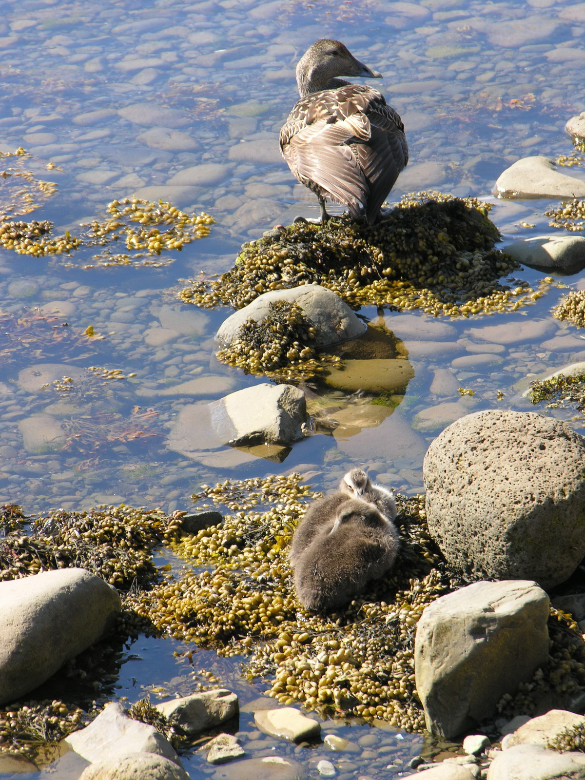
Killer-Terns and Eider Ducks |
|
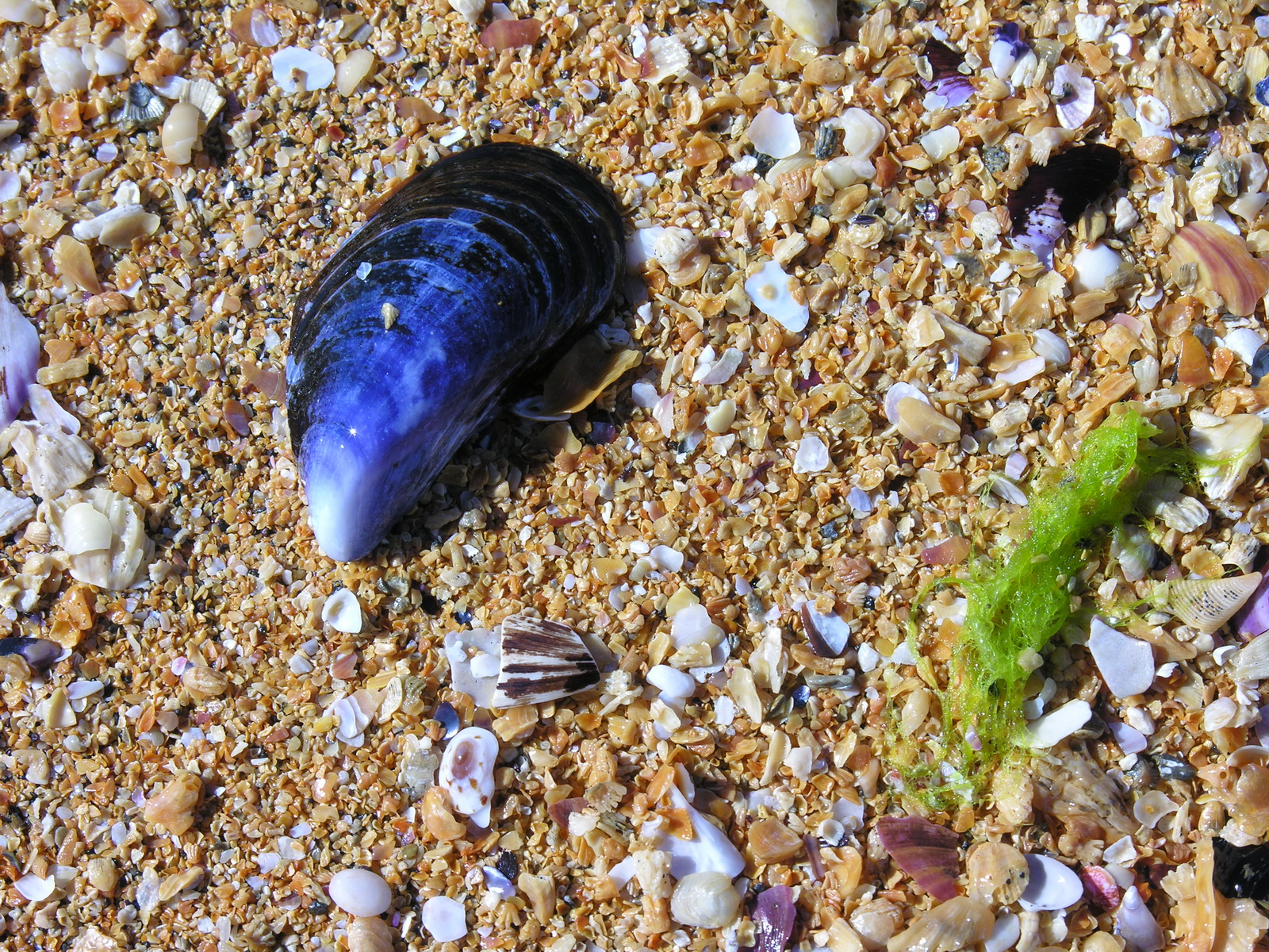
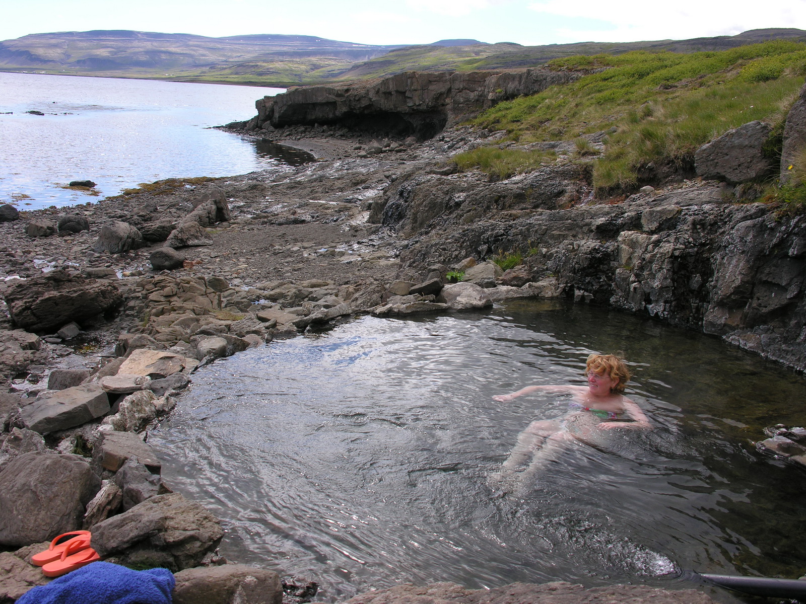
After a quiet night we were awakened by the sun coming around the mountain. Today i used my australian flymesh to go outside and prepare the camper for the drive, you could not work with both hands otherwise. Then we drove to the western end of the road and went for a walk on the beautiful beach. We had to cross a salt marsh where hundreds of arctic terns were breeding, and they were very upset about our intrusion. They flew air raids on us, and one pecked me on the head, which was quite painful even though i had a cap on. But after leaving the combat zone we had 8 kilometers of wonderful sandy beach for us alone. Clear water was iviting for a swim, and you could actually wade a few seconds in the surf, before you think your feet fall off, the water has well below 10°C. After our beach walk we had to pass the terns again, but this time we were better prepared against the attacks and had the hoods of our rain jackets up. We drove to the eastern end of the Raudasandur, where the beach was better to acess. After noon we drove back over the ridge to the main road 62 and then east. Near the Flökalundur hotel we followed a hint of our guidebook and found a hot spring just off the road. The spring feeds a rock pool directly at the sea with 40°C hot sparkling mineral water. We relaxed in the hot water, watching the eider ducks and their chicks diving for food in the waves off the rocky beach. Now it was time to drive to the ferry pier at Brjanslaekur. The ferry Baldur was leaving at 6:45pm and took us over the fjord to Stykkisholmur, which saved us 270km to drive. During the crossing the weather was quiet, and we had a fantastic view of the fjord with its over 2000 islands and rocks and all the surrounding mountains. We arrived at at 9:15 pm and drove immediately to the campground, which was unusually full. The weather was overcast now and a strong northerly wind was blowing. |
 |
 |
 |
|
|
Raudasandur
with Snaefell-Volcano in the Background
|
Attack of
the Killer-Terns
|
8 km Beach
for Us Only!
|
|
 |
 |
 |
 |
|
Seashells
|
Hot Pool at
the Sea
|
In Brjanslaekur
|
On the Breidafjord
|
|
Day
|
Vegamot |
|
|
Sa 28.06. |
Gone With the Wind |
|
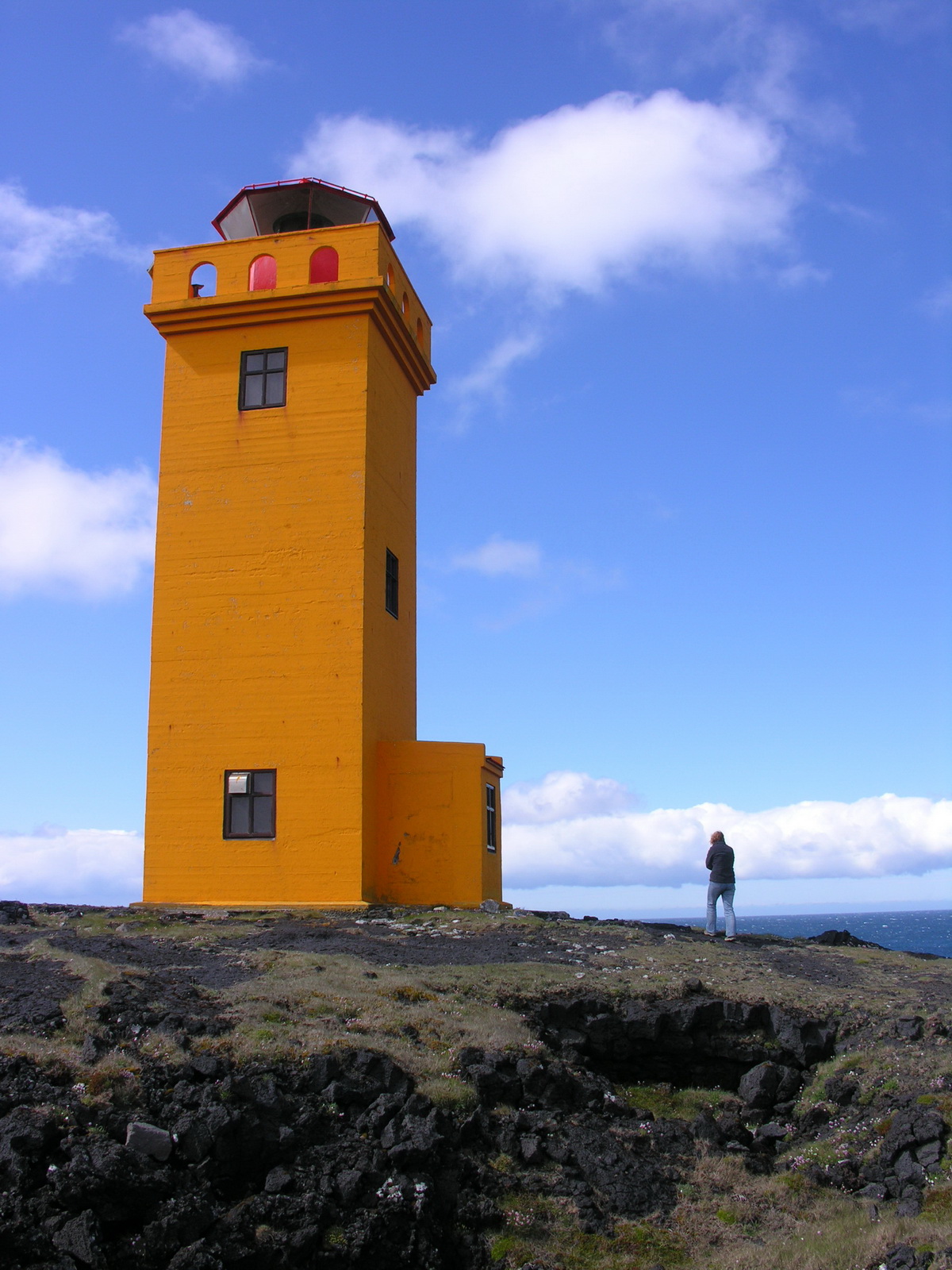
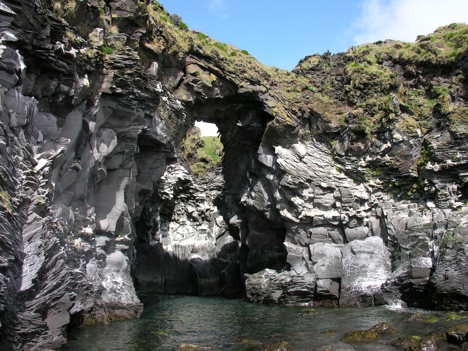
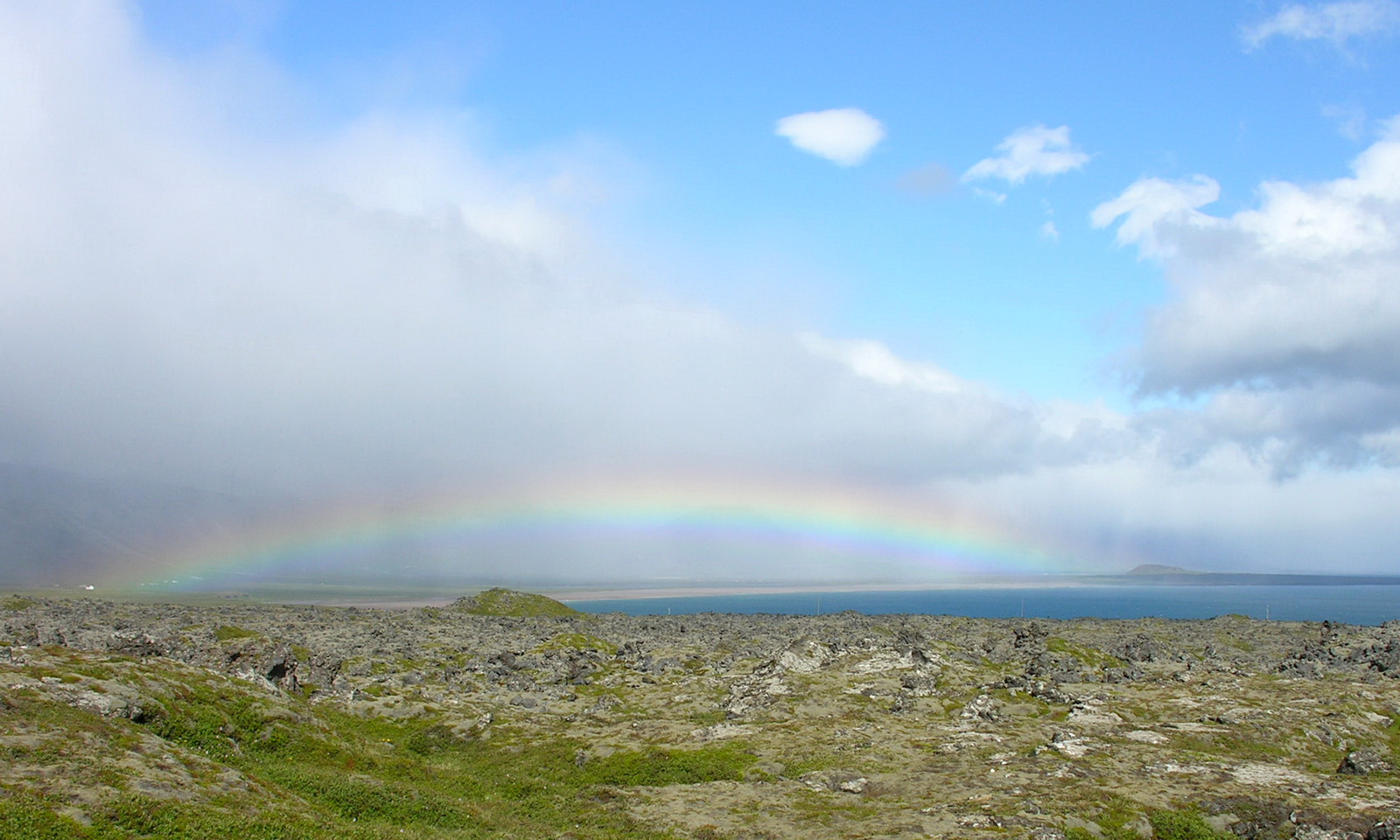
In the morning the weather was still stormy and cold, but we needed a shower. There was only one shower for 50-100 campers so we were lucky to get hold of it. The wind was blowing icy through the gaps of the hut, but the water was hot, and we felt better afterwards. But we look forward to being at home where such things are far less complicated. After a look around the village we drove on along the north coast of the Snaefellsness peninsula to the west. We liked to have lunch in a restaurant,in Grundafjördur, recommended by our guidebook, but the restaurant was closed for renovation. The next village, another recommendation: in this place they only serve hot meals in the evening. Finally we found a nice restaurant (which was not in the guidebook) and had lunch there: seafood soup and burger, water and coffee included. Then we drove through heavy rainshowers to the western cape of the peninsula, where the sun came out. Here we were directly at the foothills of the Snaefell, but the Fujii-like cone of the volcano was in clouds. At the end of a rough and winding track through the lava was a orange lighthouse in the roaring wind, and the sea was raging at the rocky coastline, that was a experience!. Then we continued round the cape to the south coast. Every 10 minutes the weather changed between rain and sun and we saw about fifteen glorious rainbows this afternoon. We took the turnoff to Hellar at the coast, and here is another miracle to see: A natural bridge of basalt columns with hundreds of seabirds nesting there. The place was protected from the wind, so we could sit on the rocks at the beach for a while. We drove to the next village, where we planned to camp, but the campground was fully exposed to the merciless wind. Now this annoying search for a good spot for free camping began again. Finally we found a spot 60km further down the road. |
 |
 |
 |
|
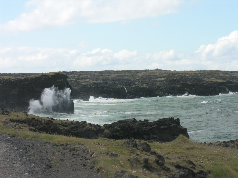
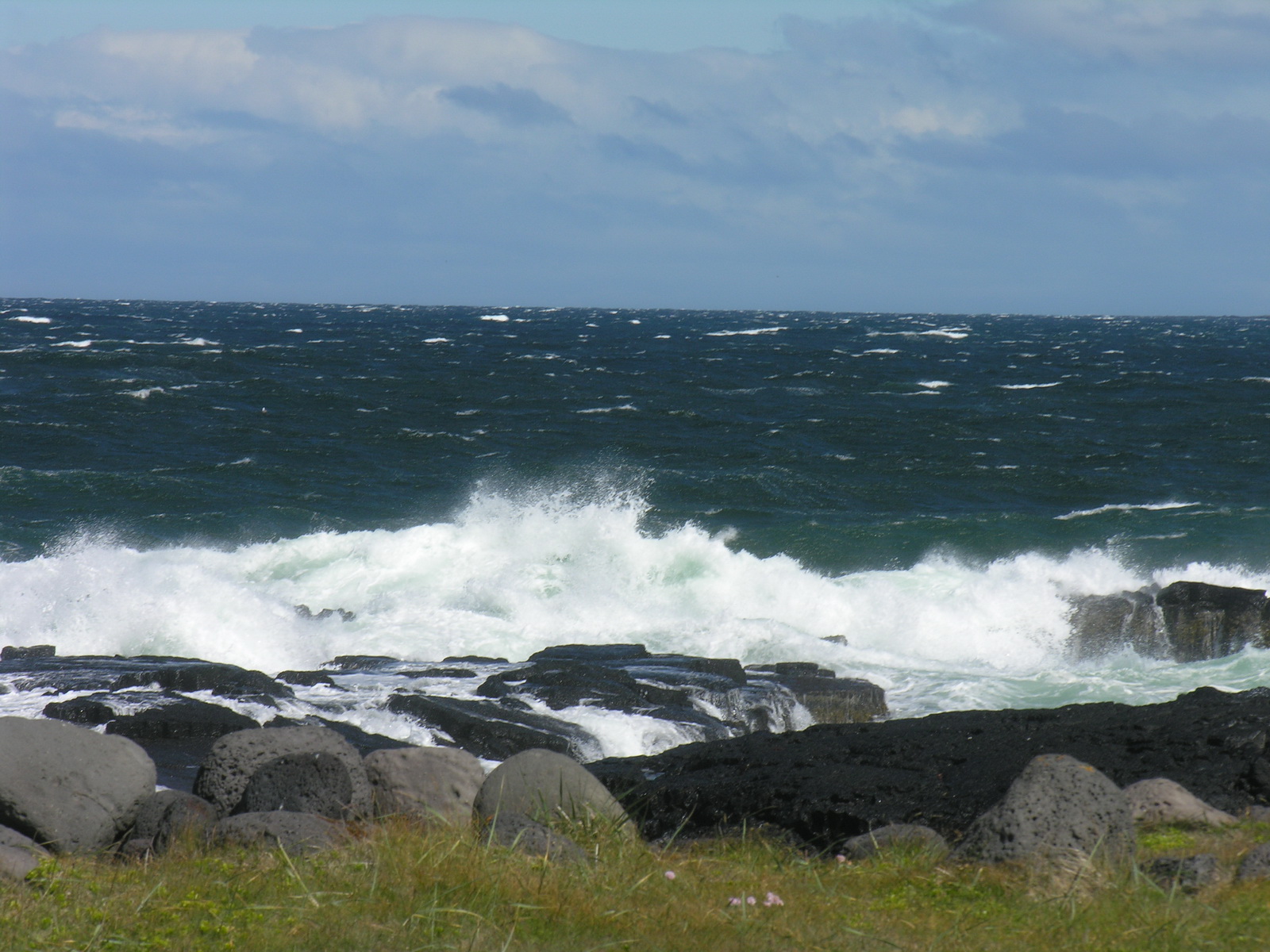
Raging Sea
|
at
|
the Ondverdarnes
Lighthouse
|
 |
 |
 |
|
Foothills
of the Snaefell
|
Natural Bridge
|
Rainbow No
15
|
|
Day
|
Hvalfjördur |
|
|
Sun 29.06. |
Museum instead of Restaurant |
|
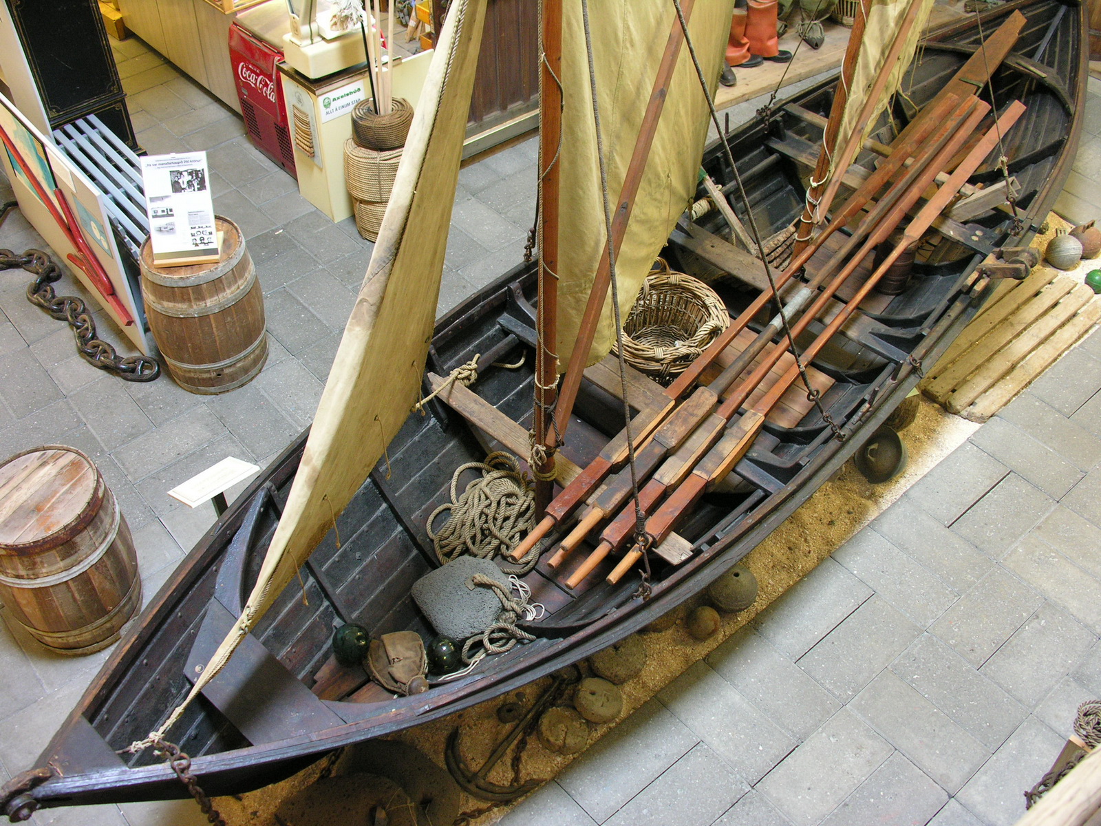
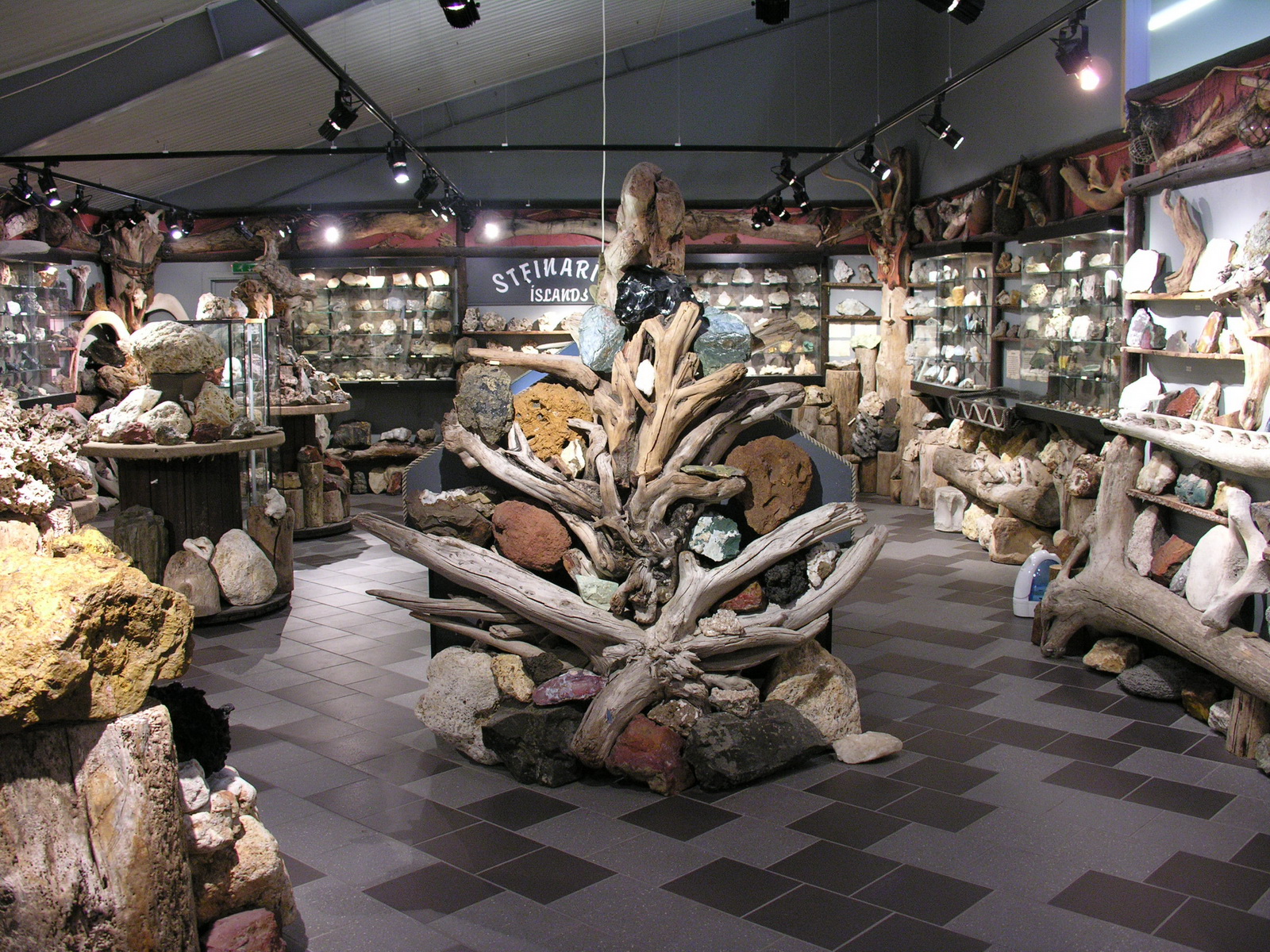
In the night we had to close the popup roof again, because the wind was shaking it too much, but we had now some practise with it and did it quite fast. Then we slept until 9, it was Sunday! After a late breakfast we drove to Akranes, a town not far from Reykjavik. We tried another restaurant, but it was closed too! Where and when do the Icelanders eat out? The only place where you could get something to eat was the cafe of the museum. We noticed there, that the museum might be interesting, and spent the rest of the afternoon there. They had many bits and pieces of seafaring, but also an old acordion made in a german town next to the town where i was born. There was also a old shipbuilders workshop and a collection of icelandic minerals. For our last camp we drove half way around the Hvalfjord. It was very nice on a farm, with the camp kitchen and the amenities in a old stable. |
 |
 |
 |
|
Museum in
Akranes
|
Herring Boat
|
Mineral Collection
|
|
Day
|
Keflavik |
|
|
Mo 30.06. |
Last Day on the Road |
|
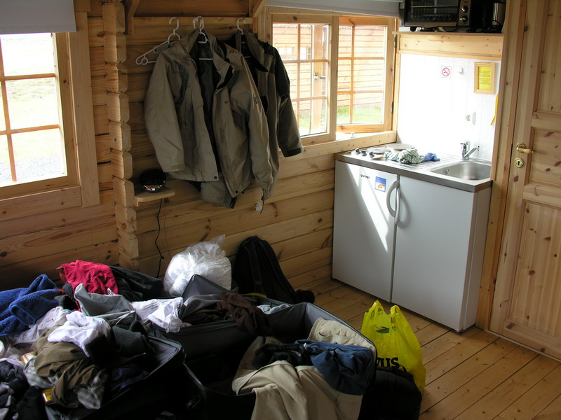
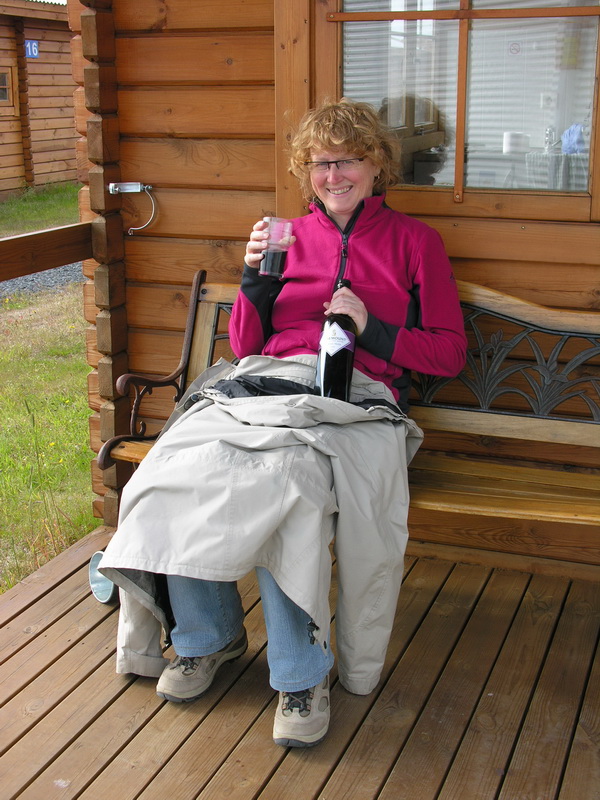
After breakfast we drove around ther rest of the Hvalfjord and then on the No1 towards Reykjavik. Ther we furelled up and bought some souvenirs (smoked salmon). We visited a viewing point on the top of the hot water tanks of the public hot water supply of Reykjavik. You have agreat view over Reykjavik from there. Then we drove the last 40km to Keflavik, where the airport is. We had rented small log cabin there for the last night. We moved evreything from the camper in the hut and i brought the camper back to the car rental at the airport, and went back by shuttle bus. After checking the internet for the weather in Germany (29°C!) and our e-mails we had to pack our suitcases, which was not easy with the sleeping bags and all the warming clothes we had needed. With the rest of our food we managed to cook a late lunch (noodles, salami, cheese, cream and eggs). At 5pm everything was done and we needed some exercise. So we walked the two kilometers to town, the weather was reasonable good. We had some icelandic Kroner left, so we bought at the "Vinbud" the state-run bottle shop a 2006 Rosemount Estate Cabernet Merlot. Funny, that the australian wine is here nearly the same price as in Germany, but german wine is extremely expensive. And "hard stuff" like irish whiskey is even more expensive. In our hut we made ourselves comfortable with the wine. And it was so cosy and warm here, and nothing was shaking! |
 |
 |
|
All that Stuff
Has to Fit Into 2 Suitcases!
|
All Done!
The Reward is Some Australian Wine
|
|
Day
|
Simmozheim | |
|
Tue 1.07. |
Flight from Reykjavik to Friedrichshafen |
|
Had to get up at 4 am, the shuttle brought us the 2km to the airport at 5 pm. Everything went well, our flight started in time at 7am, flight time 3h50m. We arrived at Friedrichdshafen at 1pm local time. While we were waiting on our train, we had pizza and salad in the restaurant of the aerosports club. The train to Stuttgart came in time, and we arrived finally a 6pm in Simmozheim. |